
I woke up that morning at 7am to beautiful blue skies. With low tide and clear weather, I could do my "risky" walk to Fort Ebey with no risk! Yay!!
Since I would be travelling in an unknown and fairly inaccessible area by myself, I took the American SIM card out of Colin's phone and put it into mine. He would have wifi at the Fort Casey Inn, in case I needed to contact him. (Despite it being advertised as "no wifi available," we discovered upon arrival that it did indeed have wifi.)
While other members of our group had American cell phone plans, I would not be able to easily phone them, due to a quirk of the SIM card that we had purchased at WalMart on the day we arrived. In fact, we had actually not purchased a *cell phone* SIM card, which would have required us to pay a minimum of a month's charge for our 6 day visit. Instead, we purchased a pre-paid data-only SIM card that was meant to be used in a tablet. It was a significantly lower price! It came with standard, micro, and nano sized cards for AT&T and T-Mobile.
The store clerks were super helpful, but didn't know whether the tablet SIM would work in a cell phone. We took the risk, and it paid off. We figured data was more important to us, so we could use google and maps while walking, while still being able to communicate with each other via email and messenger. We could furthermore use Voice-over IP to make a phone call, if needed in an emergency.
So, all set with my cell phone and packpack of supplies like water and sunscreen, Colin dropped me off at Ebey's Landing, where he and I had previously stopped our walk. The plan was to walk the official PNT along the beach from Ebey's Landing to Fort Ebey, and a little past that to Libbey Beach Park. Colin would meet me there, and we could explore Fort Ebey Park together.
I estimated the walk to be about 7-8km to Libbey Beach Park. Normally, that distance would take me about 1.5hours to walk, but I knew that walking on uneven beach trails could nearly double my time. I gave Colin an estimate of an hour and a half, and said I would message him to let him know if I ended up taking significantly more or less time. We planned to walk another 7km or so together within Fort Ebey Park.
Because google maps did not recognize any roads or trails along the beach in this section, the best way I could give you an overview of that section of the trail would be via the following screenshot from http://www.pnt.org/maps (click the map below to enlarge for detail or go to their website, which has an interactive map of the entire trail, as well as downloadable PDFs of each section.) The red line shows the PNT. My start and endpoints are marked with text.

I started my walk at 8:15am. Mists were rolling over the bluffs onto Ebey's Landing, giving it a magical ambiance.

In the end, I chose against the Bluff Trail that ran above the Lagoon, which is shown in the map above, even though that route was very popular. Instead, I was eager to walk the fascinating seaside portion of the Lagoon, and just couldn't pass up the chance.
A middle-aged couple started up the Bluff Trail just as I passed that junction. I kept pace with them on the beach. It confirmed my choice, as I really wanted to walk this portion alone.

The beach gravel was hard packed with small stones. It was pretty easy to walk on. I picked up a few pieces of brilliant white quartz, and didn't realize until later how they kind of looked like a paw print in my hand.


The lady at the Fort Casey Inn's office had warned me about the angle of the beach, saying it was difficult to walk on, but I was not finding it difficult... yet?
I passed flocks of sea gulls on the shores, and vast kelp forests bobbing on the tides. A lone seagull stood guard over the huge kelp forest.

Picking up a piece of kelp, I said out loud, "This is for you, dad!" and took a photo.

When I was a child, my dad would constantly try to get me to do ridiculous things and then photograph them. This kelp photo was a recreation of the time he convinced me that "people eat sea weed, you know" and got me to gnaw on a piece of kelp that he picked off the beach. It was several years later before I realized that was NOT how people ate sea weed. lol.
(In response to this blog post, my mother emailed me the following two photos... which I just HAD to add here...)


Sand pipers or sanderlings waded in the shallow shoreline as I approached the Lagoon. They flitted about so quickly, it was difficult to catch more than a glimpse of them, even when I was actively looking for them.
(In response to this blog post, my mother emailed me the following two photos... which I just HAD to add here...)


The driftwood around the Lagoon created marvelous magical figures. This "dragon" caught my attention, and then really surprised me when I turned and photographed it from the other side! The result looks photoshopped, but I swear it is not.


At that point, I was walking on a lovely strip of sand, but... there were LOTS of sand fleas at the tideline and in the sand. I don't think I'd want to sit around and sunbathe in those areas! More invisible sand pipers or sanderlings were constantly cheetering off my path. They didn't seem to mind the fleas. ;) From there, I could see Fort Ebey Park, perched on the top of the bluffs, a few curves down the beach.

At the end of the lagoon, a sign marked where the Bluff Trail zig-zaged down to meet the beach. In the first photo below, you can see my beach path on the right, and the base of the bluffs on the left Like on the signs along the Camino de Santiago, walkers had piled stones on this sign. A ray of sunlight shone on the small rough path, as if to beacon me upwards, but alas, I was on a time schedule, and had to press onward along the beach.


Heading forward, I took a photo of the driftwood, as I had read about a few people having to clamber their way through it, when they misjudged the tides. It certainly looked like a difficult way to traverse this section.

At that point I found that I really needed to pee... I peered up towards the bluffs. I had lost track of the couple who were walking there earlier. Could no one see me, down here, alone on the beach? Or could *everyone* see me?! I decided to try to wait for the washrooms in Fort Ebey Park.
Several little driftwood shelters had been constructed along this stretch. I paused to investigate and admire the handiwork. Full disclosure: the second shelter below, I found farther along the beach, away from the others, but it was so striking I wanted to include it. To me, it looked like a giant bird, about to pull out a worm from the ground.


As walked, I kept hearing strange clicking noises... I kept turning around to see whether someone was behind me. It took me several disconcerted minutes to figure out it was the sound of small rocks dislodging from the bluff, and clattering down the slope.


Where the line of driftwood ended, the rocks got much larger and there was wet slippery kelp right up to the bottom of the cliff. It was clear that at high tide, the entire beach would be under water. I felt smart at that point, having checked and rechecked the tide charts before I left. A big thanks to Bec at Washington Trails Association, for the warning that this stretch should only be attempted at low tide!!! I didn't see that warning on any of the maps I found, even the parks board ones.


As I drew even with the end of Hill Valley Rd, the beach got easier for a bit, but then I was back to carefully navigating the big foot-sized rocks. It was hard to imagine people doing this with a big through-hike pack on!
I paused to admire the layers of sand in the bluff. It looked like art. I was in my happy place.

Google maps said that the PNT restarted on the bluff in Fort Ebey Park around that area, approximately 0.5km before Hill Valley Rd. However, there was little indication of how one would access that trail from the beach. I kept my eyes peeled, but I either missed the park access, or there was not one there after all. A tiny bit later, I briefly heard a man's voice, but could not locate him nor a trail access that might lead to him.
As if to echo my jubilant mood, the beach was decorated like a party: strewn in brightly covered seaweed "streamers," and accented with squid egg capsule "flowers."


The rocks were covered in tiny snails, feisty little purple shore crabs, and slippery slime. Or maybe, by that point, it was my shoes that were covered in slime?!?! One little crab let me photograph it, but waved its pincers around as if to say, "I will CUT you!"

Fortunately, I had brought my gun, so I played a little "cops and robbers" with the crabs, finding cover behind a piece of concrete bunker that had fallen from the bluff.

Near the point, I saw a guard tower high on the bluff. It stood guard over Point Partridge, the West-most point of Whitbey Island. My cell phone camera was not really powerful enough to capture it clearly, even from up close. (I would get a chance later, when I walked the Bluff Trail through the park.)


Around the corner from the guard tower, at the Cascadia Marine Trail Campsite access (the sunlit area in the photo below), there was a nice sandy beach with few fleas. Now THAT would be a nice sunbathing beach. :D

The two trails from the beach to the campsite area were very easy to locate. One was a wide sandy path through the grass, in front of the park sign and picnic table. The other was at the far end, a narrower path which headed up the hill, but easy to spot next to wooden fencing on the bluff.


However, there was a highlight in this section, between the campground and Pebble Beach Drive's private beach access: a concrete bunker which had fallen off a cliff onto the beach and shattered. I couldn't wait to show it to Colin.

I arrived right on time, at precisely 9:45am. Mounting the stairs to the parking lot, I saw a lone big rig in the parking lot and freaked out, but our teeny truck was hiding behind it.


Here is a link to a high quality pdf map of Fort Ebey Park and the adjacent 179-acre bike-and-horse-friendly Kettles Recreational Area. (Note that this map remarks that there is no beach access from the bluff on the south end of the park--I wish I had seen that earlier.) Google maps also showed all the trails within the park, which was useful. However, neither google nor the PDF map showed the military fortifications, so we also used the following Fort Ebey State Park map, found at www.whidbeylocal.com/park-maps.

Although we had chosen our path through the park almost randomly, I had marked down which trails we had chosen as we walked, and upon returning to our cabin at the Fort Casey Inn, we realized that we had walked the EXACT trail laid out in the book "Take a Hike Seattle" (which someone had left in our kitchen). An amazing fluke!!!! According to the book, that trail loop was just over 5km. We walked a little farther, getting to/from the truck at Libbey Park. Probably an additional 1.5-2 km.

To get back to Fort Ebey Park, we retraced my steps along the beach to the campground access. It was pretty fun to show Colin the bunker that had fallen off the cliff. It was also easier to capture the size of the bunker debris on camera, with one of us in the photo for perspective.


At the campground access, we walked up to the picnic table that we could see from the beach, and there was trail signage pointing us towards the Bluff Trail.


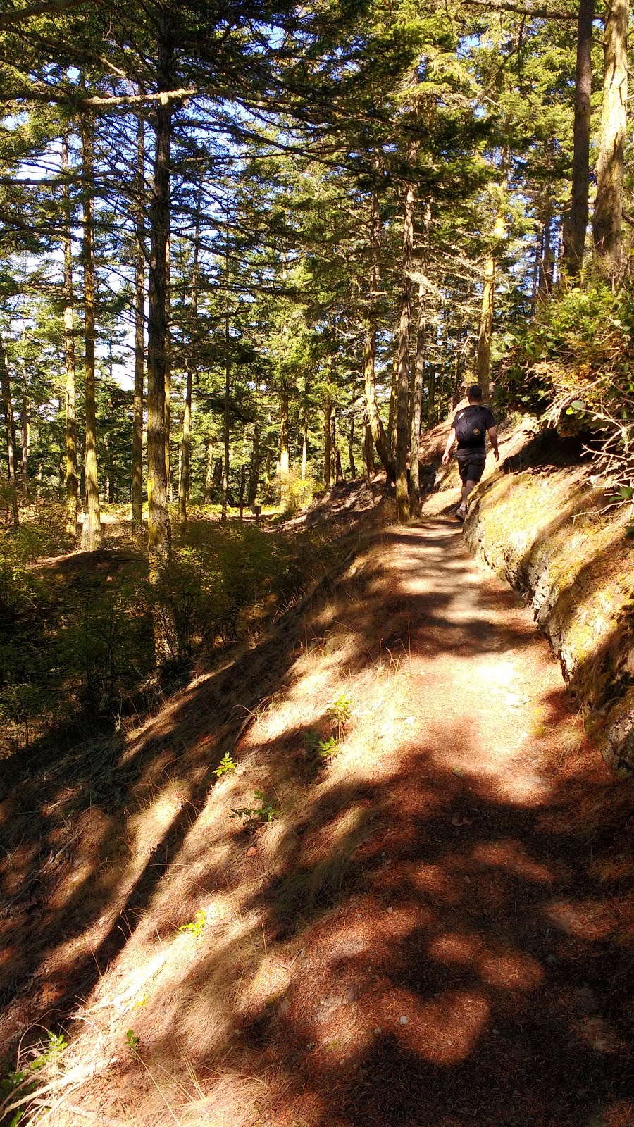
We took that narrow trail, with its high walls of salal, and it quickly led us to the lookout tower I had seen from the beach.


Climbing the tower was not permitted, but from the lookout area at its base, we could see the beach I had just walked by myself, with its narrow strip of driftwood lodged up against the cliffs.

Directly across the North end of Admiralty Inlet, we could see Fort Worden, where we would be heading after leaving Fort Casey. Fort Worden and Fort Casey were two of the three points of the Puget Sound's "Triangle of Fire" (the third being Fort Flagler), which were built in the 1890s to protect Puget Sound from a potential Spanish invasion, and later used as military training facilities during WW1, WW2, and the Korean War.

Fort Ebey, on the other hand, was built for a military defense during WW2, alongside the Whitbey Naval Air Station, which is still currently active as a Reserves Training Centre. Unlike the Naval Air Station, whose jets still streamed across the sky on a regular basis, Fort Ebey was decommissioned shortly after the war, and its 6-inch guns were removed. Since 1981, the 645-acre Fort Ebey Park offered camping, hiking, and opportunities to tour the decommissioned fortifications.


Just past the bunker, we looked up to see these strange trees, seemingly growing out of midair!!

The Bluff Trail was a little disappointing as a "bluff trail," since there was no view out from the bluff. It seemed pretty much like any other trail in the park. There were several small trails that branched off towards the bluffs, but almost every one was fenced off, and furthermore held warnings like: "Falling can be deadly."


Finally, at the big clearing near the gun battery, we could actually see out over the bluffs! In the clearing there was a picnic area and washrooms. I was positive that this was where the beach access that I "missed" was supposed to lead, and probably where that man I heard talking was standing.


I looked around all along the bluff for a trail access, but found nothing. (I did not see the note on the PDF map until afterwards, which confirmed there was no access there after all.)

The main attraction in that area was Battery 248, nearly invisible in a small hill above the bluff. Naturally, we went in. It was pretty dark inside, and just as I fired up my cell phone flashlight, a girl on a razor scooter nervously made her way towards me. Her friend quickly followed, laughing uncertainly.


Some of the rooms were so dark that even the camera flash could not light them up. Finally, sunlight from outside beckoned us through to the other side of the Battery.


Looking back at the exit from the outside, the battery looked even more invisible, especially from seaward.


I walked seaward on the open grass, and nearly stumbled over this lookout bunker. An open ladder led down to it, but I had seen enough lookouts for the day.


We followed a couple of fit army-types jogging up the small hill back onto the Bluff Trail. At the lookout, we got a good view of the Peregos Lagoon. The trees in this section were beautifully gnarled by the wind flagging, just like on the Bluff Trail in Admiralty Head Reserve.


We finally turned off the Bluff Trail at Hokey-ka-dodo Trail. It was clearly marked. That trail led us away from the bluff and into the forest. It was actually rather steep. We were impressed that two young women were jogging their way up towards us.


Next, we turned onto Kettles Trail. Kettles Trail was the bike trail that ran farther than Fort Ebey park. One could bike all the way to Coupeville, as the trail beccame a paved bike path running next to Hwy 20. We didn't see any bikes, but we ran into more young people jogging in small groups. Many said "hello" cheerfully as they passed us. One tripped on a root and fell flat on his face, but made a quick recovery.

On Forest Run, we ran into a plethora of teen joggers. There were so many, that we wondered whether they were the Fort Casey soccer camp kids. After arriving back at the cabin, we read in "Take a Hike Seattle" that: "other than the occasional mountain biker, solitude is likely on these trails." Um....

We turned right at Campground Trail. I noticed that the "Campground" trail sign had an arrow scratched into it, as to ease potential confusion between Campground-the-trail, and directions to Campground-the-Campground!

We decided to take a sharp left at Raider's Creek Trail. It was nearly a U-turn. We followed it until we hit the paved road of Valley Drive.


Just across the paved road was a sign for Kyle's Kettles Trail. It dove steeply down, then rose steeply back up again. That is why I took no photos of this portion of the trail. lol. (Although the Kettles Trail system is generally for mountain bikes, bikes are not permitted on the Kyle's Kettles part of the path within Fort Ebey Park. Perhaps it is due to the sharp grade.)

From there, the Grandpa Tree Trail took us to the far end of the park. (I suspected that Grandpa Tree Trail was named after an impressive old-growth tree, but if so, I must have missed it.) Our hope was that there might be an unmarked path that could lead us from this trail through to Fort Ebey Rd, which would connect us to Libbey Beach Park via the road. From there it would be just a short stroll to the truck.

The trail did indeed drop us onto a gravel road that was marked "Kyle's Kettle," but not shown on the park map nor google maps. It was on the pdf map that I linked to above, although that map did not show the roads, so it was still a guess as to whether they would connect. We really needed a handful of different maps to properly navigate this park! We followed the gravel road, and it "ended" at the park boundary, with a sign for PNT pointing down the staircase towards beach.


However, the trail continued ~25m along through a private driveway out onto Fort Ebey Rd. We knew that if we took the PNT trail, we would still have to walk the worst section of the beach, as it would come out at the campground. We gazed down the short clear path to the road. And took the plunge. Once on the road, we were only 600m from the truck.


We arrived back at the truck at 12:10pm. Wow, my feet were sore! Actually, they were already a little sore before we started walking the park portion. I think it was from walking on the stones on the beach.
Looking at the clock, I was confused: if we only walked about 7 km in the park, as the guidebook indicated, how did it take us nearly 2.5 hours?! We were both fast walkers, and we took no breaks, other than to pause at the fortifications as we passed. Something seemed fishy. I checked on google maps later, and the distance seemed about right. So I don't know. Maybe I was walking slower, because of my previous beach walk??
Back at Fort Casey, it was our group's night to make the group dinner, and earlier, I had made plans with Taffy and Mark to go to Port Townsend in the afternoon to buy fresh fish. However, when we arrived back at the Inn, everyone had gone to Port Townsend without us.
So Colin experimented with making mini-versions of various grilled cheese sandwiches for that evening's planned "tasting," while I took a nap on the porch.

I awoke to what sounded like banging pots and pans, coming from the little boys' cabin next door. I sat on the porch, a little dazed and confused for a minute, before understanding that everyone was back from their shopping trip. (Like my little re-creation of your childhood photos, Nihan?)


Colin presented me with his winning grilled cheese recipe: Reyes Blue cheese (raw) with Aliner Gardens and Woodland lemon verbena jelly. It was AMAZING. He was a little disappointed that after everything, the group decided to move the grilled cheese tasting to a different night, when we would no longer be there.

Instead, we had a craft beer and artisanal cider tasting in the Garrison Hall. Everyone brought a bottle or two to add to the lineup. Most were local, from Washington State. Colin and I contributed two of the growlers that we had bought in Bellingham on the way down to Fort Casey.


Our dinner was Coho salmon, with mixed green salad. For dessert, we offered fruit salad, watermelon slices, and Taffy's homemade cookies. We figured, we were on the West Coast, so why not take advantage of --and share with the "inland" folks-- the rich bounty of the sea?


While the fish cooked on the BBQ, some people milled about near the beer tasting, and Colin, Matt, Katie, and Nick, played beer frisbee. The object was to knock the other team's empty beer can off their pole with the frisbee. There were points awarded to the successful team and penalties doled out to the team who lost their can. Dropping the frisbee at any time also incurred penalties, all of which involved taking a swig of one's drink, which had to be kept in hand the entire time. (Sounds complicated, I know, but it's really not that difficult. Then once you master beer frisbee, you graduate to beer golf.) Just as I snapped the photo, Nick swung around and mugged for the camera.


The salmon was a big hit and some "non-fish eaters" said they were converted. I think one of the main reasons why people think they "don't like fish" is that the fish they have previously eaten was not fresh enough. We got ultra-fresh fish, direct from the fishmonger, and even so, rinsed it very thoroughly. Absolutely no "fishy" smell should be present. We left the skin on the bottom (grill) side, then covered the fish with fresh dill and lemon slices, then squirted a little lemon juice over top and sprinkled with fresh ground pepper. Then, because the Inn's BBQ didn't have a lid to close, we covered the fish with foil. No need to flip the fish. Here's the finished product.


Sitting around by the fire after supper, I stayed up the latest that I would on the whole trip: 10:30pm. Lol. I did get a nap that day, you know. That's probably why I could stay up "so late." Lol.

Different people were sharing their stories, and Corb's dad recounted an exchange he had with his son earlier that day. He had found his son engrossed in watching slugs. He asked Corbin: "Do you like it here?" and Corb, his eyes still glued to the slugs, replied, "I didn't know life could be so awesome!!"