Dec 15, 2016
There had been a lot of dramatic goings-ons over the previous couple days.
On the evening of Dec 13, I went out to see the
super moon and the
Geminids meteor shower. Within minutes, I saw an earth grazer!!! (It looked just like the example given in the link.) I was so excited, that I didn't mind that we didn't see more than a half-dozen other meteors that night before turning in.
It had also been -8°C and icy over the last few days, and we were running low on propane. Now, some people may argue that -8°C is "not that cold" (especially those of you in the interior who were facing -25°C!), but it's cold for Vancouver, and it's a "wet" cold that soaks in, through all your clothes and into your bones.
The propane delivery was scheduled for Dec 14. As I've
previously mentioned, propane and gasoline can only be brought onto the island once a week, on a special "dangerous cargo" ferry sailing.
On Dec 14, I waited around most of the day for the propane delivery. Finally, Colin said "go for your walk" and told me that he would wait for them. I started on a walk to Dorman Point, but slipped and fell in the icy parking lot, and decided to abort that trip. Still got this nice pano of the Snug Cove picnic area.
(click to enlarge)
I wandered over to Snug Cove, and saw the propane truck in line for the ferry! Surprised, I approached to ask why they didn't deliver to our house, and the driver claimed they couldn't find our house. Then, when I have them directions and sent them back, the propane truck got stuck on a small patch of ice, and couldn't deliver. We would have to wait another week for propane. We decided to restrict our stove/oven and fireplace use to emergencies, and hope it didn't snow too much more over the next week.
On the bright side, while I was in the village, I ran into a friend who told me about a new trail to the golf course. And got invited over by our neighbors for our first "block party" Xmas party. Now, when I say "block," I really mean our private lane which has four houses on it. Lol. But still, it was exciting. Colin and I spent a few minutes mentally scrolling through our adult memories to confirm that this was indeed the very first time we'd ever been "invited over to the neighbors" for such a gathering. I learned about more trails and more of the island's history and politics.
So, on Dec 15, because I was tired of falling down on icy trails, I decided to stick to the roads for my daily walk, and changed my shoes, in hopes of getting a better grip.
I settled on a "Figure 8" through Miller's Landing, Snug Cove, and Cates Hill, with a little detour down Collins Rd. I thought I would head on to Artisan Square, but the cold did me in. In the end, in all, I the walk was about 5.5 km (I couldn't get google to plot the easement from Captain Cates Walk to Village Dr, so I added a few dots by hand).
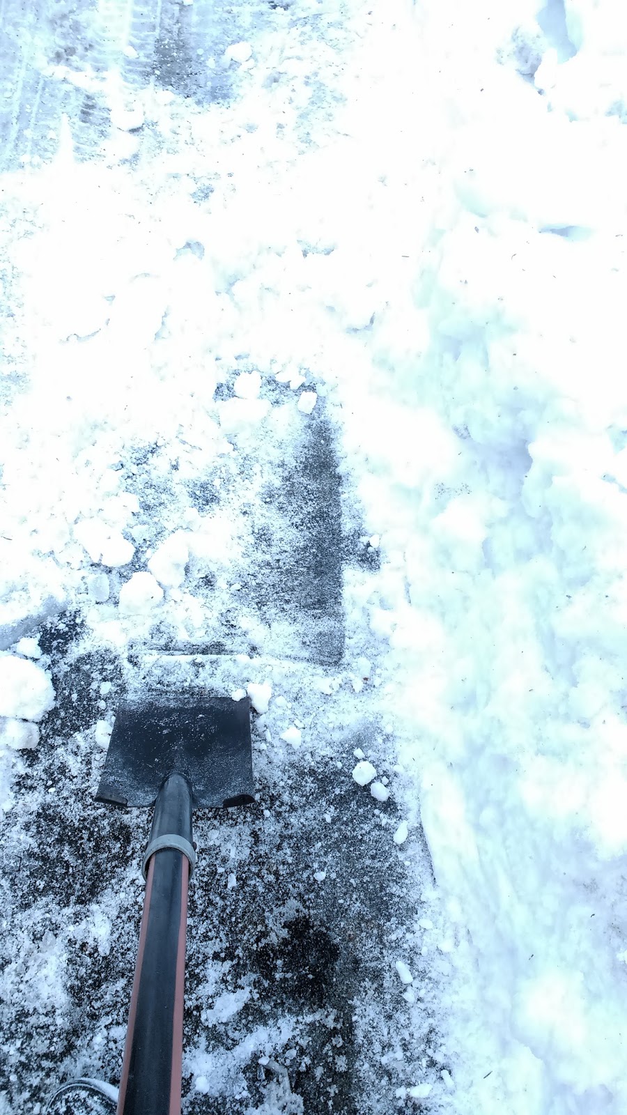
I took the footpath running next to Miller Rd, heading towards Miller's Landing. (Yep, that "shadow" on the right side of the snow piles is the path.)
After getting away from the intersection with Bowen Island Trunk Rd (the main thoroughfare through town, and the only road to/from the ferry), the snow glistened white and pristine. However, in the sunshine, the top layer had melted then refrozen into slick ice.
Fortunately, the path alternated between shaded and sunny, so I got the best of both worlds: the gorgeous sunshine, and a somewhat less slippery walk in the shade.
On the left side of the road, at Millard Rd, was the senior citizen housing co-op called
Bowen Court, also home of the evangelical Protestant
Bowen Island Commnunity Church. The blackberries on the right side of Miller Rd were beyond dead-- dried and frozen onto the vine.
While I stood in place to answer a text I had received (no texting and walking on ice!), a lady passed me, asking whether I had power in my house (she didn't in hers), and saying she was going to try cutting through the park to Collins Rd, up ahead.
When passing the entrance to Crippen Park, I considered cutting through park to Collins Rd too, but was too nervous about the potentially very icy trails. I thought that continuing on the path next to the road might be a better bet.
However, at the
St Gerard's Mission Catholic church, at the corner of Melmore Rd, I second guessed my decision, as the roadside trail vanished under piles of snow.
This church was built in 1971, although Catholic priests from
Holy Rosary Cathedral on Richards St in downtown Vancouver had been visiting Bowen Island during the summer months since the first half of the 1900s, when Bowen was a popular vacation destination. It was actually kind of amazing to think that this church was built at a time when only 400 people lived on the island, and half of the congregation was not Catholic. According to this really neat newspaper article, it seems that much of the work was done by local volunteers.
After passing the church, I crossed to the other side of Miller Rd, where the shoulder was wider.
I was able to follow the shoulder all the way to the
Bowen Island United Church, also known as "The Little Red Church," at the corner of Collins Rd. However, as I got closer, the the shoulder became completely covered in broken branches that had been knocked down in recent snow storms, and I had to retreat to the road itself.
This United church was much older than the Catholic church I had just passed. It was actually the first church on Bowen Island. Like for the Catholics, Protestant worship on the island also had its roots in the resort-era. However, in 1932, James and Laura Collins donated land and volunteers built this church to house the diverse group of Christians who had previously been meeting in a schoolhouse.
Beside the church on the right side was Collins Hall. When the resort closed down, James Collins donated more land, and Collins Hall was built in 1964 and has served as a gathering space for the community since that time. Today, it can be rented by the hour, and is used by diverse groups such as the Rotary Club as Alcoholics Anonymous, as well as by private citizens, and of course, events related to the church.
On the left side of the church was the driveway to Collins Farm. According to the
Bowen Island Heritage Inventory page, "
James Collins came to Canada in 1895, arriving on Bowen Island to work in the logging industry. In 1906 he bought up the earlier pre-emption of District Lot 1628 for $150 [from the original pre-emptor of the land, a Mr. Murphy]." After marrying Irene Smith, serving in WW1, and producing a large family,
he developed the farm, and in 1923 built the large Collins Farmhouse, which was designed by Irene's uncle, William Linklater, who happened to be the head carpenter and building designer for the USSC, and who also later designed the United Church and Collins Hall.

In modern days, the farm became a co-operative effort among some half-dozen families. Two granddaughters of James Collins took over the property after their mother died, and remained the "backbone" of the group, continuing to advise the gardeners, even as they neared 100 years old. According to a 2015
Undercurrent article, sisters Jean Jamieson and Marion Moore were still actively planting seeds, weeding, and running irrigation lines, at 96 years of age! A tribute to this tenacious family, the produce on the farm was available at the
Bowen Island Farmer's Market, nearly a century after the farm got its start.
Proceeding along Collins Rd, I was pleased to find the roads pretty clear. I was glad this "road based" route was working out for me.
About 150m later, the road curved right. I could see the entrance to the park trail, heading off into the woods on the left, and noted the presence of a street sign and a red truck parked there, for my return trip.
The road rose up gently over the next 250m or so. The air smelled like xmas-- it must have been all the fallen fir branches.
At the top of the first rise, I could see Mt Collins ahead of me.
The road curved to the left, and several bright red holly bushes attracted my eye.
After the turn, the road ran perfectly straight for 300m. The road was lined with Cedar trees, and thrushes (like the one that
hit our window) flitted in and out of the branches around me.
The walk along this stretch as gorgeous and scenic. There were picturesque farms, tiny rustic cabins, and big luxurious estates, most of which were set far back off the street, giving the illusion that there were almost no human structures around at all, and I was merely strolling down a lane in the forest. It was quiet, except for a group of corvids that just wouldn't shut up.
I liked this pile of wood: the way the snow shaded the curves on the logs.
Nearing one farmhouse, I spotted a mare and her foal, standing in a patch of sunshine
Nearing the end of the road, I had an inkling of a memory that there was a footpath leading though the end... That I had taken one summer long ago... But I couldn't immediately see an obvious right-of-way easement, so I didn't bother traipsing through the properties to find one. I would have to check on that and try again after the snow melted. So instead, I simply turned around and retraced my steps on the road back to the entrance to the park.
After negotiating the small incline after the turn in the road, which was strangely much slipperier on the way down, I could see the hill of the eco-reserve and Valhalla in the distance.
Soon I spotted my red truck landmark next to the street sign, and easily located the trail into Crippen Park.
The park trail's direction marker was clearly visible, even from the road. The snow was hard and crunchy, but based on the number of footprints (and pawprints!), this was the way the locals walked.
Although the occasional car engine reminded me that I was actually pretty close to Miller Rd, it was like walking in another world. The sunlight through the trees cast a magical glow on the sparkling white snow, and the trees were outlined in multiple shades of brown and green. I tried to capture some of the beauty I was seeing, but I don't think the camera did it justice.
The trail meandered lazily through the trees. At several junctures, it was difficult to tell where the trail led, except for the many footprints, set in the snow like celebrity signatures in cement.
About 240m from where I entered the forest, I was at the junction with Killarney Creek Trail. I recognized it by the colorful garbage cans at the junction. I briefly considered turning right and rounding Killarney Lake, then decided I could save that for the next hike.
So I turned left, and too soon, I was walking through the parking lot and onto Miller Rd. The snow had been compacted by cars and foot traffic into an icy skating rink. I nearly slipped and fell here, confirming my decision to avoid the more popular trail around the lake. It would likely be much slipperier than the path I had just exited.
I crossed Miller at the crosswalk, and headed up Melmore Rd. A boat floated in a lawn turned to snowy sea. At the next intersection, one had to turn right to stay on Melmore Rd. Lenora Rd continued straight ahead and to the left, and made a loop around what was now called Miller's Landing, and met Melmore Rd again later on.
According to
Bowen Heritage, this loop once contained the vegetable farming areas of both Terminal Farm and The USSC Farm, both owned by the
previously mentioned Captain Jack Cates around the turn of the century.
Although no longer in existence, the Terminal Farm barn and grain silo were originally located in this area. They raised chickens, pigs, cows, and horses, and had an on-site slaughterhouse and dairy farm. The dairy cows were driven along Killarney Lake Trail, which was at that time a wagon road, to
Terminal Meadows, which had been cleared by none other than our Mr. James Collins (along with Roger Green) in 1905. The USSC cattle were also driven to the Meadow from Grafton Lake area daily, even after Captain Cates sold his business to the USSC in 1920. In the 1940s, the USSC riding stable moved to the Meadows as well. In modern day, a good chunk of these meadows were covered in alder trees and flooded, but a large grassy area and equestrian ring still remain.
Since I had
previously walked the Lenora Rd loop, I decided to cut straight through Miller's Landing to the Lagoon via Melmore Rd.
As I walked along Melmore Rd, I remembered that a colleague I had taught with at the college lived along there, and true to the area's history, raised chickens in his yard. I reminded myself to send him an email to say I had finally moved onto the island!
A little while later, I passed a curious little freestanding "bird house" along the side of the road. Intrigued, I approached it only to discover that it was not a bird house at all, but a Lifepak defibrillator box! I had not seen one of these out in public before, although I had heard they were getting more popular at public schools in the last few years.
At the third turn of the serpentine road, I reached the Lagoon. I could see through the trees that it had frozen over completely, and a large tree had fallen onto it.
The trail led off the road right where the road bent, just past the 20kmh speed limit sign. This trail led down an incline towards the historical location of the Terminal Hotel resort. When the USSC bought the hotel from Captain Cates, they renamed it
Mount Strahan Lodge, and added even more amenities. To see what the resort grounds looked like in 1937, click
here.
The path was icy, and although I was being very careful, I managed to slip and fall on my butt.
As two tiny dogs frolicked around me, I called out to the two ladies following me down the incline, "Watch out, it's slippery!" As I pulled myself up, they seemed to make it down the hill no problem. I must have just been running bad karma with all these falls! :p
From the Causeway, the Lagoon looked really neat, and I captured the path running around it in the following pano. It was a struggle to get the pano function to work, because of the difference in light from one horizon to the other.
Turning around and facing the waters of Deep Cove, I noticed that the tire swing at Mother's Beach swung freely in the wind. What a difference from when I had been here
before, at high tide! The mountains looked spectacular, and I froze my fingers off, trying to get the pano function to work on my phone. Again, it would shut itself off as it went from "too bright" to "too dark." :p
As I crossed the Causeway towards Snug Cove, I could really see its concrete arches and fish ladders very clearly. Again, a big difference from that high tide visit, when the water had completely covered both.
And here was my "photo of the day": a lovely shot of this house, looking like a gingerbread house in the sunshine!
The Causeway was actually one of the oldest developments on Bowen Island. People would use it to get from the steamship in Snug Cove to the Hotel. Around 1900, it was a wooden footbridge, not much more than a long dock with railings. By 1920, it had been replaced with a trestle. You can see some neat old photos of it
here. In 1924, the trestle was destroyed by a storm, and the Causeway was redone in concrete. The fish ladders and the gravel bar were later added by the GVRD,
to help with salmon spawning, which had been disrupted by the initial creation of the Lagoon by the installation of the original Causeway.
Next, I headed away from the Lagoon and toward Snug Cove along a path that used to be called "The Boulevard." It didn't currently look like much of a "Boulevard"... more like an alleyway. But things were different in the 1920s... ;)
The Boulevard dropped me onto Cardena Rd. I passed two small cabins, one aptly named "Boulevard Cabin." This was the first cottage to be built by the USSC. It used to be located on the peninsula overlooking Deep Bay, but had been purchased and moved by the GVRD when the owner wanted to develop his land in the 1990s. The cottage became home to
The Caring Circle, which helps community members access the health care and social services that they need.
The other cottage was "Seaside (Cottage Number) One." It was designed by renowned architect Samuel Maclure for Albert Tulk, the lawyer and whiskey baron of the Gold Seal Liquor Company. Maclure also designed several extravagant homes in Vancouver, for example, the
Tulk house in Shaugnessy (aka "Vancouver's most Expensive House"), and the sugar Baron
B.T. Rogers' mansion in the West End (aka Gabriola House, and in recent years, aka The Macaroni Grill), as well as the
Hatley Castle in Victoria. Seaside One had been sitting vacant for several years when efforts were made in 2012 to renovate it and install a caretaker.
Sadly, for some reason, I didn't manage to snap a photo of either cabin on this trek. Here is a poor photo of the Seaside One from a different day. You can see the Boulevard leading to the Lagoon on the right, and the signage marking the Crippen Park trail entrance on the left. I got a better photo
here, in blog 38.
Here's an even more terrible photo of the Boulevard Cabin with a mini-van out front, that I also took at another time. I'm so sorry-- I will try to retake these at a future date. At least you get the idea of what they look like and where they are located.
The very corner of the blue Boulevard Cabin can be seen in bottom right of the following photo. The red building behind it is the Public Library, which used to be the USSC Company Store from 1924-1975 (it's now referred to as "
The Old General Store") . They had fresh produce, McGavins bread, a meat counter, and ice cream, as well as postal services. In the winter, it became a social gathering place.
In 1975, the General Store moved up the street to its current location, and the property sold to Crippen Engineering. It was only after a lofty-minded development deal fell through for Crippen Engineering (to turn Mt Gardner and its surrounds into the next Whistler), that the community of Bowen Island campaigned for the building and surrounding lands to be made public. Several years and struggles later, the province loaned the GVRD the money to turn the building into a public library, and the surrounding area into a park, named... yep,
Crippen Park.
I turned right up Bowen Island Trunk Rd (aka "Government Rd") and crossed at the crosswalk towards the iconic green USSC building. But I had had enough history for the day, and was frankly freezing my butt off.
I popped into Sung Cafe to try to warm up. I tried to get an order of perogies, but they were already sold out for the day. "We'll have more tomorrow," the server told me cheerfully. That was all well and good, but that didn't help me in the moment. ;) I decided to order "breakfast" (hey, don't judge me, breakfast is great for every meal!)
Breakfast was great. I thought I would be all warmed up after that, but outside felt even colder than it had before. :p
I snuggled into my tuque and mittens, worked up my nerve, and decided to make a loop up around Cates Hill to Artisan Square and back.
I headed up Bowen Island Trunk Rd to the intersection with Miller Rd and Dorman Rd. Turning left on Dorman, I passed a few shops and navigated a very frozen little walkway, before heading up Village Dr.
On Village Dr, fallen trees had been cut off at road level. There was a lot of damage to the trees still standing as well.
It was a steep walk, and at that point, I was more cold tired than I had realized I would be.
At Captain Cates Walk, I turned right, and used the right-of-way easement beside the blue house.
The stairs were very snowy and slippery, so I took it slow. I was definitely second-guessing the wisdom of continuing my walk after visiting Snug Cafe. I probably should have just gone home after I had eaten.
I was temporarily distracted and pretty amused to see that the deer had also used the stairs! How civilized of them!! :D
When I reached the top of the stairs, I reconsidered continuing through the other staircase to Artisan Square. I had fallen on those other stairs recently, and I was tired enough to risk another fall now. One fall today was enough. So I turned left onto Village Dr and headed back down Village Dr to Snug Cove.
The view of the mountains was delightful, and gave me the extra boost to make it back to the Village (or was it the fact that I was now going downhill, that helped so much? lol)
A careful re-negotiation of the icy path and I was back in front of the stores, and back to my starting point at the corner of Miller Rd.
It was time to go home and nap. ;)


