
There was snow on the ground, but our crocuses didn't seem to mind. :)


Lots of map screen shots
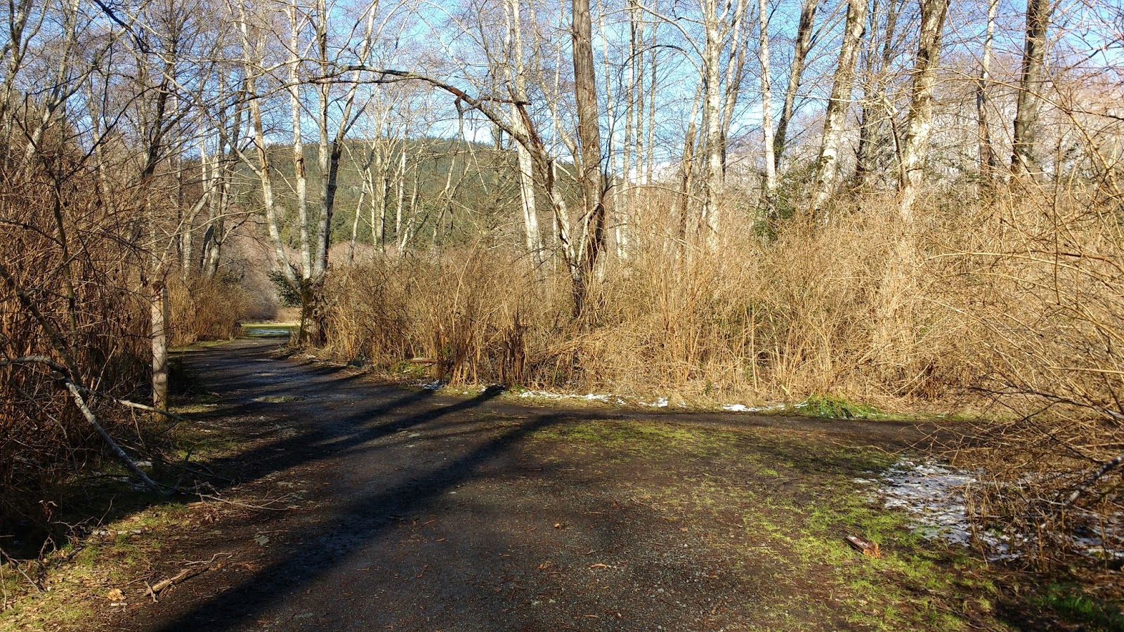
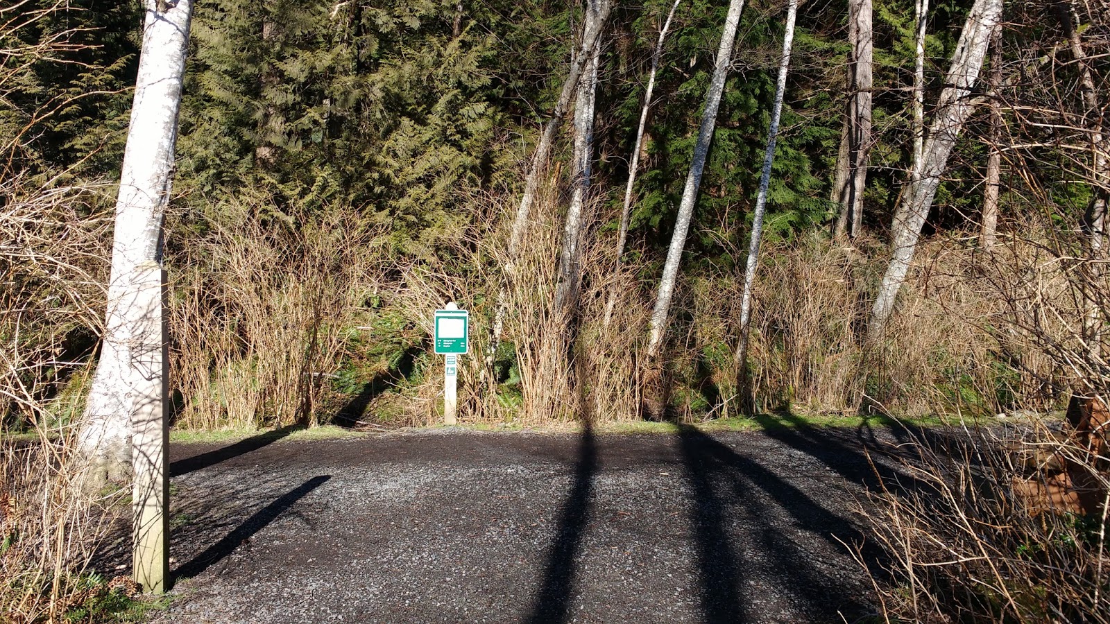
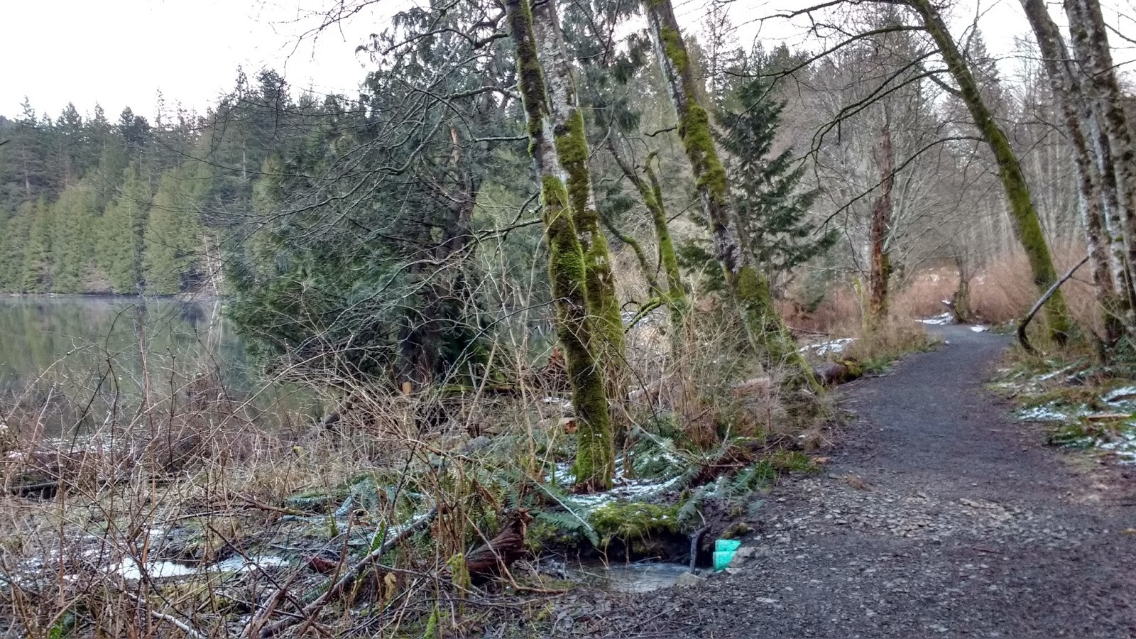
I decided to spend the day exploring some of the many side trails around Killarney Lake. On a previous trip, I had done the most popular loop of the lake, which was extremely well-marked and fairly-well advertised.
This time, I'd follow some of the unmarked and unpublicized trails, to see where they led. The lovely Schedule E map showed quite a few side trails, and bowentrails.ca showed others. I had hopes of locating them all IRL, and did pretty well (even found one not on either map!) but there were a couple that I just couldn't find. It probably didn't help that the maps didn't totally agree with each other or with google maps, even about where the roads were. >.<

screenshot of Schedule E map

screenshot of bowentrails.ca map
I tried to do my best to show the routes I took on the map below, but please consider this an approximate representation. I am guessing it was about 12km total, although it is difficult to calculate. The 4km loop around Killarney Lake is relatively flat, but several of the side trips I took were steep. The blue "X" shows where I failed to find the trail(s). The pink connected dots show the route I took. The blue connected dots show where I went back the next day, to try to find the connecting trail from the other end. The pink "H" marks the Hatchery, where I started and ended my journey.

(click on map to enlarge)


A kiosk next to the Hatchery showed a trail map and some local announcements. Lucky me: the Bowen Island Conservancy was hosting a tour of the hatchery, with the help of the Bowen Island Fish and Wildlife Club. (Actually, if you see anyone in the Hatchery at any time, you could ask for a free informal tour, but on this day they were offering a more formal event.)

The Bowen Island Conservancy had been established in 1996, and modeled after pre-existing Conservancies on other Gulf Islands. They decided that their mandate should be to "work formally with the provincial and federal conservancy bodies, to educate Bowen Islanders about the advantages of [ecological] protection, and to prioritize areas for protection on the Island." This solidified into the management and conservation of nature reserves and other "ecologically-valuable land" on the island.
The Bowen Island Fish and Wildlife Club was established much earlier, in 1967, as a Rod and Gun club. However, with many enthusiastic hunters, the small island was quickly depleted of game (mostly deer), and hunting was banned. The deer population rebounded, and the group's focus shifted towards the fish, primarily Salmon Enhancement, including management of the Hatchery, stream-keeping and rehabilitation, conservation and education.
The event began with 1 hr of talks in the Bill Rush Memorial Classroom. Then we all got a 30 min tour of the facilities.
BIFWC President, Tim Pardee, opened the presentations and gave us an overview of the history of the Hatchery, and an idea of its operations. Some funny stories of their early "trial-by-error" adventures were sprinkled amongst more serious tales describing the obviously passionate care that the early (and current) volunteers had for their endeavor.

Since the Bowen Island Hatchery is a PIP (public interest participation) venture, which means it is volunteer-run, they need members like Mike Von Zuben, who ensures that they comply with the regulations set out by the Department of Fisheries and Oceans.

It was the Dept of Fisheries and Oceans who first noticed a decline in salmon stocks in the 1970s, and launched the Salmon Enhancement Program. The Bowen Island Hatchery opened in the 1980s.
The hatchery has a gravity-fed water system, originating in Carter Pond on Terminal Creek. This means that no electricity is needed to run the hatchery! (Of course, they do run a small amount for "human" needs, like lights.) They get their eggs already fertilized from Brackendale, so all they do here is feed, raise, release. They can handle about 400,000 max total eggs of chum, coho, and pink salmon.

Below, volunteer Janice Martin showed us how the eggs are stored, constantly screened for dead eggs, and then transferred to other racks when the eggs hatch. They have had great success: 97% of dropped eggs live to be fry, compared to only 5% in the wild.


Below are some Chum fry. They are kept several weeks before they are mature enough to be released.

Then we walked out to see where the Coho salmon fry are released in to the nearby Terminal Creek. Just outside the Hatchery, the trail splits. We took the right-hand fork to go down a small side trail to the creek. The other fork leads to The Meadow and eventually to Killarney Lake.


A set of wooden stairs led to a tiny gravelly beach that looked like it would make a great swimming hole in the summer.

But I supposed that (human) swimming was probably not allowed here: this creek had been carefully selected and maintained to match perfect young salmon conditions. A different volunteer explained how the young salmon need shelter, like overhanging banks and greenery overhead, to hide from both land and air predators.


Coho live 1 year in Terminal Creek before making their way into the ocean. The Hatchery was also trying Coho releases in Explosives Creek, on the other side of the island, but it had been slow progress. Coho are a smaller fish, great swimmers, and can do the fish ladders, so when they spawn, you might see them much farther up stream. The annual Salmon Bon Voyage party, where the public is invited to come help release the Coho fry into Terminal Creek, is set for June 4, 2017.
Compared to the Coho, Chum salmon are fat and slow, and can't get up fish ladders, so you'll see them spawning in the Lagoon (as long as you are there at the right time of year!). Although the Hatchery also deals with Pink Salmon, there were no Pink salmon here at the time. Pinks spawn every two years. Both Chum and Pink fry get released near the Lagoon, and at the mouths of Davies Creek and Killarney/Terminal Creek.
Tour completed, I left the Hatchery on the left-hand fork in the trail, and continued onward towards The Meadow.
In the Meadow, I decided to take the right-hand path around the edge of the field, rather than the main trail that cut directly through the field.

At this time of year, the grassy outer ring path was quite easy to see, as it meandered through the snow to several wooden benches.


Rejoining the main trail at the other side of the Meadow, I crossed Killarney Creek to get to Killarney Creek Trail. A couple of ladies were enjoying the views of the marsh.


I turned left onto Killarney Creek Trail, and not long after, spied the side-trail I was looking for.
This was the connection trail that I couldn't find earlier, from Collins Rd. Yes!! I figured I would rediscover the location of the other end of it, by following it from this end.


I reached a fork in the trail. The right fork had a log fallen across it. I tried that fork first, but in a short distance, it simply led to a little ladder over a tiny creek, and then the trail fell apart.


So then I tried the left fork, and that was the way to go. I walked past the length of a VERY large fallen tree.

When I arrived at the next fork, the left fork was covered in snow, and the right fork completely bare! It was as if someone had drawn a line in the earth. It was nearly impossible to photograph, because of the stark contrast in light from one side to the other.

But there was a house sitting in the crook of the fork, and a large Buddha statue perched on the top of a gigantic stump.

The bare right-hand fork appeared to quickly lead to the house's shed. The snowy left-hand fork was the way to go. There was another, smaller Buddha's head on a stump along that route as well.


At the exit of the trail, I turned around to see what it looked like from the Collins Rd side. The path seemed completely unmarked, but there was a yellow Dr Seuss fish between it and the next driveway marked "618," which also sported a large statue of a pig. I had gotten this far on my trip down Collins Rd, and seen the fish and the pig, but didn't realize that the unmarked "driveway" on the left was the trail I was looking for.


Once you know where the trailhead is, the trail is really easy to follow, coming back from Collins Rd. You'll see the house with the big Buddha to your left.

Watch for the little Buddha head on your left, to signal the fork. The fork is harder to see in this direction.

It's here, to the left of the mesh surrounding this little tree.

The rest of the way down was easy as pie.

Just remember to stay right at the next fork, if you notice the fork at all! In this direction, it's easy to not notice that there's a fork at the fallen log. But at least that works in your favor, when travelling in this direction. All you need to remember is to keep heading "downhill."


Back at the junction with Killarney Lake Trail, I took a right turn and continued on in the direction I had been heading before this little detour. Just as I hit the main trail, some trickster Ravens went nuts, cackling. "What are you on about?" I asked them, "I was successful! Don't tell me I'm about to get lost or something..."

At the next fork, I took Cedar Trail, on the right. It was well-marked with a trail sign.

I was looking for a side trail I that would cut across from Cedar Trail to Killarney Lake Trail, before I hit Magee Rd.

Jackpot! I had never noticed this trail before, even though I had already walked Creek Trail several times. On this day, the snow really emphasized the trail that split off to the left before disappearing behind some large cedar trees.

The trail led uphill, then turned and split into a fork, which actually shows on the bowentrails.ca main map.


First, I tried the grassy left-hand fork. It quickly started to disintegrate, and I pushed through twigs and branches for the last few metres to a lookout over the portion of the Cedar Trail I had just come, far below. Then it quickly disintegrated into nothing at all.


Even after the trail seemed to dissolve into nothing, there were signs that people had been there, including a beer bottle, and the ancient remains of what I think might have one been a rug. It seemed like this little landing would have been a great picnic spot at one time, but now it was covered in fallen branches and deer poop. I imagined deer getting together to chat and watch the hikers on the trail below.

I retraced my steps back to the last fork, and continued onward.

In this direction, the trail was much more established. However, there were very many fallen trees and logs on the path, which were only partially cleared. Some, I needed to step over, although it was not too difficult.


As the trail started to drop down, I could see the Killarney Lake Trail ahead and below me. I joined it, feeling pretty accomplished.

Just in case you wanted to find this side-trail from Killarney Lake Trail, I backed up a bit along the Killarney Lake Trail to get this pano of the side-trail leading off to the right.

Actually, it seemed as if the side-trail crossed the Killarney Lake Trail, and I went down to see where it led. Turns out: nowhere. lol. The path was pretty clear until a big pile of fallen logs, then I lost the trail after that. I was pretty close to Killarney Creek at that point. Was I supposed to bushwack to the creek from there? I decided against it, and returned to the Killarney Lake Trail.


I continued on Killarney Creek Trail until I hit Magee Rd, where I turned right to follow the contour of the lake. Magee Rd is a gravel road that is barely more than a car-width wide. While cars do use it, at points it is indistinguishable from a walking trail.


When I reached the next fork, I decided to stick to the footpath close to the lake, rather than Magee Rd. I had already explored that next section of Magee Rd on a previous hike.


In this next section, I was in constant awe of the large stumps. They seem like "nothing" in the photos, until you get a banana or a person for scale.


As the foot trail rejoins with Magee Rd at its other end, there are a couple of wooden footbridges. I stayed left, keeping to the trail, rather than going back up to Magee Rd.


So I went onward, past the boardwalk over the marsh at the north end of the lake. A sign gave notice that they were rebuilding a section of the boardwalk, and indeed, parts of it were dismantled.


I soaked in the view as I rounded the tip of the lake, then plunged back into the forest. I knew there was a side-trail to Xenia Retreat Centre that started right at the other end of the boardwalk. They called it the "Frog Trail," because... well, you guessed it! But since my next planned side-trip would take me past Xenia anyway, I skipped the Frog Trail on this day.


The trail clung to the shore of the lake, offering some nice views.


The side-trail I was hoping to find would give me a second chance at connecting with the trail to Honeymoon Lake and Mt Collins. I was looking for a trail leading off to my right, so these neat wood features caught my eye.


Then I saw what looked like a path off to my right! It was pretty rough, and a little hard to follow, but I followed it up the hill to....


A MUCH more established gravel path, that appeared to lead back to connect with the trail I had been on before.

Curious whether I had taken the correct "right-hand-path," I back-tracked, and realized that had I just gone a little farther on my original trail, I would have encountered a very official-looking intersection with a map, from which I could have walked up the more established trail the whole way.


Amused, but happy I had found the right side-trail, I followed it uphill until it suddenly ended at a paved intersection!


Here's a photo looking back to where the trail meets the road, for those of you heading in the opposite direction. You can see it is marked with a Crippen Park trail sign, although it does not offer a name for this trail.

The street signs read Fernie Rd and Allan Rd. While Fernie showed up on google maps, Allan Rd did not. None of my maps seemed to accurately portray this area. I checked down Allan Rd, just to see what was there.

I was rewarded with a peek-a-boo view of this cool house! It looked like it belonged in a fairy tale.

It was a fairly short little road. Just past a red house with a "barn-like" architecture style, I encountered a closed gate. The sign read "no hunting." It appeared that people simply walked beside the gate, and beat a small trail there. I wasn't sure I was supposed to walk there, so I gave up, turned around, and went back to Fernie Rd.


I walked down Fernie Rd, which was really just a gravel road. It was fairly scenic.


I passed a horse ring. I knew from walking Xenia's Labyrinth that the Labyrinth was just on the other side of the horse ring, connected by a small path. I wasn't sure whether Xenia owned this horse ring, or just seemed to use it. The ground was flooded with melting snow, so I didn't try to cross it into the Labyrinth. Besides, I had bigger fish to fry!

The road turned a corner, and I saw a sign for The Cat's Pyjamas Cattery (which I initially read as Catering!). According to their website, their cat "hotel" has 20 individual rooms, each with a window, and cat door to access their own covered outdoor enclosure, from which they can watch the passing deer and birds. What luxury!!!


As I approached the corner of Fernie Rd and Smith Rd, I could see horseshoe prints in the muddy gravel road. I guess they had finished their routines in the ring already, and were home eating some delicious hay.


The Schedule E map seemed to show a trail leading straight out of Fernie Rd and bisecting Smith Rd, right about where the far stop sign was in the photo above. Beside that, were these interesting "giant mushrooms" constructed from a stump.

I could see the entrance to Xenia just around the corner on Smith Rd. I scoured the intersection, to no avail. On the map, the trail seemed to go right past Opa, and continue North a ways, before turning North-East. Maybe I was meant to go down Smith Rd (Xenia's "driveway") past Opa, and pick up the trail there. Nothing.

(BTW, if you are heading up Fernie Rd in the opposite direction, you might notice a sign saying "End of Public Road," and worry that you can't walk there, but according to the BC Ministry of Transportation, "[An End of Public Road] sign is used to mark the end of a public road and the start of a private road on which public traffic is allowed.")
I wanted to try to walk down the length of Jones Rd, and rejoin Killarney Lake at the access across from Bolton Rd. All of my maps seemed to show that as a possible route. However, after turning left and walking up the very steep Jones Rd, I ended up at someone's house, didn't see any obvious thoroughfare, and didn't feel comfortable poking around in their yard to find a "hidden" trail.


So I headed back down and turned left at Woods Rd, and stayed left at Bolton Rd and onto Mt Gardner Rd, to approach Woods Rd from the other end.


Just before the intersection with Jones Rd, a curious llama urged me to explore. My guess is that he was there to help "guard" the sheep. Although I am not sure what predators Bowen actually would have... besides dogs, I suppose.

Now, you might be wondering why all the snow suddenly disappeared... hehe... Well, to be honest, on the day of this blog -- i.e. the first time I tried to figure out this end of Jones Rd -- I chickened out at the last minute. With the snow on the ground, I couldn't see what was what: road, driveway, "nothing," all looked the same to me. So I went back another time, after the snow had melted. So these next photos were from that time.
I made a hairpin turn off Mt Gardner Rd down Jones Rd, which was really more of a gravel lane. An overgrown grassy road led off to the left, beside the fence that contained the sheep. The gravel road continued past a house on the right, which was boarded up and looked like it was perhaps being used for storage. I followed the gravel, but it seemed to just lead to another house, so I turned around and headed back.


The grassy lane appeared to be the right way, based on my GPS and google maps. It was very overgrown, and quite wet. My shoes and pant legs quickly soaked through.

After a short distance, it turned to dirt, and came to an intersection.

I wasn't sure which way to go. The left-hand fork looked more like a foot path than a road. The right-hand fork looked more like a road. In the centre, between the forks, a fallen tree obscured what might have at one point been a logging road.

I checked down the left and centre paths, which ended up quickly merging, but the "road" seemed to disintegrate into a creekbed. Despite it heading generally in the right direction, I was not so sure that it actually led through to the other end of Jones Rd. Plus, by the time it became a creek, the ground was so muddy that I didn't feel like bushwacking through it, just to find out it didn't go through. So I turned around and headed back to the intersection to take the other fork.
Just for your edification, here are some photos of that dead-end path. It started out seeming quite like an old logging road.

Here a flicker had made some short work of a stump.

Someone had put this pair of noise-reduction ear-protectors on a tree, just before a creek crossing. It reminded me of when Chris McCandless put his toque beside the river, on his way to The Wild Bus.

As the path became more muddy, a little frog posed long enough for me to photograph him.


On the way back, I looked past the fallen tree I had mentioned earlier, and it really seemed like THIS was the continuation of the grassy road I had come in on. However, clearly, if it ever was, it was not really passable any more.


I walked past it, along the previously-mentioned right-hand fork, which, it turned out, quickly forked again! Both forks had pink markers. The one on the right read "easement" and pointed back the way I had come. Well, that was promising! Looking down that fork, I could see the house that I had seen before, at the end of the gravel lane. I guess the path did cut through by the house somewhere, but I was glad to come this way instead, because it looked as though that part was private.


I took the left hand fork, which quickly turned back to grass. Such long wet grass. Then finally I was through it, and back to dirt, although my feet were now actually audibly "squishing" in my shoes. Good thing it was not very cold out!


Just as I realized that the route was taking me pretty far off where I thought "Jones Rd" should be heading, I encountered another fork! At this both, both forks were obviously footpaths. I took the left fork first, which looked like it might have at one point started being prepared as a housing site. It had several sets of wooden staircases, which zig-zagged uphill.


At the top was a small house. Doh. Maybe this was a private path? I peered around to see whether the path led past the house, but it seemed to just disintegrate into mossy hillside. I didn't want to bother anyone, so I went back down the stairs to the last fork.

This time I took the right-hand fork, which led through the trees to an interesting wooden staircase.


Getting closer, I could see a small building up the staircase to my right, with the stairs leading past it up the hill beyond. A small sign on the ground said "climb stairs to Bowen Island Hideaway B&B." Thinking that the stairs looked similar to the ones on Cates Hill, which were an easement, I went up to see if the path continued over the hill. There was another house at the top. A gravel path seemed to lead through the yard, but this REALLY seemed like private property, so I didn't proceed through it, but rather turned around and went back down the stairs.


At the bottom of the stairs was a blue building with a white sign that I could see at a distance. It also said "Bowen Island Hideaway" and this time "Private Property" and "please respect this cabin's privacy." However, there was also a sign pointing away from the building, reading "to Killarney Lake." Since I could just stay on this side of the building to proceed along the path leading away from it, I figured it was ok.


The path led through a small grassy clearing, and into the woods beside the big tree on the right of the photo below.

It then ran along a fence, in a straight line. Suddenly-- much sooner than I expected-- I was at a trail junction and I recognized the Killarney Lake Trail! I had actually walked past here with the owner of Bowen Island Hideaway one day, after meeting her walking along Fernie Rd. What a coincidence! A sign on the trail pointed back the way I had come, as the way to the Bowen Island Hideaway. A few metres away was a park map, indicating my position.


I turned around and headed back up the trail and back out to Jones Rd. Here is a short version of the route in reverse, in case you are coming from that direction.


The trickiest part of this route in reverse is the staircase. After climbing the first few stairs, there is a "landing," before the next set that head up past the small brown "cottage." A set of three stairs lead off the landing to the trail. But it doesn't really look like a trail right there. It looks like the three stairs lead nowhere. Head up the small grassy hill and the trail will appear.


At the intersection, keep left, and you will downhill slightly. If you see stairs or start going uphill, you've taken the wrong fork.

The trail looks much more like a "road" here, and curls behind a house. Then you'll be at the clearing with the speedboat. Take a left turn at the speedboat/tires, and you'll pass the farm with the llama and sheep, and exit out onto the gravel road.


Turn right onto the gravel road, and go uphill to Mt Gardener Rd.

I did retrace my steps back out to Mt Gardner Rd, and turned left onto it. The Schedule E map showed another trail that let up through Bolton Rd to Mt Gardner. Since I was "sidetracking" in the area, I wanted to see if I could find it.
Bolton Rd was INSANELY steep!!! I trudged all the way up until it hit a house. I poked around a little at a distance in their long driveway, and saw a few ribbon markers set into the woods here and there, I couldn't tell whether any of them were actually signalling a path. Stupid snow. With no obvious trailhead to be found, I didn't want to actually start randomly traipsing about on their property, so I turned around and made my way back down.


At the bottom, I turned right and continued on Mt Gardner Rd.


I could see a power pole off in the distance to my right, but no clear path leading in that direction. Instead, it appeared as if maybe a path led over a small creek and up to the right. So I followed it. It sure seemed like this could have been an old logging road, even if now, many trees had fallen over it.


The trail seemed to peter out at the edge of a steep rocky cliff. There was just too much snow and debris to see anything resembling a trail. After spending far too long trying to figure out where the trail went, I realized I was just wandering around blindly at 3-4pm -- meaning that dusk would soon be upon me -- with a low cell phone battery and a non-functional power bank charger, even though it had worked fine the day before.
My GPS on Google maps told me I was almost through to Bolton Rd, and I could hear kids playing on the road far below me, but I was worried about slipping down the cliff in the snow, and worried that it was not the right way at all, and I would get stuck there, in the sub-freezing temperature, in the dark, without a cell phone. I chickened out and turned back.

I followed the footprints of guy with dogs along Hikers Trail back to the trailhead. I bet myself it was the guy I had met on my last trip through there. Just as I turned back, it started to snow. Boy that made me really glad I had decided to turn back instead of tackling the cliff. By the time I reached the trailhead at the bottom, it had turned to rain. By the time I got home, to hail. I was getting ALL the weathers that day!
Just past Bolton Rd was an entrance back to Killarney Lake, marked by yellow posts and a Crippen Park trail sign. I turned left and headed in.


The trail led downward and connected with the Killarney Lake Trail right by the lake. A right turn put me heading towards the parking lot and picnic area.


A little bridge marked where a person could head to the water and get a great panoramic view of the lake. I skipped that on this trip, and kept going along the main trail.


Arriving at the picnic area, I turned left and walked through its length, past the dam at the far end, and out to Magee Rd.


There, I turned left, and then made a quick right at the signage for "ferry" and "Snug Cove."


The light was fading fast as I got to the Meadow Trail. The clouds glowed pink and orange over the mountains.


I hurried through the Meadow back to the Hatchery. By the time I reached it, dusk was upon me.


Getting home after such a long day of trekking up and down hills, I was nearly beside myself with leg and foot pain. I put some of Cathleen's magic cream on it. Then Colin massaged it while I tried not to cry.

