
That morning, Google photos sent me an image of "this day in 2010"... Snow in Kilsilano. (For those of you not from Vancouver, that was very unusual.)


On this day in 2016, the news reported such high winds, that a BC Ferry from Nanaimo, on nearby Vancouver Island, couldn't dock at Tsawassen the night before, and spent 5 hours stranded at sea overnight, until finally arriving 7 hours late.
On Bowen in 2016, despite weather predictions to the contrary (it had been pouring rain all week), the day was clear.
I planned to find the route to Valhalla, from Cates Hill. (No, not THAT Valhalla.) It's actually another residential area on the top of the next hill over. I hoped to also make it to the "September Morn" nude beach on the way back, but as you'll see, I ran out of time. The sun sets darn early on Bowen in winter. :(
The route was about half way (approx 4.5km UP) along the foot paths, and half way (another 4.5km mostly DOWN) along the roads. The elevation rise was about 270m to the peak.
There is no truly accurate map of this trail. I made the following one based off of the map at bowentrails.ca plus the property title maps. I plan to return later and plot it out with my GPS-- don't know why I didn't think of it at the time. (I included the trail to the top of Cates Hill and the one to September Morn Beach in dotted lines, for reference.)


In 1999, the developer of Lot 489 (aka Cates Hill, as described in my last blog) gave Right of Way to Bowen Parks & Rec (BPR) to maintain a trail through these lands for public use. According to the land titles for Lot 489:
The BPR can maintain
parks, recommend future suitable parks, and build trails for public use.
They may cover the trails with asphalt, gravel, or bark mulch, or any other
material the owner deems suitable. They may also build things like
railings, bridges, gates, drainage, signage, garbage cans, or
portable/temporary structures. BPR can cut down or trim trees that obstruct the trail or cause a hazard on the Right of Way (trail).
The public can use these trails on foot (no
motor vehicles). However, it's important to realize that despite the public being able to use it, the right of way trail is
NOT designated as a "Park." It's still technically private land. The owner can alter the non-trail area and the trail area, including digging wells, removing/adding
soil, erecting temporary/removable buildings, roads, fences etc, without
asking permission of the BPR. The owner is also NOT liable for injuries etc that people have on the trail, except if there is a breach of contract by the owner. Same for the BPR.

As I walked, I noticed that several water run-off tributaries ran perpendicular to the trail, down the hill towards Davies Creek, which in turn, ran through the valley between Cates Hill and Valhalla.


I loved the mossy giants that stood next to the trail. Raven croaked overhead as I passed.


There were a few clearings here and there. I imagined the owners okaying campouts for their teens there. I would have loved that as a kid: tenting in your own forest! :D I don't actually know if any of the owners ever did that, but I was enjoying imagining it.
At one point, I got a nice view of the valley, and could see a couple of trails on the other side: one heading up the hill, the other down next to the Creek.

Smaller side trails branched off here and there. Many owners had forged smaller trails throughout their properties. Most of these were not officially included in the "right of way" trail, but led to the owner's homes. However, in the photo below, the smaller trail on the right was a continuation of the main trail, which headed up to the top of Cates Hill. I decided to save that route for another day, since I did not want to delay my journey to Valhalla!

Instead, I took the left hand trail, which dropped down to Davies Creek. Close to and just before the Creek, another small trail branched out on the right and led up the hill towards Cates Hill. This one simply joined the right-hand trail in the photo above.
The last time I came here, about a month ago, this area was dry. Now the trail was slick, and tiny tributaries had sprung up everywhere. I chose my steps carefully, but negotiated them fairly easily.


After crossing the many little tributaries, the trail very obviously led straight ahead and up the hill towards Valhalla. But then, I noticed that a very well-constructed set of stairs led off to the left. I thought I was *already* on the trail to Valhalla...??? I couldn't resist climbing down the stairs, and saw another trail following the Creek. I started doubting my route. Valhalla HAD to be "up," I reasoned. I decided to take my original route, and come back and check the stairs' route another time.


It was only later that I realized I had been at the junction of the two paths I had seen from the other side of the valley, earlier.
I headed up hill on a path flanked with ferns. I was glad for my knee-length raincoat. The ferns were not soaking wet this day, but it still offered protection.

As I climbed, I saw the other trail, receding far below me. I would definitely come back and see where that trail led, I affirmed to myself.

Colin had been sure that there was a path leading from the mailboxes down on Dorman Rd that ran up through here, but I had looked around in that area when I walked through Crippen Park, and I couldn't find the trailhead. (He turned out to be correct, I discovered, on a later hike.)
The path went up and up, and I felt a twinge of vertigo as I glanced over the left side of the narrow path to the plunging mountainside below. Every time I wanted to take a photo, I had to stop to secure my footing first.


Through the trees, I caught a glimpse of Snug Cove far far below. The path felt steep, but I must have really been gaining altitude more than I thought!

Passing some large trees, I noticed that the trees had their own tiny forests growing on them!


I clambered over a smallish recently fallen tree, and paused to rest and munch almonds when I saw the trail surging upward ahead of me.

To my pleasant surprise, instead of continuing straight up, the path suddenly took a hairpin turn to the right. The path straight ahead must have been an optical illusion. A Raven cackled at me. That trickster!

I moved slowly up the steep incline. Then, out of nowhere, a set of well-built stairs. I imagined someone taking on the daunting task of hauling lumber in on these trails. My mind wandered back to the day I saw a worker hauling 20-foot bundles of bamboo scaffolding up and down the slopes of Wudangshan in China.

The path switch-backed upward, and Raven cackled even harder when I arrived at another fallen tree-- this one much more formidable than the last. It had taken out the stairs under it.


The wood was slimy, and gave way to the touch of my fingers. The surrounding earth was saturated and soft, and plunged steeply on each side. More of the tree was resting perpendicular to the path, just above it. It, too, looked like it would disintegrate at the slightest disturbance. The earth around it was soft and looked ready to dislodge.

I decided it would safest to climb over the tree, rather than around it on the soft earth, and hoped the wood would hold. Fortunately, it did. And double fortunately, my route wouldn't bring me back this way later. I hoped that it might get cleared before I took this route again.


A later trip revealed someone had mostly pushed the tree off to the side of the path.

Ducking under another fallen tree, I could see Snug Cove far below, peeking out between the trees. Then: a house!


It looked like the trail would lead straight out to the road, but it kept switch-backing steeply upward. The terrain was littered with ferns.


Soon, I encountered another fallen tree. This one, I stepped over. Those high winds the day before must have really done a number on this area!

The trail split into three. Valhalla Strata signage pointed the way. I believe the unmarked fork between the signs led directly to the nearby road.


The path kept going up and up. My thighs were on fire. The trail seemed to be taking me away from the road... I started to get nervous, as the sun would set in about an hour. I looked out to sea: I was REALLY high up.


Yet another tree over the path...

When the path finally leveled out, I sighed in relief. The trees cleared, providing a mossy rest area, and I first saw THIS. I knew where the local kids probably came to party. ;)


Then I looked up and saw this stunning view. The rocks offered a lovely picnic spot. I thought of a few friends in Vancouver who would really like this hike. Yep, I'm looking at YOU, Ruth, Alex, and Ben. ;)

After the lookout, the path started heading downward, and I nearly cheered.

My enthusiasm quickly turned to dismay, however, as the trail plunged downhill at an alarming angle. I descended slowly, ensuring each step was secure before taking the next one.

At the bottom, looking up, I could see the incline was actually "stairs" of sorts, but that was impossible to tell from the top-- or even while descending!

After that, the trail got worse and worse. The light was also starting to fade, which worried me. According to the GPS on my phone, I wasn't very far from the road, but I couldn't see it, nor make out the path. I tried some deep breathing. I made my best guess as to which way the path went, descended, then looked back to see a couple more near-invisible stairs.


Sometimes, when I turned around to check, the "invisible stairs" would only be iron pegs sticking out of the ground, where stairs used to be. I guess this part of the trail would be much easier to walk in the reverse direction to the way I was going. I continued on in that manner, guessing, then turning and checking, until a saw another lookout.


This clearing, like the last, had a nice little mossy rest area. As I stepped into the clearing, the view was spectacular: Vancouver, from UBC to downtown, and a big chunk of the North Shore. I waved at my friend Nihan in Vancouver, who I had been missing since the move. "I see you!" I called out to her.


Buoyed by the nice view, I turned to continue onward, and quickly lost the path again. I spent about five minutes walking in circles, then I made my best guess. Looking back, I saw stairs, so I thought I did good, but...


The path seemed less and less of a path. I ended up on a VERY narrow ridge running along a steep slide area. It looked very unstable. Every step, I just kept repeating to the earth, "Please stay firm. Please stay firm." Everything I tried to use for handholds just crumbled at my touch.


Fortunately, I ended up practically in their back yard, with a view of a gravel road. Unfortunately, the route down was sheer rock, then a Creek.

I saw what looked like it might be a trail above me, and climbed on all fours upward a few metres. This strategy had worked in the Cowichan. Unfortunately, it didn't work as well here. Arriving at my destination, I was not convinced it was a trail, but at least the ground was flatter and more stable. I could also use trees as handholds.


Finally, I was within a couple metres of the gravel road, and only 2m above it. It looked like a person--or an animal-- had used this route to get down, so I held on to a tree to get one secure footing, then, knowing that a slip would land me in the creek running between me and the road, took a deep breath and "went for it."

Two well-placed steps got me to the road. A beautiful little pond sat placidly beside a house I recognized from an online article I had read about Bowen Island.
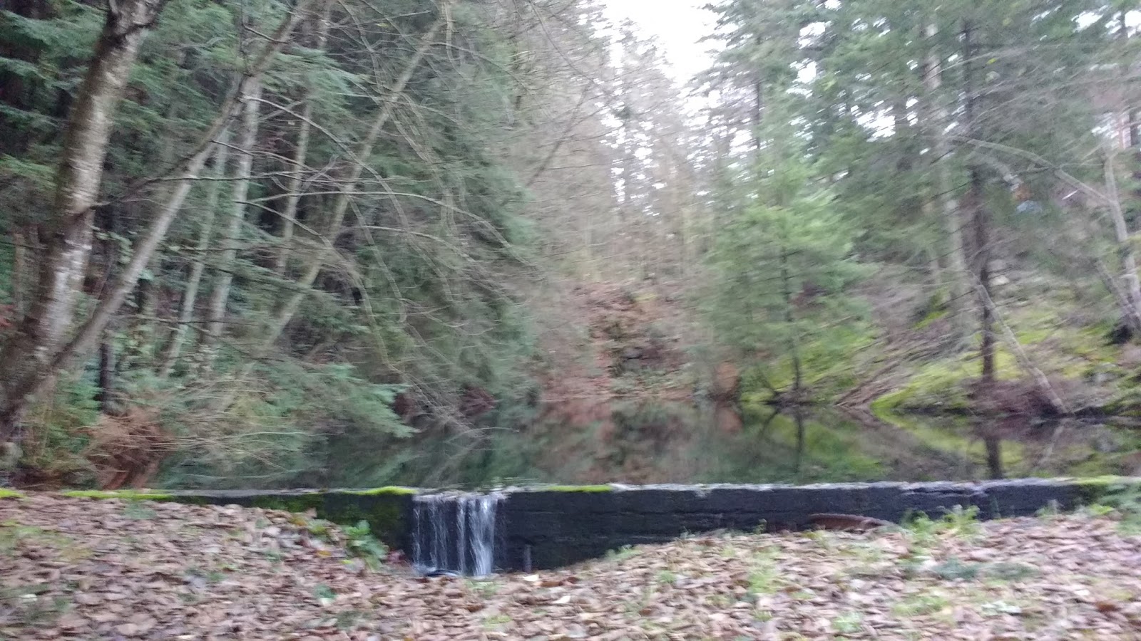

I searched around a little, to see if the exit to the "real" trail that I had seen was closer by, but I saw nothing. I didn't know where I was supposed to have exited.
Checking online, I read:
"Keep on going until you reach a relatively level strip. If you follow a precipitous downhill trail on your left, there is a lovely viewpoint just above the Valhalla water tower, an excellent photo op of Howe Sound and Georgia Strait." There was nothing to indicate where to go next. Plus, I felt like there was no "precipitous downhill trail" BEFORE the water tower, rather, it came after it, before the second viewpoint. Was the main trail up on the flat, before the second viewpoint? I had no clue.
I saw a gravel road beside the pond. I got momentarily annoyed that I had missed the real trail by so little, but, walking to the end of the gravel road simply led to a house's driveway. A dead end. It was not the trail after all.

***UPDATE***
I was wrong about the gravel road by the pond. On another trip up, I found the actual trail down from the water tower!
Just past the first viewpoint above the water tower, and before the steep "stairs" or the second viewpoint, there was a trail leading down to the water tower itself.


Around the side of the water tower, there was a gravel access road leading down to a cement road.


To the right, was the house I thought was the "dead end," and the beginning of the gravel road by the pond (at far right of photo below).

However, if one turned left onto the cement, instead of right, one could actually walk all the way down the hill on the road. (Coming uphill along the road, the turnoff is just past the Valhalla common area "park.")


Conversely, exiting onto the cement from the water tower access road, one could also re-join the Valhalla trail, and descend past the green "trail" signs I saw on the trail. The entrance to this trail was marked by a red reflector on this big tree. Watch for it on the left side, very soon after joining the cement from the water tower access road. There is a green "Emergency Evacuation Route" sign right in front of it.


***END OF UPDATE***
On that first day, when I had lost the trail and didn't know any better, I followed the gravel road away from the pond and house. It went past a few more houses, and exited onto Valhalla Place in front of a house that we had considered buying! That house had had an amazing 180+ degree view, and had sold almost immediately after we viewed it. As I stood there, a car pulled into that house's driveway, and the man waved at me in recognition.

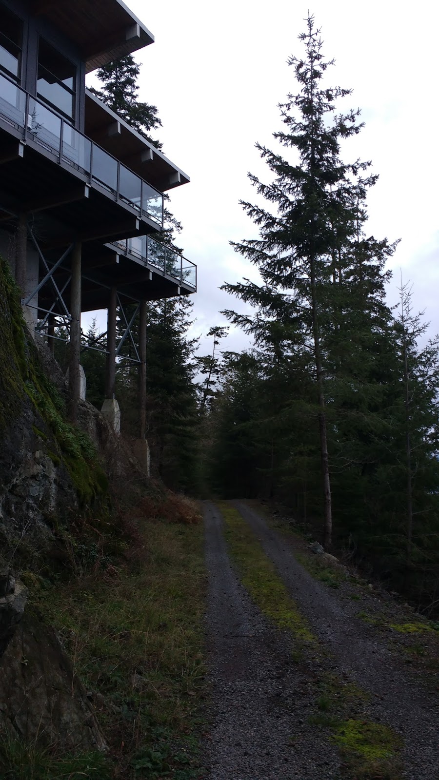

To give you an idea, here's a "fake pano" of the views from this house... Gotta re-learn how to use the panoramic function... :p


From there, I could see the same house from below. And from there, you can see a big reason why we ended up not buying it: the property, while large, is basically all unusable cliff! Our dog is not so bright-- he falls off the bed sometimes-- so imagining him on those rocks terrified us. We were sure tempted by that view though...

Where Valhalla Place turned into Channel View Rd, a sign announced the boundary of Valhalla neighborhood.


I continued to jog until about half way down Taylor Rd, when it started going uphill again. I resumed a walking pace.

It sure was more slow-going to walk than to jog! But there were a few cars going through here, plus the fading light, not to mention the uphill grade, so it was ok to walk. I got a nice view of the mountains.


After the road curved in a half-circle, it straightened out. It was around there that I noticed a footpath leading off the road to the right. It quickly dropped away from the road, but then I could see it running parallel to the road, below. I wondered if it connected to the Dorman Point trail. I knew the Dorman Point trail did connect to the end of Robinson Rd, but I didn't think it ran so close to Dorman Rd along the way. I didn't have time to explore unknown trails at that point, as darkness was falling.
As I walked on the shoulder of Dorman Rd, I tracked the trail with my eyes, where I could, and it seemed to join the end of the Bowen Wastewater Treatment Plant. I realized that this was probably the other trail that I had been trying to find on my trip to Bowfest Beach in Snug Cove.


I quickly poked around the entrance to the waste water plant, to see if I could tell where the trail came out at the road, but in the growing dark I had no luck. I walked up the last incline to "town" (Snug Cove), and caught the Bowen Island Antique Emporium before it closed its doors for good. I had seen two matching baskets there a couple of days before, and everything was 75% off in their "closing out" sale. Then, I climbed up Village Dr to where I had started.


Settling in on the couch in front of the fireplace, I munched on my "pre-dinner snack." Another habit I brought home with me from my time France: afternoon cheese time. ;) I was pretty happy to have located some French cheese at the Ruddy Potato, the local specialty grocery. I have a dairy allergy, and for some reason, perhaps the genetic differences specific to French cows, French cheese does not cause me to get sick. In Canada, I get very ill from eating dairy, but in France, I could eat it every day with zero trouble. Perhaps its in the additives, perhaps its in the feed, perhaps its in the genes (France is one of the few areas whose cows carry predominantly A2 casein, instead of A1. A2 and A1 proteins differ by one amino acid--maybe that's enough to trigger an allergy?).

Anyway, I delighted in my Bleu Azur and my Comte, two of my favorites. My dog jumped up beside me, as if trying to tell me something.... But I just couldn't make it out... What was he trying to tell me??? Oh yes... "PUT IT IN MY FACE!!!"

Eventually, he appeared to give up.

But as I cut another slice of cheese, his hopes rose again, so I gave him a smidge for being a good boy. ;)

After cheese time, it was time for my nap. Another of my France routines, brought home to roost. Who knew the amazing benefits of a daily walk, cheese time, and nap time? ;) Life-altering!
As a parting gift, here's a little tongue-in-cheek picture of "Colin and I" figuring out our priorities when buying our home on Bowen... I'll take 20 naps please... ;)


