Monday, June 22, 2015

Everything’s coming up Millhouse!

After three days off hiking to rest my poor rib, searching the internet to discover there is nothing doctors can do for a broken rib (they don't even wrap broken ribs anymore, for fear of pneumonia!), ensuring I don't have anything really serious (like flail chest), and rearranging my bed to create a mountain of pillows for my legs that would take the pressure off my back, I’m finally feeling better enough for a short randonnée.  I pop another extra-strength Advil, fill my pockets with the daily dose limit, and plot a route. 

We decide to drive to Sainte Paule, and do a circular route of about 3km, with the option of adding on another 1.5km at the end, depending on how I feel. The 3km route has a 250m drop in elevation to the creek, then another 250m back up.  The extra 1.5km would add another 80m up and 75m down.


We park at the Sainte Paule cemetery.  The view from the parking lot is amazing!! We stand there a good long while, taking photos.  I notice a church perched all alone on a ridge.  It seems like a great destination hike, and I mentally start planning my next hike there.


The trail starts on the opposite side of the cemetery from the parking lot.  There is a yellow randonnée signpost pointing us South towards Le Vervuis. 


We walk along the length of the cemetery until the pavement turns to gravel.  There, the path starts plunging downward at an alarming rate. We can see Oingt ahead of us, perched on the top of a hill.  It really doesn’t look very far away.  We plan to return to this area and do a walk that includes Oingt, which is on the list of “the most beautiful villages of France.”  Maybe we can do Oingt and that church I saw in the same randonnée.
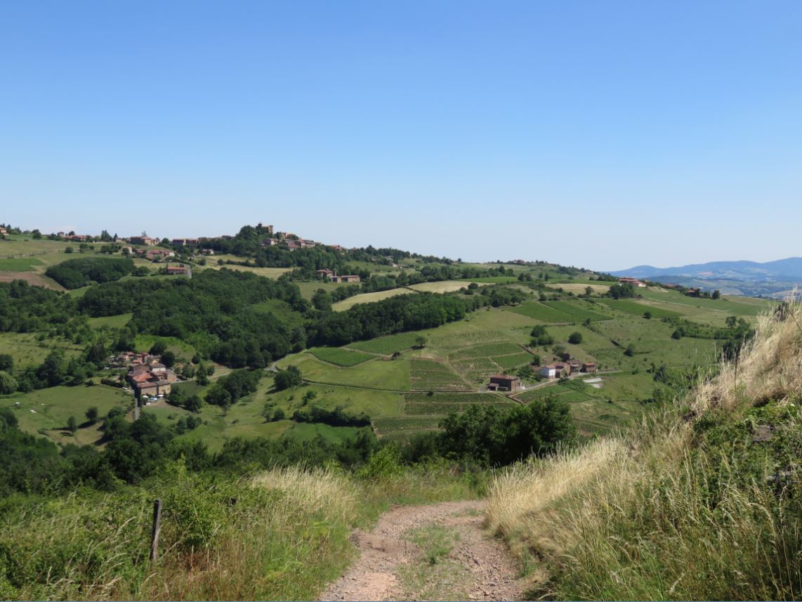


It seems like this path is still actively being used by vignerons, who are working in the vineyards today as we descend.


To my right, I can see the path I think we will take on our return from Le Vervius.  It seems less steep than the path we are currently on.  Our path turns to grass we pass through vineyard after vineyard. 


Closer to Le Vervuis, the path returns to rock, but here it is extremely rough and creviced, as if ravaged by water runoff.  At the Vervius signpost, we practically do a U-turn and head back up the rocky path towards Lambert.  We’re a little disappointed that we don’t actually get to see the Vervius creek that runs along this valley.   


Heading back through the woods, we hit a fork, and I notice a spray painted red arrow pointing us on the obvious rocky path straight ahead (where Colin is standing).  But Colin checks the GPS, and decides that the correct path up to Lambert is actually the grassy path to the right.  We head up the grassy path.  It has wheel ruts so deep, we can’t figure out what kind of vehicle wouldn’t bottom out on this road.  Looking at the randonnée map afterwards, I think the "correct path" was the rocky one after all, but in the end, both lead to Lambert, so it really doesn't matter. 


Soon, we are up on the ridge I could see from our path down.  I pant:  “Did I say this was the LESS steep route?” 


At the top of the hill, we find ourselves in Lambert le Bas, which yields seamlessly into Lambert le Haut.  The houses are very picturesque.  


Soon we are at the Lambert le Haut signpost.  We decide to tack on the extra 1.5km to the summit of Cret de la Garde, but then instead of heading for Les Avenières, which would take us up to Cret de la Garde, we mistakenly head towards Haut du Bourg and the Cemetery.  


As we enter the town, we notice the stones are much more “pink” here, rather than “golden.”  Colin muses: “I wonder how many places in France are called Saint Paul?  Wasn’t he pretty important to Christianity?”


We pass the church of Sainte Paule, whose plaque answers Colin’s question: “Welcome to Sainte Paule.  We are the only commune in France with this name.”  The French language portion of the sign includes additional info: “A commune with this same name is situated in Canada.”   Huh.  Go figure.   Plus, the sign specifies that this particular Sainte Paule was a Roman woman who died in Bethlehem in 404.  Not the same Saint Paul we assumed.  I guess the e’s on both Sainte and Paule should have tipped us off.   The sign indicates this church is 11-12th century, with a 17th century statue of Sainte Paule inside.  To our great fortune, the doors of the church are open and we can look inside!  


The cross outside the church shows an image of the Virgin Mary with angels (in the middle) and Saint James de Compostela blessing a pilgrim (on the base).  The Saint James imagery is an exciting feature for me, because The Way of Saint James is one of my dream hikes.  I had originally planned to do the first 100km or so from Le Puy on this three month sejourn to France, but very poor weather caused us to delay from the original dates we had planned in May, then 29 days of visiting friends and family delayed a June reschedule.  Now almost July, with our week-long trip to England looming, I don't think we will have the opportunity to reschedule the Le Puy hike on this sejourn.  I'm sad about that, but I also feel better about it than I would have predicted, because I have still had the opportunity to randonnée almost every single day, in some pretty amazing countryside.  :D    


As we approach the camionnette, parked by the cemetery of Sainte Paule, I feel very happy with today’s randonnée.  My rib seems ok (woohoo!!) and the scenery in this area is truly lovely.   I can’t wait to explore it more tomorrow.  :D


Saturday, June 20, 2015

Lost in the Woods

Let me just start off this blog with a quote by Thomas Edison:  "I have not failed.  I've just found 10,000 ways that won't work."  Now that we have gotten that over with...

After 19 days straight with friends and family, I am excited to get back to our quiet little countryside routine.  Colin and I are planning a randonnée to an area we've often looked at but never been: the hills directly opposite us, across the River l'Azergues.


Specifically, we will head towards Le Néanne, then up the hill towards Dième, before turning North through the woods to Les Brosses, and coming back down towards Chamelet somewhere before Bergeron (the most disappointing of all the towns so far).  It's an ambitious route of approximately 12.5km, with a 625m drop in elevation, and another 625m rise in elevation.  As you can see from the map below, we did not accomplish our goal.  We still ended up doing about 12km, with 450m elevation up and 450m elevation down.


My damaged rib is not happy with tights, so I throw them into the backpack instead of putting them on.  I know at least the first part of our route will be on concrete, safe from ticks.  I can put the tights on mid-route if I need them. As we head out, I simply must take a photo with the vines on Le Cocon.  They have sprouted up amazingly high since I left for Paris, only two weeks ago.  They even have little grapes forming on them.  I fantasize we will be able to watch the entire growth cycle of the vines while we are here: from dry brown stumps to lush vines dripping in fully formed grapes.


Right where Le Cocon turns back on itself at les Blanchines, we take the grassy path off the road and travel straight onward. I almost put my tights on, but the first part of the path looks recently mowed, as do all the other (formerly) lovely fields in the area of Chamelet.  I mourn the lush green grasses and wildflowers that used to dance in the sun with me as I walked.  Now it's like they've all been given a dry bristly brush cut... and it's about as attractive as that implies.


The path drops steeply through fields, then woods, then fields again, and down the hill to the highway where it meets the opposite end of the Ancienne Route de Lyon.  The grass gets longer and wilder as we descend, and I worry that I've missed my chance to safely put on my tights.  I start doing regular tick checks.  The path finally disintegrates into a field of grass, but fortunately we are close enough to the highway that we can make our way through.


We must do a dash across the highway on a blind corner.  This is not the only time we've had to do this.  Who designed these roads anyway?  And perhaps more significantly:  who designed the walking trails to cross the highway this way?!  It's really dangerous.  Have I mentioned the cars that scream around on these roads at 90km/h, ignoring all painted lines?  I have?  More than once?  Ok then.  lol.


On the other side of the highway, we take Rue Au Néanne to go to -- where else? -- Le Néanne.  We pass a field so green I swear a contingency of little people are going to jump out, offer me a lolly, and welcome me to Munchkin Land (ok, here's the full scene for you diehards). 


A few feet later, I change my tune, when I see crop circles.  My first real live drop circles!  There are no paths leading to them from the outside... I have no idea how they are made.  I guess maybe dust devils from the road we are standing on??


We cross over the River Azergues on a little metal bridge, then go under the railway trestle.  At the intersection, we follow the signage to Le Néanne (the leftmost fork).  It leads us up a long steep hill to a great view of the path we took through the fields on the other side of the highway.  It is only now that we realize the path was actually a terrace!  That's neat.


The road passes through a really neat field growing barley and oats, and as we reach the summit of the rolling hill, we see La Chapelle La Salette on the next rise.  I zoom in on the church with my camera, and am surprised to see a Kestrel hovering nearly motionless in the air, hunting (see centre of photo with church).  The bird suddenly drops straight down to execute a prey only he can see.  (Thanks Alex, for gifting me the "Pocket Birds of Britain and Europe"!  It helped me identify this Kestrel!!)


We soon get to the Le Néanne signpost.  It tells us that we're possibly at Chamelet.  It's very confusing.  From Le Néanne, the plan is to head up to La Font Davy, then up across the peaks to Les Brosses, and back down to La Grange, at the base of Chamelet, before taking our usual path home to the gite.  Unfortunately, after Le Néanne, the plan goes very grandly awry.  I blame the signpost.


The Le Néanne signpost tells us Le Font Davy is only 1.7km away, and we follow the directional arrow.  It seems simple enough.  What we don't realize, as we walk merrily along, is that we are supposed to somehow actually only walk West about 100 feet, then hang a left (which we didn't see existing), then a quick right, and another quick left, to get to La Font Davy.  Instead, we take no turns, as we see no turns.  Until we do.  But it's not a turn we can find on our map.  This should have been our first clue that something was very wrong.  Hindsight is 20/20.  Colin checks his phone, and decides we should take the right fork, which leads towards the woods.


We pass a really ancient looking animal pen, and a lovely fern gully, then the road splits again.  Like the last fork in the road, this split also does not appear to be on the map.  


As we go onward, the road starts to disintegrate.  We cross a creek, and Googlemaps guides us to overgrown trail after overgrown trail (for example, the light green "trail" heading left -- yes left -- in the first photo below).  None of them are passable beyond a few metres.  Colin gets two ticks on his pants within 10 minutes, and I put my tights on.  Finally, we call it quits.


"Let's go back to the last major fork we saw," I suggest.  "The one near the fern gully.  Maybe that was the right one?"  We try it.  It appears to be much newer, and not overgrown, so Colin is game.  As we advance along it, it too, starts to disintegrate.  It seems to be a logging road, leading to a big clearcut area before disappearing into the brush.


At this point, Colin is done.  We finally have to admit: we are lost in the woods.  Well, specifically, les Bois Pouissons.  We can't find the way through to La Font Davy, and we can't seem to get through the woods to the next valley.  "I'm going back!"  Colin says flatly.  We easily retrace our steps to the Le Néanne signpost.  I point at it accusingly: "Liar!"

To cheer us both up, Colin suggests we take a different route home: across a meadow, through the forest and across the Ruisseau de Saint Martin, to Le Maroc.  This trail definitely looks like tick central, but since I already have my tights on, I go for it.


From here, we can see a very rare sight:  our gite!!   We have been trying to see it from the many different vantage points our walks afford us, but this is the very first time we can actually see it.


On this trail, we pass a really neat looking old house that seems one strong wind away from rubble.  Then a big patch of butterflies.


 I am preoccupied taking photos of butterflies when I hear Colin call out from ahead on the path: "Ummm.... fence."  Someone has blocked off the path Colin planned for us.  I get flashbacks and start looking for cows.  There are none.

We have no choice but to take a right, and follow the field's perimeter down towards la Tuile. Fortunately, someone has mowed a path in the tall grasses of the field.  The path then passes a vineyard and drops us right into a large garden party.  All conversation abruptly ceases and much staring ensues.  We wave a timid "Bonjour," and I resist the strong urge to take a photo of their party.


As we rush off, I bet they wonder where on earth we just came from!  As the pavement starts up again, we are back on one of the little branches of Rue Le Néanne.  We hang a left and end up back at the train trestle, bridge, and my beloved emerald green field.  I am reminded of the Japanese waka poem by the Meiji Emperor: "I wish my heart could be as clear and broad as the great blue sky and the spring green field."  Then I notice the sky ain't looking so blue anymore. It actually looks like it is about to rain.  The clouds above the forest we were trying to cross not long ago let loose a torrent.  I suppose it's a good thing we didn't find the correct route, or we'd be up there right now.  Looking ahead, the skies ahead above our gite are lighter.  Colin thinks we can beat the rain home.  The aching in my rib and the new, alarming, spasming of my back says otherwise. 


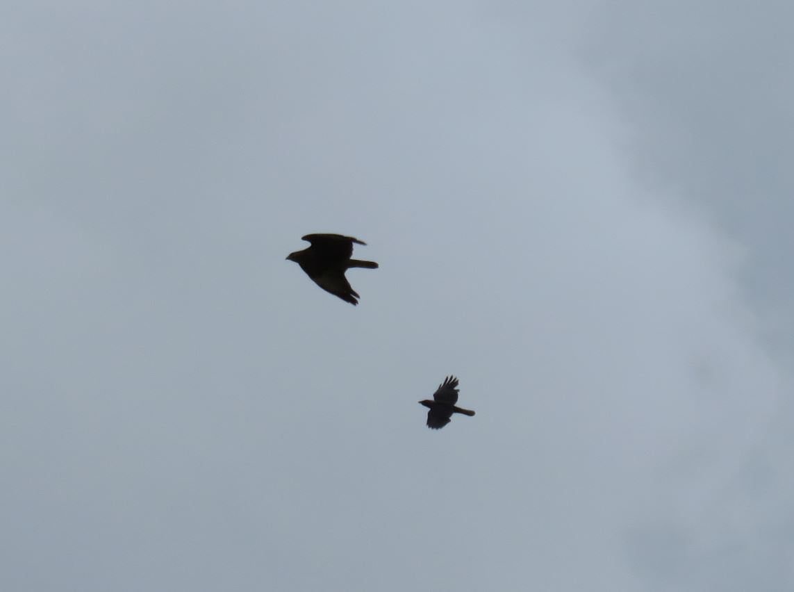
As we cross the highway, we decide to return to Chamelet via the Ancienne Route de Lyon.  I make it as far as the cemetery and must rest on one of the benches there.  I sit and watch a bold crow attacking a buzzard, driving it out of the area.


I suggest that the grassy path next to the cemetery might take us up to Le Cret faster, but Colin is sick of grassy paths for today.  We walk the rest of the way to Chamelet on the Ancienne Route de Lyon to the little parking lot behind Chamelet, turn onto Rue Terme/Le Cocon, and that's when it starts to rain.  What is much more surprising than the rain is that there appears to be someone in a blue jacket on Le Cocon!  Today, of all days, in the rain, we encounter another walker on the hill?


In my state, I cannot rush, and let the rain pour down my face as I trudge up the hill.  At Le Cret, the cows seem to give me sympathy.  I look back towards the hills across the valley and feel dejected.  From this vantage point, I think I can see the turn we missed that would have taken us to La Font Davy.  That does not improve things.  Worse than our trail fail... I worry I might actually have to go to the hospital for my rib.  I worry about the rest of my sejourn in France.


I force myself up the last brutal hill, where I get one last surprise:  a trio of little cows I have never seen before.  They are so little and so pure white, they melt my heart.  I hold onto that feeling as I arrive to the gite.  This might be my last randonnée for a while.