
🎼 Oh the weather outside is frightful, but the fire is so delightful... 🎶 And since we've no place to go... 🎶 Let it snow! Let it snow! Let it snow!!!!! 🎶 ⛄❄❄❄❄
The forecast called for snow, but with my propane tank replenished, I no longer worried about the weather. :)
Colin was working from home. I sat in front of the fire, watching the wind whip at the cedars.

On Colin's "lunch break," we decided to hike up to "Dorman Point," named after Jacob Dorman, one of the earliest settlers on Bowen Island.
As part of Britain's system of land pre-emption (which meant giving the land titles of vacant Crown Lands to anyone willing to clear the land and establish a homestead on it), Dorman pre-empted Lot 1348 in 1890. He then sold the land to Royal City Planning (later known as the B.C. Mills Timber and Trading Company), who logged it.
According to The Undercurrent newspaper, Dorman later served in the British Army, and in the Vernon Internment Camp, which is a little-known part of Canada's darker war-time history. (In preparation for the 100-year anniversary of the opening of that camp, the Vernon and District Family History Society and the Canadian First World War Internment Recognition Fund were working to restore the grave stones of those who died there and erect a memorial to raise awareness.)
However, Jacob Dorman was perhaps best known as the steam engineer who had built the steam-powered carousel and calliope on Snug Point, as a feature of Jack Cates' steamship-era luxury resort.
The trail was probably one of the best-known on Bowen Island, after Mt Gardner. A short but rewarding hike, it was about 2.5 km round trip from the ferry, and had an altitude gain of about 105m up to the lookout. Some sections are fairly steep.
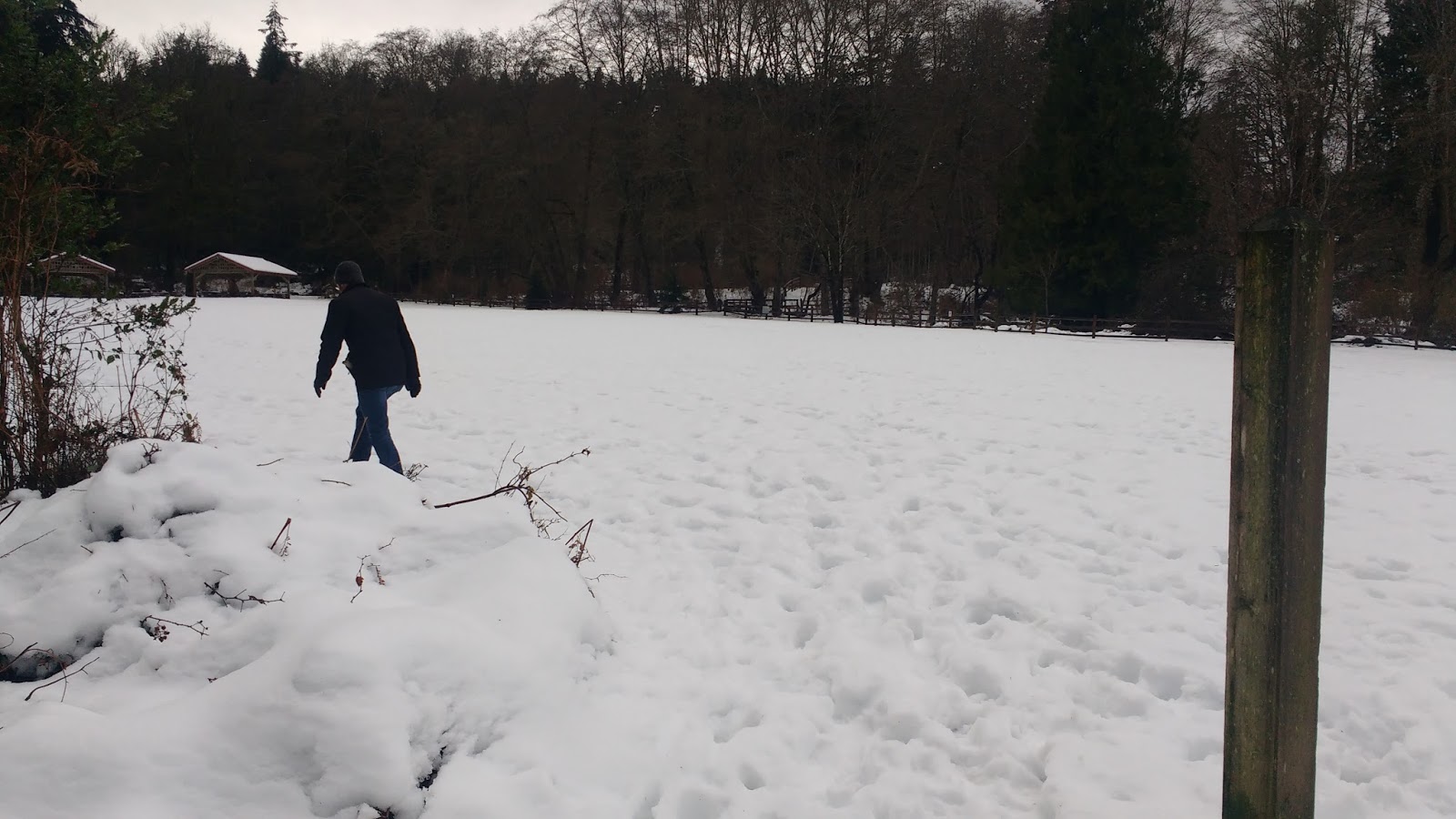
I had been up there before many times, before we moved onto the island, but Colin had never been. The snow was not helping him gain access either, so we decided to try to get to the end of the trail along the road instead. I had never gone that route before, so we both got to try something new! :)
As you will see, we didn't make it the last 200m up to the viewpoint, but we decided that conditions were ok to take the trail back down. Our route is in red. Just for your information, I marked some alternate routes and the last bit of the trail up to the lookout in blue dots.


The corner of Village Dr and Dorman Rd currently served as a parking lot and had a bank of mail boxes in it. At the time we walked, plans were in place to rezone that corner to build a rental apartment building and a medical centre, which would improve the state of two major issues faced by island residents.
I had previously mentioned the first issue, one of seniors moving off-island due to the lack of comprehensive medical services. However, this issue was really one that had to be navigated by all residents of the island, not just the seniors.
For non-emergencies, there were two medical doctors on the island available during weekdays, as well as an ND who offered limited hours two days a week, but, as The Bowen Island Health Care Society recently discovered, this often didn't meet the residents needs.
The Bowen Island Health Care Society recently analysed the medical needs of islanders via a survey, and discovered a few disturbing trends:
- only "35% of those with a primary care physician have a primary care physician on Bowen Island"
- 51% of respondents "delayed seeking medical care because services not available on Bowen"
- 47% of the respondents "experienced difficulty getting timely access to primary care"
- and "41% have felt their health was at risk because they live on Bowen Island"
Now, emergency services did already exist on-island, and were apparently often being used as a kind of ad hoc emergency medical system:
- a police station with two RCMP officers, which was only open Tues-Thurs 7am-3pm. The BIM website kindly notes: "Please be aware that the RCMP may not be on shift when you call, be prepared for a delay in response." Fortunately, the crime rate on Bowen Island is among the lowest in the region. ;)
- an on-call volunteer Fire Dept with about 30 members and two fire engines. The fire hall sat empty except for weekly training exercises. According to the 2016 Fire Chief, only 7 calls in 2016 involved fires: "Ninety percent of our calls are medical and most happen between 6pm and 6am."
- a 24-hour paid-on-call ambulance service with one ambulance vehicle. Two paramedics are on-call at any given time, drawn from a pool of 3 resident paramedics and 40 more from off-island. Having some of the on-call paramedics be off-island at the time of the call has led to a few uncomfortably long response times. As a result, many residents with emergencies have simply walked in to the Ambulance Station, treating it as a sort of emergency clinic (which, to be clear, it is not-- for anything requiring the hospital, patients would be accompanied to a mainland hospital (usually VGH) by water taxi, ferry and private car, or, in the worst cases, by helicopter).
Despite the various emergency responders having various amounts of emergency medical training, they are not fully-trained physicians, and no substitute for a full-fledged medical centre.
As for the second issue: rental housing had been very hard to come by on Bowen Island. Most housing on Bowen consisted of single-family detached houses, and while those were generally priced lower than real estate in nearby Vancouver, they were still out of reach of many people's budget. For example, last spring, local realtor Dee Elliott reported that "There are 21 homes on the market... and 15 are priced over $1 million."
While there were a few apartments above the stores in Village Square, 18 units of senior's housing units along Miller Drive, and six townhouses between Village Square and City Hall, turnover in these were very low. For example, in the townhouses, there had been zero turnover in the last 10 years!
Some residents were able to rent out secondary suites in detached houses, and some families rented entire houses, while the owners lived elsewhere. However, in the recent red-hot housing market, many tenants found themselves being ditched out of their rental houses, when owners realized they could make a big profit by selling. Some would find new housing, only to go through the same scenario again and again. Others had no choice but to move off-island.
Increasing the number of rental apartments would surely help keep some of these families and individuals on-island.
Although the snow might have been doing its own part in trying to keep people on-island. ;) The white car was still sealed in by the snow plough along Dorman Rd.

In the past, I had turned left into Crippen Park along this stretch of Dorman, but today we walked right past the entrance sign and kept to the road.

Past the entrance to the park, the road curves left and starts uphill. Someone had made tire tracks on the snowy shoulder, and we were unclear whether that was on purpose or not.

As we headed up the hill, the land to the left of the road fell away steeply, covered in forest. On the right side of the road, a rocky slope was punctuated by ferns. It was really quite scenic. The photos don't do it justice.


The entire way, I had been tracking a path below us in the forest. I had first spied it on my return from Valhalla. That time, falling dusk had prevented me from seeing it very well. This time, in daylight, I managed to track it all the way to its exit on Dorman Rd. It looked fairly free of snow! I got excited, thinking I could take it back instead of the road, on our return from Dorman Point. However, I was bamboozled yet again, as the steep entrance looked too icy to go down.


We followed Dorman Rd as it curved right, and approached the intersection.


Turning left onto Robinson Rd, I ventured into new territory. I had never been along this road before.

The pavement soon gave way to earth. It was like walking on a quiet country lane. Very enjoyable!

Right near the end of the road, I was startled to see a big blue-and-white boat perched above-ground, among the trees.

At the end of the road, the signage for the trail between Snug Cove and Dorman Point was quite clear. About 200m straight ahead was the trail to the main lookout at Dorman Point. It was however, a pretty steep trail, and despite looking clear in the photo below, it was covered in snow just a little beyond that. We decided against it. Even when the ground was dry, it was a challenging section.

So Colin would have to wait to see the view. (We did go back, about a week and a half later after the snow melted. It was quite a different experience, without the snow, plus we did the full trail both ways, so I'll blog that trip separately.) Just to save you the anguish of having to wait as long as Colin did to see the viewpoint, I'll give you a sneak peak of the top:

As a consolation prize, I showed Colin the more moderate viewpoint to the right of the road. One can walk out a few metres and get a taste of what the view at the top might be like.

Looking at the trail heading down towards the Cove, Colin felt it looked clear enough to make the attempt. Well, it didn't stay clear for long!


The path alternated icy and clear, as it went through several switchbacks, heading down the hill.

To avoid the slipperiest corners, we took the much steeper (and clearer) "short-cut" paths that I remember no one ever wanting to take, whenever we hiked up the hill in the summer. ;)


About half way down, there was a wooden rail, and another smaller trail forked off to the left. I used to know where that trail led, and what it was called. I seem to recall it having a woman's name... but my memory escaped me.

We stuck to the main trail, which was very obvious, despite big sections of it being under snow.


Nearing the bottom, we started getting peek-a-boo views of the harbour.


The trail pretty consistently went in and out of snow-cover. I jogged lightly to catch up with Colin every time the trail cleared. Then slowed to a snail's pace whenever the snow re-appeared.

As the trail started to flatten out at the bottom, we saw another trail sign. A small side-trail led to the beach on the right side of the cove.


Another small side trail led off to the left. But it was only a right-of-way access to a Hydro power box, and looped around and rejoined the main trail soon after.


Just past a set of giant "conjoined twin" trees, the trail exited into the picnic area in front of the beach.


Finally, we spotted the trail beside the field. Colin accessed it from the porta potties area. From there, we looked back and could see where we should have gotten on it from the original trail (by the big twin trees).


I went back and walked it from the twin trees.

The trail exited near the picnic area shelters. (Fun fact: this is where Dorman's carousel used to be!)

The shelters were surprisingly well-equipped, with garbage and recycling facilities, electrical outlets, and large electric BBQ flat-grills.

The route through the parking lot was incredibly slippery, as cars had compacted the snow into all but a skating rink. Incidentally, I had read a request for help on the Bowen facebook page, from a guy who got his car stuck in there (even the tow trunk couldn't extract him!), and later watched another car try about a half a dozen times to get out onto Dorman Rd, spinning his tires and billowing smoke on each run. (He eventually got out!)

We proceeded very slowly. When we finally got to the road, Colin threw his hands up in victory: we didn't fall!!

After that, walking up the small incline of Dorman Rd to the Village was a piece of cake.


Arriving at home, I again tried to free the trees on our trail from the snow. I succeeded in getting one free. The other two were still stuck. One looked broken. :( Time would tell.
While Colin went back to work, I rounded out my afternoon with cheese time, blogging, and a nap.

After supper, Colin made "dark and dangerous triple chocolate cookies" (swapping out the white chocolate for peanut butter chips). I don't know why he looked so perplexed, while making the cookies... maybe it was just too dangerous, having so much chocolate all in one place! Maybe he was worried that by using that recipe, he would appear too Canadian... ah, screw it...

But he did take a little time out to be silly too. ;)

With sexy results... Yum!!!

No comments:
Post a Comment