

We said our goodbyes and hopped the ferry to Port Townsend.

We got a good view of the Fort Casey RV campground on our way out. It looked like a really great spot, right on the beach.

From the ferry, we could see all the way from Fort Casey (the brown part on the right) to Fort Ebey (the tip on the far left), and the fact that I walked it all in this past week seemed very impressive from this vantage point. :) Sorry about the poorly done DIY "pano" below-- it didn't all fit into one frame.

I had recalled being able to drink local draft beer on Washington State ferries in the past, but on this voyage, the mess hall was closed. :(


We parked across from the old Port Townsend city hall/courtroom/jail (in 1891, these were all in the one building). In current years, it stood mostly occupied by a museum, but city council still met there.

From there, we walked over to Velocity coffee for some decaf cappuccinos to take with us on our hike. Velocity was located in the Northwest Maritime Centre, a nonprofit which hosted an annual Wooden Boat Festival and "Race to Alaska," where participants literally travelled by motorless boats from Port Townsend to Alaska.


While working our way around to the back of the building, where the coffee shop was located, we watched some men taking a "scamp" boat-building class, and perused some nautical equipment at the shop adjacent to the café. Before you start googling, the photo below shows a scamp!

Next to the till, the coffee shop had posted a short article about genetic dispositions for caffeine. I got really interested, since I am very sensitive to caffeine. This was not the article, but I thought I'd give you a more comprehensive one on the same topic.
Outside the coffee shop, I did my best impression of a pirate. Although I questioned that pirate's intentions towards that seal... ;)

The day's hike, decided on the spur of the moment, would be Fort Worden, another fort in the "triangle of fire" (the others being Fort Casey and Fort Flagler on Marrowstone Island). At 434 acres, it offered plenty of trails, along with a lighthouse, and many historical military sites of interest. Click here for a neat virtual tour.
Our circular walk was about 6km in total. The only steep section was in getting from the campground up to the batteries above the bluff. The rest was fairly flat. It drizzled on and off, but we didn't mind.

The above map is from http://wspf.org/virtual-tours/FtWorden-State_Park.html (click to enlarge or visit their page). Friends of Fort Worden offers an immensely detailed, really high quality PDF download of the entire park, including the trails, military relics, campgrounds, and conference centre. Like at Fort Casey, a person or group could stay in the Officers' Cabins or barrack dormitories at Fort Worden, although that was not our plan on this visit.
We parked near the front gates of the park, and walked up Fort Worden Way to Eisenhower Ave. A lovely little white church was on the left.


A half dozen deer grazed on the lawn between Eisenhower Ave and the pink houses of Officer's Row on Pershing Ave.


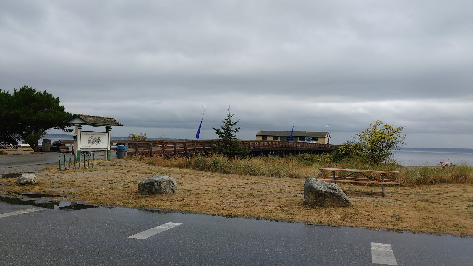
On the way, we saw a family heading in to the Port Townsend Marine Science Center, on the end of a pier. Just past the science centre, the Knapp Circle "trail" was actually just a trampled patch of grass beside the road. Along that stretch, there were several signs announcing "beach," pointing past the dried grass to the sand a couple metres away. In case anyone was confused. ;)

At the end of the road was Point Wilson Lighthouse. A sign at the entrance informed us that "Point Wilson Light was activated on 15 Dec 1879, the original light was located atop the lightkeepers [sic] house. It was moved to its present position when this structure was built in 1913. The lighthouse has been closed to the public since its automation in Nov 1976." Beside that, was another sign advertising tours "today 1-4pm" and "large groups by appointment only." We glanced at our watches and it was only 11:30am. Too bad for us.

Although the main gate sported a "no trespassing" sign (to help remind us that we were in America), a path led around the outside perimeter of the fencing, right to the lighthouse. It seemed odd that the no trespassing sign would apply to the house and barn, but not the lighthouse itself, but then we saw a sign in the window of the house indicating "private residence."


After circling the lighthouse, we took the Knapp Circle Trail past the remains of the Searchlight Tower to Battery Vicars and Battery Kinsie. According to the signage, the 29 foot iron Tower was originally built as a firefighting tower up on Artillery Hill, but was moved down to the beach and converted into a searchlight tower about 10 years later, in 1910. The little cement building we had passed was the power supply. The rusted tower is visible in the last photo below, beside the tree.


Battery Vicars was small, with a gun turret and a few ammunition rooms. It was meant to have two 5-inch guns, but they were sent to France in World War 1. They were returned after the war, but then scrapped. The guns seemed to rely on manual loading, due to the absence of an ammunition elevator in the battery.


While Colin went on ahead, of course I popped inside Battery Vicars. There was not much to it.


Battery Kinsie, on the other hand, was quite large, although nearly concealed the reeds, and included several tunnels and large rooms, its own power plant, various winches to load up ammunition (which consisted of 1000 lb shells plus 500 lb of gun powder per shot), a lookout tower, and an elaborate communication system. Its two 12-inch "disappearing" guns had been removed at the end of World War 2.


I convinced Colin to try one of the dark narrow hallways, like the ones in the Telegraph Room in Fort Casey. One was enough for him. He gave me props for braving them on my own at Fort Casey. I later read that this battery had "air spaces" between room that were meant to help absorb the shock from the massive gun shots. I wasn't sure what these "air spaces" would look like, but I wondered whether this was the purpose of the narrow corridors.


I was fascinated by the different winches and wondered why there were a few different styles. Were they for different sizes of ammunition? Or some for ammunition and others for different purposes? Looking down the shafts past the winches, I could see they led to the rooms we had walked through below.


Next, I saw a weird tube sticking out of the wall. Was something missing here? I wondered. Then I took a step back and noticed the pipes on the ceiling. This was the communication centre!


Just past the Western end of Battery Kinsie, a little sandy trail led past a picnic area to the RV campsite. We watched a man put up a huge and elaborate TV antenna next to his equally large motorhome. I guess one cannot be expected to go camping in a rig that size, without including all the comforts of home! ;)


This trail led steeply uphill towards Artillery Hill. At the first unmarked fork, we stayed right. (Staying left would put us onto JFK Trail, and take us back to the lookout where we turned onto Bliss Vista Trail.)


At the next unmarked fork, we also stayed right, joining Bluff Trail. At the lookout over the bluff, we could see the lighthouse below, and just past that, Fort Casey. I waved, and called "hi family!" as if Colin's relatives could see us.


Just then, we heard a plane engine, and Colin said, "the Japanese are here!" We turned to see a float plane and a big tanker. For a moment, we did imagine what it could have been like, had enemy combatants actually arrived on these shores, a century earlier.

Turning out name to the ocean, we were at Battery Ash. Actually, *on top* of Battery Ash. As we approached, we were very surprised to see modern military trucks and equipment right behind the battery.


Even though the Bluff Trail had passed by them, it was only once we were standing on Battery Ash that we could see Battery Quales and Battery Randol. All three of these batteries were originally conceived to be a single large battery that contained the main gun line of the Fort, with five 10-inch barbette guns and two 12-inch barbette guns, but no Cannon. ;)

We went from Battery Ash to Battery Benson, where we immediately noticed a small tunnel headed off into a bank. Of course, we had to drop everything and investigate! The tunnel was barely bigger than our bodies, and it sounded like someone was right behind me the whole time, whistling tunelessly. It was very eerie, even though I knew that the young man who was whistling was back at the battery, where I had passed him. From the other end of the tunnel, we could see what I took to be Battery Powell; however, we decided to backtrack to Battery Benson.


The signage in front of Battery Benson explained that this was the last battery to be built here on Artillery Hill, as well as the most modern, and the most used of the "big gun" batteries (notably, it was used only in practice). It had two 10-inch "disappearing" guns, which could be raised on pulleys to fire at approaching ships, then quickly dropped again to be hidden below the bluffs.
We continued on Gunline Rd until just past Battery Benson, then took Tolles Steps directly toward Battery Tolles.


However, just short of the battery was a yellow caution tape, blogging the path. We were forced to turn right onto Tolles Rd, which then, fortunately, led us past the battery. Since we were both feeling pretty tired, we didn't explore the inside of this battery.


We decided to head back, along Searchlight Road. On Searchlight Road we found, of course, a searchlight station. There was a storage shack with railroad tracks leading out from it to the edge of the bluff. The little tiny shacks near the edge of the bluff were a communications centre, and storage for the light's power cord. The station's search light was meant to hang over the edge of the cliff, to find landing parties, or light up ships at sea up to 4.5 miles (7km) away!


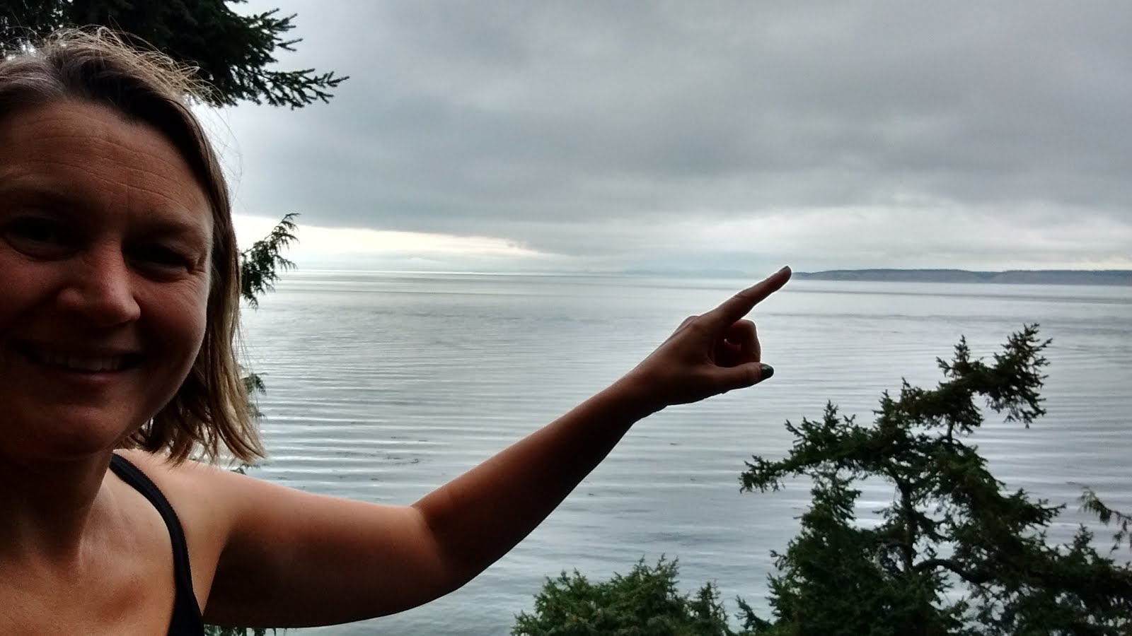
From there, we got a nice view of the beach below, and could see Fort Ebey. (I'm pointing to it).

Just past the Searchlight Station on the road was Battery Walker, named after... you guessed it-- Walker, Texas Ranger. However, this particular Walker was killed in Mexico in 1846, helped design the Walker Colt Revolver, and held the honor of being the only non-US-Army-Officer to have a battery named after him here.

With its two, small, 3-inch rapid fire M1903 pedestal mounted guns, designed to target enemy minesweepers (small ships whose purpose was to detect and destroy underwater explosive traps), this battery was also the most active of all the batteries. It was often used for practice, because it employed less expensive shells, and was more sheltered (meaning less noise pollution for nearby towns).
Again, we didn't go inside, but continued on Searchlight Road. We turned right onto North Beach Trail. The signage in this area was all very clear.


We finally exited the woods and got a view of the lake, and the site where the Chinese Gardens used be. Only a small mosaic plaque marked the spot. Here, we turned onto Chinese Gardens Trail, and followed it along the East side of the lake.


Near the end of the lake, we took a left onto a small, unmarked trail. At one point I worried that we had wandered into a creepy enchanted forest.


Then the path opened up, as we took a right onto Peace Mile Trail, which took us back to Eisenhower Ave, just 500m from where we came in. I could see the West Gate to our right as we exited Peace Mile Trail, but instead we turned left and followed Eisenhower Ave to Fort Worden Way and the main gate where we originally entered.


We decided to go to Doc's Marina Grill for a late lunch. Colin ordered a Crab Louie salad, which had incredible-tasting crab, but it sadly got a little lost in the strong flavors of the greens. I ordered manila clams with Port Townsend mussels and a Port Townsend Hop Diggedy IPA. When in Rome, right? ;) I totally loved both.


After our meal, we drove to our air BnB, called Zoe's Cabin. It was a cute tiny little cabin, nestled in the woods. The hosts greeted us and explained how everything worked, including the outdoor shower.


After a little rest, we made salad wraps with the end of the salmon left over from our dinner at Fort Casey, and sat on the patio sipping red wine and listening to the birds in the trees.


After supper, we tried a little walk down Jolie Lane, but didn't make it far. For one thing, the road dead-ended about 500m down, at Mulder's private drive. (Why was Mulder so concerned with our potential trespassing? What could he need all that privacy for?) For another thing, every muscle below my knees was complaining. That walk on the beach to Fort Ebey sure did a number on my muscles! Plus, I still had a goose egg on my right ankle from playing frisbee --ahem, I mean from "missing" said frisbee. ;)


No comments:
Post a Comment