
Deception Pass Park had 4134 acres of parkland, including three lakes, and 77,000 feet of ocean shoreline. Here's a pretty cool virtual tour (sorry, it doesn't seem to work well on cell phones, but it's great on bigger screens).
With my options of walking on the road, or walking the park, my choice was fast and clear. I decided to skip most of the road walking, and instead start at Sunday Drive (seemed like a lucky choice, it being a Sunday that day), before walking the PNT through Deception Pass Park. It would give me a taste of what the road portion might be like, without having to do it for 6 hours, and allow me to spend a lot of time in the park.
Colin was interested in touring the park, but not as interested in walking as far as I wanted to, so we decided he would drop me off on the Southeast side of park (the bottom rightmost point on the map screenshot below), where I could take the PNT trail (shown in red on the PNT trail map below--note that this section is on PDF Map 8), which ran North up Jones Rd, then around the perimeter of Hoypus Point, before passing the Deception Pass Marina, where I would meet up with Colin, where he would join me to walk the rest of the PNT trail to the Deception Pass Bridge, where the PNT then turned North to cross through Anacortes Island. But instead of crossing over the bridge, we'd continue on the "alternate route" (shown in purple on the PNT trail map below) to Cranberry Lake, then cut back through the park to the truck. For me, a total of 14.5km.

The following park map does not go far enough South to show where I started, which was about 1km South of the last shown intersection on the far right, but this map was HIGHLY useful to me in navigating the park, as it included every trail intersection, name, and section distance. It also clearly showed where the park trails met up with the local streets, so I could better navigate my various entrance and exits from the park. The image below is just a screenshot of a portion of the map and the trail legend. You can download the full, high quality, PDF version of this map at www.deceptionpassfoundation.org/maps/


I supplemented these two maps with google maps, which did not show all the park trails, or how the trails connected to the local roads, but did have the street names on it. I recorded my actual physical locations in real time on HERE maps, which had almost no trail/road detail, but allowed me to pin as I walked. Like our walk in Fort Ebey Park, several maps were needed to properly navigate this portion of the trail.
Also like my hike to Fort Ebey, which followed the same pattern of me walking the first part alone, then the second part with Colin, I took the American SIM card in my phone, in case of emergencies.
Just as we were heading out from the Fort Casey Inn, we were informed that Colin's immediate family had planned to go to a wine tasting at a local winery, and that we would miss it. I was sad to miss it, and sorry I didn't know about their schedule earlier. :'( At least I might be able to sample the best wines they tried at the winery, if they brought back any bottles for the scheduled group wine and cheese tasting that evening.
It started raining when we were driving the 40 mins North to Deception Pass Park, but it stopped again before we got to the park. We spotted a baby deer on the side of the road, near where Hwy 20 entered Deception Pass Park.
Due to the fact that we would need to purchase a Discover Pass to park within the park limits, we chose Deception Pass Marina as our meeting spot, because it was technically not in the park. Colin wanted to check out the possible free parking spots near the marina before he dropped me off on Sunday Drive at Jones Rd. He found one on a side street that he was happy with, and then asked me to meet him at the the marina's general store. I estimated I'd get there in about an hour and fifteen minutes. He would run errands in between.

Despite the double-yellow centre line, which indicated that Jones Road was a highway, it was a pretty quiet rural road. I felt comfortable walking on the grassy shoulder, and only a couple of cars passed me on the entire 3.3km stretch. I did see one couple, out jogging with their gigantic dogs, but other than that, didn't encounter anyone else.

Google maps showed the road in close proximity to the shore, but I only got a few peekaboo views of the water.

Checking the time on my phone, I somehow thought that I had mis-calculated the distance from Sunday Drive to the park, and ran the steep downhill where the road curved near Ala Spit Country Park, try make up some time.

Peeking over the houses and through the yards, I could see the pleasant-looking Ben Ure Spit. I also noticed an interesting-looking wooden "guard dog" under a tree. Or perhaps it was meant to be a deer? A guard deer? ;) It must have been made by a local person, as I saw several of these wooden sculptures at various houses along that stretch.


Looking back, I located the Ben Ure Spit and Ala Spit Park access, at a hairpin turn from the road and marked "Ala Spit" on the signage. I could see there was also parking available there.

The properties in the area were very "gulf island style," and were interspersed with small farms. Apple and plum trees dotted the road side. The scent of plums drifted on the air.


Jones Rd switched seamlessly into E Troxell Rd, as it turned away from the Spit. I located the turnoff to Angler's Haven Drive... more thanks to google maps than the road sign...

Here's a photo of the corner, in case the road sign is not there when you pass by.

About 150m past the intersection of E Troxell Rd and Angler's Haven Dr, the road curves in an "S" shape. Keep your eyes peeled for the park entrance in the middle of the "S." The entrance was unmarked. I basically figured it out by comparing where my GPS said I was on google maps, to where the park map indicated the path should be. Below, you can see the road curving, and the "path" is that grassy bit on the left side of the road. Want a close up? See the second photo below.


Oh, but it got trickier! As I entered the grassy path, I could see a larger trail leading straight ahead, and a smaller one heading off to the left. Neither were marked. I peered down one, then the other.
The bigger trail had an open gate laying on its side, and the smaller one had a small pink ribbon/flag hanging from a branch. Standing there in indecision, worrying about Colin waiting for me, when I already thought I was behind schedule, and assured by the park map that the next portion was only 300m long, I finally decided it might be faster to pick one of the two paths, try to find a trail junction or marker within 300m, and retrace my steps if I were wrong.
I strode down the bigger of the two trails. About 100m later, I walked right into a house. Oops. Wrong choice. But at least my dilemma was solved. I retraced my steps back to the smaller trail, and followed it, as it wound its way through the trees.

Although the "winding" part of the path was disconcerting, since the park map didn't show any "winding," I soon spotted another pink ribbon hanging off a bush, and thought that was a good sign I was going in the right direction.

To my relief, I eventually encountered an official park sign, telling me I had gotten to E Hoypus Point Trail!


Another 300m along the trail, I came to another junction. There was no obvious signage. Based on google maps, it seemed like I should take the left-hand fork to continue straight on E Hoypus Pont Trail.
However, when I looked down the right-hand-fork, I noticed the official park signage nearly hidden on the right-hand side, which showed me I should go right. So I followed the signage, and the junction with Fireside Trail was actually a little ways along the right-hand trail.


Zooming in on google maps, it seemed to indicate that it was simply a complicated looped junction, and I probably would have been fine either way. When in doubt, I follow the official signage. ;)


I tried to capture this Hairy Woodpecker on camera, as he circled the tree away from me, but all my shots turned out blurry. This was the best one. I jogged a little bit after that, to make up for the time that I spent taking 6000 blurry photos of the woodpecker.

It was nearly impossible to capture the scope of the forest on film. The big trees, the ferns, the skunk cabbage... ;) Actually, it was all very beautiful.

Quite abruptly, the trail ended in a picnic area.

I walked into the centre of the clearing, and looked back to see that there was no signage to indicate which trail to take, if one was to walk the PNT in the opposite direction (ie North to South), which was actually the direction most through-hikers would walk.
I quickly snapped a couple photos, to help anyone wanting to locate the trail in that direction. The correct trail was the rougher, unmarked one on the right, not the clear gravel one with the posts on the left.


Continuing on: as gravel gave way to pavement, I realized that Cornet Bay Rd had already started, even though the maps indicated that I had not reached it yet.

I encountered one lone jogger on this stretch, and stopped her to let her know which of the unmarked trails led into the park. She said thank you, and laughed that she lived nearby, and jogged this stretch often.
There were several benches along this stretch of road, which amused me, since I didn't see any benches in the park proper. All of the benches had great views of the Deception Pass bridge. I was surprised at how far away it looked!


As I approached a gate marking the opening of a parking lot, I glanced at the time, and realized I was supposed to already be at the store meeting Colin. Just then my phone popped up a message from Colin, asking where I was. He had gotten the wifi password from little store at the marina.

I mistook the nearby washroom for the store, and said I was almost there. I had to message him soon afterwards, to relay my mistake. There were actually two separate sets of docks, about 500m apart. I was at the first and Colin was at the second. From the parking lot, I could see the beginning of our planned path, along the strip of forest (on the left of the photo below) to Goose Rock (the hill on the right).

Between the washroom and the marina store, a little gravel path kept pedestrians segregated from the road, which was busy with trucks loaded with boat trailers. A group of teens passed me on this path, eating ice cream bars. I was hungry, and the ice cream looked delicious.

As I got closer to the marina store, with its giant American flag, I saw Colin waving exuberantly.

We decided to buy some more water and a few treats for the road: a bag of beef jerky, and some local Whidbey Island Ice Cream bars (I picked pistachio and Colin tried chocolate fudge). The Hungry McGee beef jerky was surprisingly delicious and the packaging was hilarious. We later tried in vain to find more of it elsewhere.


While Colin grabbed a bottle of water, I laughed that the store was selling canned pulled pork. I almost bought some, just to see how spam-like it might be. I couldn't imagine that canned pulled pork would be good, compared to the real thing, but I guess I will never know...

Just as we headed out, it started raining. I mentioned how it didn't rain on my whole walk, and Colin joked that he brought the rain with him.
He then surprised me by saying that on the way back to meet me, he saw what appeared to be a dead body on the side of the highway! A young man was laying face down and motionless on the side of the road, and the five cars ahead of Colin had all stopped to help. Since Colin didn't see what happened, and had no way to contact me to tell me he was stopping, he kept driving, hoping that the five cars ahead of him would take care of the situation.

We walked along Cornet Bay Rd about 2km to Quinn Dr. We had seen on the park map that the first entrance was marked "restricted access," but since the second one was not, we wanted to use it to connect to Little Alder Trail.


To the right of the trail, we spotted what looked like a communal building, perhaps a group dining room, overlooking the bay. As we passed by the field, with a row of small cabins on its opposite edge, I thought that this could be a great location for future family reunions.


It was easy to locate the connection to the park trail. The park signage was all very clear. We walked a short distance on North Beach Discovery Trail before switching to the Goose Rock Perimeter Trail.


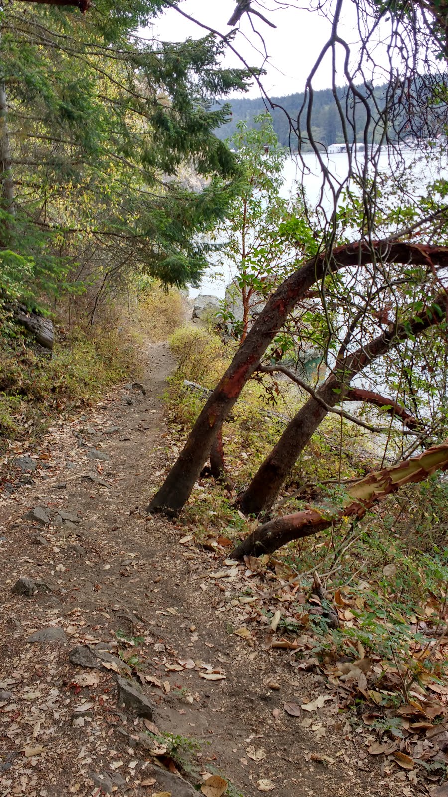
After a short stretch in the woods, the rough narrow trail had us teetering precariously over a steep cliff down to the water. The Arbutus trees leaned gracefully over and away from the trail.
Across the bay, we could see the marina where we had started.


You can tell I was a bit nervous taking a selfie on this part of the trail. I stopped taking photos for a while, as I navigated my steps. I had read about hikers falling off the trails in this park, and dying when they hit the rocks below the cliffs. It was worth paying extra attention.

Next, we followed a series of steep switchbacks upwards, then quickly dropped back down to water level. I worried about Colin's knees, but he said they were OK. I thought it ironic that he has joined me for this hilly section, when the part I had walked alone was basically all flat.

After walking along at sea level for a while, and passing the privately-owned Ben Ure Island (visible at right, in above photo), the path dove back into the forest. Definitely, this trail was much more scenic and varied than the part I had walked by myself.


From the very start of my walk until the bridge, I had encountered very few hikers. None at all in my loop of Hoypus Point. A couple on Goose Rock. Suddenly, at the bridge, the trail was teeming with people.
Certainly, the bridge itself was a big tourist draw. The views were spectacular. It was built from mid-1934 to mid-1935 for $420,000. Wikipedia informed me that, "It cost more to paint the spans in 1983 than to build them in 1935."
Deception Pass Bridge was actually two bridges with the tiny unpopulated Pass Island in between. The total span was nearly 1.5km. With a height of 56m, over 300m-deep waters moving at up to 16km/h, it was also unfortunately a popular site for suicides.
Over 425 people had lost their lives jumping from the bridge. Many were purposely trying to end their lives. A few totally misjudged what would happen if they jumped. The lighthouse keeper at Fort Casey had told us about the local impact of this Reebok Pump commercial, which was banned and pulled off the air in 1990. I couldn't find anything online to specifically link the commercial to an increase in deaths at the bridge, but the commercial had certainly become part of the area's lore.
A set of stairs led up to street level, and permitted pedestrian access to the bridge. Signage warned us again that "falling can be deadly." I had read about a few accidental deaths in this area, which were all off the trail, not the bridge itself.

At street-level, I could see the parking lot and main info centre for the park. There was no safe way to cross the road there. Pedestrians were meant to return to the trail under the bridge, cross under the road, then climb the stairs on the opposite side. I had previously read that one could obtain a paper copy of the high quality PDF we were using at that info centre, but I had plenty of phone battery to use my PDF version, plus the rain made a paper copy seem less useful.

We walked out onto the bridge, but didn't cross it. The strong current was clearly visible, and the views were impressive in every direction.


We had actually already driven across the bridge, and walked around a little bit on the other side, when we had originally driven through, on our way to Fort Casey. There were more walking paths on that side of the bridge, but we merely got out and took in the views from one of the lookouts at street-level. I was disappointed to not capture a stunning photo like those I had seen online.


A park sign on that side spoke of the Salish Native Americans, who fished these waters in canoes for thousands of years before Europeans arrived in 1700. Captain George Vancouver had re-named this area "Deception Pass" in 1792, after realizing his error that Whidbey Island was not part of the mainland.
Back on the trail underneath the bridge, which was now called North Beach Trail, we could see the beach of Macs Cove far below us. A sign warned us: "People below: Do Not Throw Rocks!" We puzzled over the need for such a sign. Was this a common occurrence?
Back on the trail underneath the bridge, which was now called North Beach Trail, we could see the beach of Macs Cove far below us. A sign warned us: "People below: Do Not Throw Rocks!" We puzzled over the need for such a sign. Was this a common occurrence?


The trail stopped at a parking lot, which I think was connected to the info centre I had seen from the bridge. The map told us to simply walk straight through the parking lot, and the trail would pick up again on the other side, which indeed it did.


We followed the arrows to North Beach Trail, and were intrigued by an accompanying sign for an "amphitheater." We were again alone on the trail.

Colin was impressed by the giant trees on this path.


On one of the many views of the water along the North Beach, we spied a seal swimming along beside us. I did capture it on my cell-phone camera, but it was too small and blurry to be recognizable. We didn't see any whales, although they are commonly seen in the area.

The small uninhabited Deception Island was also visible. I decided not to meddle. This big frog approved.


Near the Lower Loop campground, there was a long boardwalk. Small trails led off the boardwalk to the campground, and we could sometimes see vehicles and picnic tables through the trees.


We kept following the signs towards the Amphitheater.

We wondered whether this was it. It was not. lol.

THIS was it! It was very obvious, once we arrived.

A lone man stood facing the seats, as if practicing his interpretive talk. I don't think he worked for the park. lol. The North Beach Trail continued on behind the back seats, and took us towards the water.


We ended up in a parking lot, between the ocean and Cranberry Lake. We wanted to take Cranberry Lake Trail, but had a difficult time locating it. We walked to the tip of the lake, where there was a swimming area (naturally empty on this rainy day). From there, we finally located an unmarked path that seemed to be heading in the right direction, which was parallel to the road that ran along the lake.


Finally, we found a trail sign, to confirm we were on the right trail. Colin caught this photo of me trying to pin the correct trail on HERE maps. He laughed that my previous hiking photos didn't accurately reflect the amount of time I spent pinning maps. lol.


Somewhere just past Forest Loop campground, we missed the correct turn, and ended up on the road near a building. A helpful map noted all the different types of trees in the area... but not where in the park we actually were standing. We decided to walk on the road, which headed downhill.


We snaked our way through the parking lot, and ended up at the North Whidbey RV Park where Cornet Bay Rd crossed Highway 20. Rather than try to return to the park, we figured we would just walk back to the truck along Cornet Bay Rd. The trees overhanging the shoulder sheltered us somewhat from the rain. We were also rewarded by a glimpse of a deer.


As we got closer to the marina, it really started raining. I messaged Nihan, my walking companion from my recent Cowichan hike: "How do you know that what you are doing is good for your soul? Your feet hurt, it's raining, and you're still ridiculously happy!" and sent her the following photo.

She answered: "So this is what it looks like to follow your joy. Loving it! Wild Woman!"
Naturally, the rain let up soon after we got back into the car. ;p
That evening, Colin and Matt had a "bad wine" tasting in the kitchen, right before the scheduled group wine and cheese tasting. Matt had found some $3 wine at Trader Joe's, and wanted to see whether it could hold up to the $9 bottle that Colin had bought. The verdict? They were both terrible. lol. I guess that is why neither of them had the stomach to try the quality wine that others had brought for the tasting, and instead tried to finish off the growlers of local beer we had purchased.
When it came to the cheese, however, we all sure sampled our share! There were raw cheeses, pasteurized cheeses, hard cheeses, soft cheeses, goat, sheep, and cow cheeses, European cheeses, local cheeses, even a coconut cheese! The accoutrements were also really fun: variously spiced homemade sauerkrauts, an assortment of gourmet dried sausages, a wedge of pate, pickled asparagus, and a couple different jellies and sauces.


While waiting for dinner, people played more beer frisbee and chatted in the grassy area behind the cabins.


Dinner was a yummy homemade vegetarian soup. Perfect for warming my bones after our damp hike. Dessert was delivered by Gemma. It was a collection of cupcakes homemade by Becky, with tantalizing flavours like huckleberry, and chocolate mint.


No comments:
Post a Comment