
After a slow morning, we stopped by BIRD to drop off our recycling, then decided to check out Alderwood Farms on the way to our walk in Evergreen. We were excited because we had only just heard about the farm store from our neighbor the previous evening. Before that, we hadn't heard of any food stores outside of Snug Cove.

The driveway up to Alderwood Farms is very steep, narrow, and winding. If you meet a vehicle headed in the opposite direction, one has to back out to let the other one pass. We were happy that there was no snow on the pavement, because we had to do just that.
Upon arrival in the parking area, we rushed into the store, excited to find all kinds of high-end gourmet foodstuffs alongside the large assortment of meats and poultry prepared by their on-site butcher. I wondered whether they raised their own cattle onsite, but in the end, discovered that they "only" raise chickens, geese, ducks, donkeys, and emus. ;) We bought some beef jerky for the hike, and a frozen Thai coconut veggie curry for later (which was AMAZING, btw-- I still think about it a lot).

The man inside was very helpful and polite. It turned out that Alderwood Farms was more than just a gourmet deli. Its 5-acre property had been hosting fully-serviced weddings since 2003, complete with a wedding chapel and a covered terrace reception area set into 2-acres of gardens. Furthermore, they ran a B&B on-site!
We navigated the steep driveway back out and headed down Bowen Bay Rd towards the parking lot of Evergreen.
Chewing on my beef jerky, I re-examined the two maps of Evergreen that I had found on bowentrails.ca. They were a little confusing, because they didn't match each other...
The main map showed many more trails overall than the PDF (which included a description of the Evergreen trail), but it actually showed fewer trails on the left (West) side of the map. It took some attentive comparison to sort it out.

(main map screenshot)

(PDF screenshot)

In the parking lot there was a trail map... which didn't really match *either* of the two bowentrails.ca maps very well... :/ (Actually, this one turned out to be the most useful of all the maps.)

Why not use google maps, you ask? It usually shows many trails, as well as roads. Well, google maps was fairly useless for this area, as the only trail showing on it was the one between Amelia Ln and Laura Rd. The same single trail, btw, that the usually abundant Schedule E map showed. I suppose that would be sufficient if one only wanted to walk in a circle along that trail, then Bowen Bay Rd. But we didn't really want to do a lot of road walking, when there were trails to be had!
Perhaps the map inconsistencies could be explained by the fact that this area was still being developed. Evergreen was an 80-acre subdivision designed in 2004, meant to eventually hold 23 homes on it, but since 2008, only maybe a dozen had been developed. It was an area in flux.
Eyeing the parking lot trail map, we decided to do the walk the "variation" trail suggested on the bowentrails.ca PDF: East along the red trail from the parking lot, then North (left) along one of the "vertical" trails on the right side of the map, then turn West (left) to take the orange trail back to Amelia Lane, and come back through Aaron Slugget Field.
Now, I *think* we did that... lol... Although I am still not positive which "vertical" trail we ended up walking on. I am guessing the middle one, although it was marked as "future trail" on the map. :p I guess the future is now! ;)
I'll use the PDF map to show our route below, and let you work out the rest, because I couldn't! I estimate it was about a 3-4 km loop, with about 150m in elevation change up, then down again.

Reading out the instructions from the bowentrails PDF, I looked for a "unmarked trail to the right approximately 10m along from the parking lot on Evergreen Lane." Well, there appeared to be a pretty obvious-looking "logging road" type trail heading off to the right of the parking lot, near the map I was looking at! (I know this looks like it leads off to the "left," but I took the following photo from a different angle, facing back towards Bowen Bay Rd, so I could show it in relation to the map kiosk.)

So we went down that path, and quickly realized that it could not be the trail... It simply ended, as soon as we crested the small uphill.


Fortunately, looking over to our left, we saw through the trees what was very obviously a hiking trail, and hopped over onto it!

From that point onward, the bowentrails description fared us well. We followed the path through the trees.


A little creek ran beside the path, and there were a few obvious attempts to divert the creek off the path.

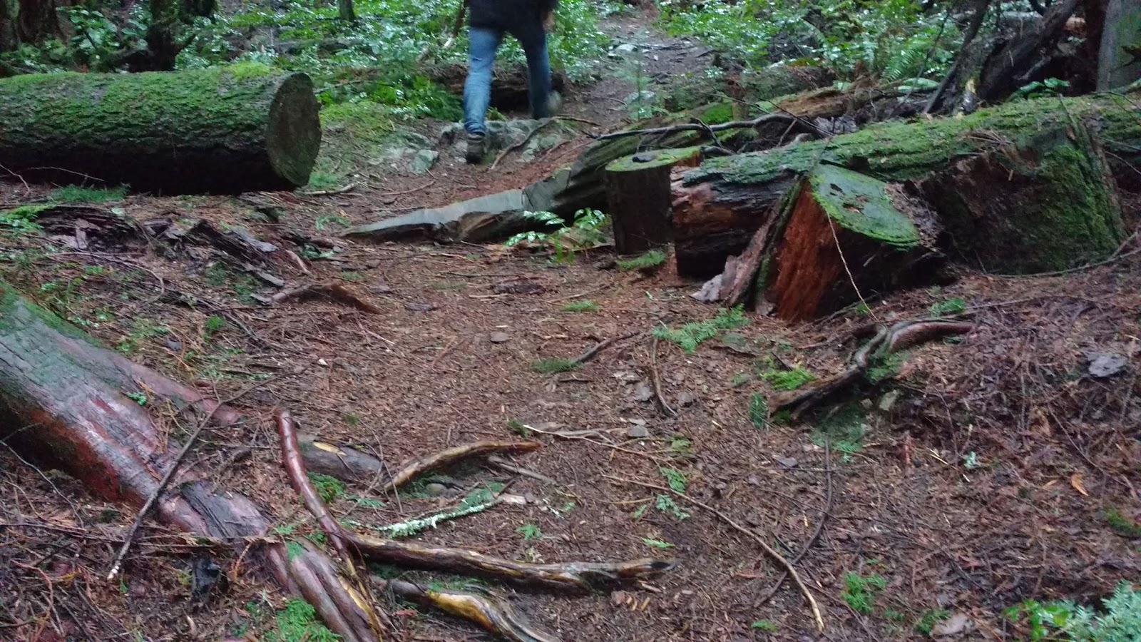
Then I noticed some weird structures beside the path. Were they ladders??? What were their purpose??? Was this previously a raised walkway?? In any case, they were pretty dilapidated.


We approached a giant pile of wood, probably from fallen trees. It seemed like a trail intersection. But we headed straight on the trail without turning.


Then we hit another trail intersection. Based on the traffic noises coming from up ahead, it seemed like the trail we were on might exit onto the road up ahead. We guessed that this was our time to turn left, since the parking lot map showed the trail ahead ending on the road, near the intersection of Bowen Bay Rd and Westside Rd.

According to the bowentrails PDF, we were supposed to have "climb[ed] steadily for 750 metres" from the parking lot. It didn't really feel like we were "climbing." I had been trying not to say "this isn't very challenging," lest I jinx it, but Colin finally said the fated words and the trail promptly started climbing.

The trail wound around beside a little creek, through a forest of miniature evergreens.

Beside us, the forest looked like a water color painting.

The salal leaves were the brightest and healthiest I had ever seen anywhere... and these puppies grow EVERYWHERE around BC, so I've seen my share. ;)

As we climbed, we hit the snow. We had been pretty lucky thus far, to have clear paths on this trip. Generally, the West side of Bowen Island was warmer and sunnier than the East side, which might also have served us on this day. Fortunately, there were only a few patches of the white stuff on the trail.


"It's so beautiful here!" I sighed. "This is my new favorite walk!" I announced. Colin still preferred the Cape.

I was really enjoying the massive tree stumps, left over from the logging that once ravaged this island. Colin tried not to be in the following photo, and I did get one without him in it, but you just can't get a feel for the immense size of these old-growth stumps, without someone in the photo for scale.


Quite suddenly, we were at a "T" intersection. I pulled out the bowentrails PDF trail description: "continue uphill on a woodland trail that ends in a T-junction. You will see a small sign here indicating the path back to Evergreen."

"Here's the sign," said Colin, gesturing to a plank nailed to a tree, with an arrow and "to evergreen" printed in block letters. YES!!!!! "Ok," I said, still reading, "Turn left here and follow the trail back down to Amelia Lane, along the path of a creek." So we turned left, and headed down the trail.

We passed one small group of hikers walking in the opposite direction. The trail seemed more difficult in that direction, as now we seemed to be going down more than up.

At one point we passed a fork in the trail, which was not on any of the maps. However, based on the logs and stones that someone had placed on the right-hand fork, we assured ourselves that we were meant to take the left-hand fork.


Soon the trail did indeed parallel the creek. The bowentrails PDF warned that the creek sometimes overflowed onto the trail in wet weather, but it was nowhere near doing that on this day. And the weather had been pretty wet, I must say!

Looking back at the trail I had just walked, the creek was actually a series of small waterfalls!! it was very pretty.


However, then the creek turned and we literally had to leap over it to continue on the trail. Colin went first, using his big thigh muscles to pull himself up the steep incline on the other side, then he held out a hand to me I used his arm muscles to haul myself over, since it was almost too far for me to jump. Then he slipped and lost his footing on the steep bank, and I stabilized him. Teamwork! :)

The trail was pretty wet in the next section, even though the creek ran alongside the trail at a small distance. Finally it dried up, but based on the grooves in the downsloping trail, I understood that this section would be a runoff channel in heavy rains.

Then, the trees suddenly thinned, and our GPS confirmed that we had exited onto Amelia Lane, although it was not marked on the street itself.

Turning around to photograph where we exited, next to a driveway with grey signposts marked "1580," a small white sign read "Mt Gardner," with an arrow pointed towards the trail we had just exited, and declared "bus route," with an arrow pointing at the driveway. That was confusing, since about 10 feet down the road (basically where I was standing to take this photo), we saw an "end of public road" sign, paired with "do not block intersection." What intersection?!?! Where was this bus going, anyway?!?! Was it a ghost bus???? (sorry for the German... here's yer subtitles)

Heading away from the "intersection" at the end of the road, we started walking down Amelia Lane.

The road snaked along in serpentine curves. About half way down, a trail led off to the left of the road. It was "blocked" with a chain, to prevent vehicles from entering. The footpath led around the left side of the chain. The sign said the trail led to Malkin Creek Trails, and pointed to the left. It also pointed back the way we had come as "Mt. Gardener" and the way ahead, down Amellia Lane, as "bus route."


We took the trail. It was a level graded gravel path. Much different than the trails we had been walking thus far that day.

Not long after, the trail split. The right side was "blocked" with a chain. There was a parks signpost that indicated that the "trail to Malkin Creek" was somehow behind us (apparently, we had crossed it at some point, between Amelia Rd and this spot), the "trail to field" was ahead of us (on the left fork), and there was a "trail to viewpoint" pointing off to the right, towards no trail in particular. Perhaps it was also back near the Malkin Creek that we hadn't seen? Or did they mean to point to the right-hand fork??
Examining the trailhead map afterwards, it appears we were at the corner of the top-right end of the yellow trail, where it met the red and grey trails, just to the left of the Aaron Sluggett Field. The right-hand fork was the yellow trail to the viewpoint.


On that day, we took the left-hand trail, "to the field." There were some neat trees on that stretch.


The field was somewhat underwhelming. It was a field. I tried to find out who Aaron Sluggett was. According to The Undercurrent, he was a 19-year-old local who was killed in a car crash in 2009. Besides this field, Bowen Island honors him with a yearly 5k/10k race, whose proceeds fund an annual scholarship in his name.

We walked across the field, looking for the continuation of the trail. We passed a picnic bench, and a raised area that could have been used as "stands."


We spotted the trail, near some large rocks on one end of the field. We couldn't see the trail sign until we got fairly close.


The trail swung around through the woods and dropped us at a trail T-junction right before the paved road. The left-hand fork led to the parking lot. The right-hand fork led to a different loop of the far-West side of the park. We took the trail to the parking lot, although we could have just as easily taken the road, since they ran parallel.


At one point, just as we were approaching our final junction with the road, a trail branched off to the left. I realized that this was the trail we had been looking for at the start of our walk. The one that we had cut through the woods to find. Doh!

As we exited into the road, just before the parking lot, I looked back and took this photo, showing where the trailhead ACTUALLY started, no matter which trail you want to end up on. The stone pillars on the road are visible from the parking area, even if the trailhead is obscured until you get closer.

I also noticed another one of those strange "ladders" on the side of the trail here. No idea what the origin or purpose of these were.

And we made it back to where we started! :D

The sky was really pretty the whole walk back, but my camera didn't capture it on most of my photos. I tried for some artistic ones at the end, but they only sort-of captured it.


I was super keen to return and walk the other half of the park, so stay tuned, because I did it the very next day!! :D
No comments:
Post a Comment