
After falling in love with the Evergreen Forest the day before, we went back the next day, and parked at the same place: the parking lot on Evergreen Lane, off Bowen Bay Rd.
Using the bowentrails.ca map, I plotted out a route on the West side of Evergreen. In retrospect, I should have used the map at the trail head instead, because we ended up going in the completely opposite direction than we planned. We wanted to do "The Grind" upwards, and ended up going down it instead. We had no idea where we were at least half of the time. lol.
(If you missed the map confusion of the day before, go back and take a look!)
So here is the walk that *I think* we ended up doing (in pink), which was maybe 4km and about 150m in elevation change (I am guestimating!).

(click on image to enlarge)
We had planned to go North up to Malkin Creek Rd, then swing around the loop to the West, and finish off with "the Grind" (marked as "steep trail" in orange on map). Somehow, we missed the turn we wanted and ended up getting to the centre of the park, then heading South again, through the "viewpoints." (I just now, after writing this entire blog, noticed that they are actually marked as "Forest Meditation Nodes," which as you will see, explains a lot.)
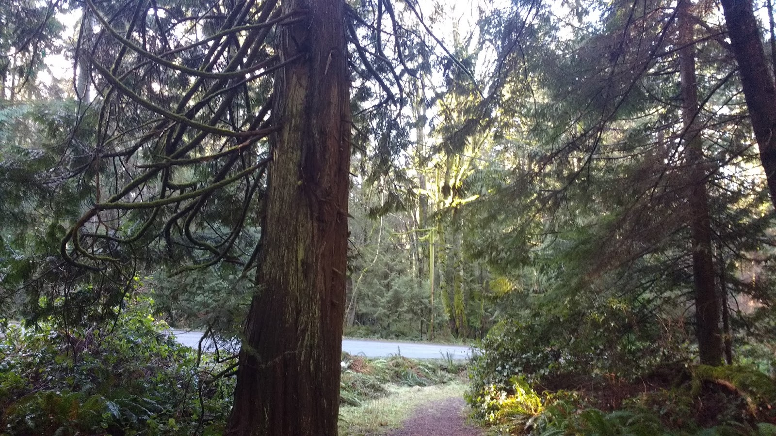
This time, unlike the day before, we took the correct trail head -- the one next to the stone pillars on the road. But after that, we were definitely not as well oriented as the day before. lol.

At the trail junction, we kept left/straight, and continued walking parallel to the road, following the signs "to Malkin Creek."

Yes, my dog Rory joined us for the walk today. He was pretty pokey. I told him so, and called him "Pokey" for most of the walk.

Where the road split into a Y, the path cut across the corner. I couldn't figure out where this was supposed to be on the map. On any map. (And if you remember, I was using four different maps.)


Where the trail exited onto the other road, I could see the trail continuing straight ahead on the other side of the road. None of this stuff seemed to be on any of the maps I was using.

We passed a small pond, which turned out to be Maggie's Pond. I had mentioned Maggie Cumming and her contributions to the island's parklands in my blog about the Golf Course Loop Trail. Her name stood all over the island, to remember her efforts.

The trail led off into the forest. The trail signs were not helpful, saying things like "viewpoint" and "Bowen Bay." Pretty much any of the trails could have led to those things. We gave up trying to navigate and just followed the trail. We would only much later figure out where we were.


I thought this set of trees was pretty neat. Sorry for the quality, you might have to click on the image and enlarge it. It shows maybe 10 little trees growing out of a fallen tree, suspended in the air. I wondered whether they could grow fast enough to set down roots before the tree inevitably rotted and fell.

At this point, we were not sure whether the trail went left or right. Treefalls didn't help, as they obstructed the paths. We decided to try left, along the length of the fallen tree, up onto the top of the stone.

It opened to a nice mossy clearing. We didn't know if it was supposed to be a viewpoint, but there was not much to be seen besides the moss and nearby trees.

We wandered around, trying to see where the path went from there. The clearing seemed to slope steeply down on all sides, with no way to get down, except how we had come.

I tried using my GPS to figure out where we were, and got quite a shock. Based on the little "pond" we had seen, I had thought we were up near that little "pond" showing on the upper right of the following map screenshot. Instead, we were in a totally different area of the park! (Turned out that the upper "pond" showing on google maps was the Community Water Supply, and Maggie's Pond was simply marked "Pond" on the trailhead map--and didn't show at all on google maps.)

I guessed incorrectly, that we must indeed be at one of the "viewpoints" labelled on the treailhead map. We didn't know it then, but we were most likely at the "forest feature."
We retraced our steps back off the rock and to the fork, and took the right-hand trail to move onward.


Soon we were at another fork! The sign on the path to the right said "to viewpoint," but, less than impressed with the last "viewpoint," Colin wanted to push onward. We took the fork towards Bowen Bay.


Then we hit yet another fork. "Viewpoint" proclaimed the sign. What?!?! Ok, it was at this point that we figured out that the first "viewpoint" (the "forest feature") never meant to be an actual viewpoint, and so Colin relented into another side-trip to check it out.


This viewpoint was... SURPRISE! another mossy clearing. lol.

If I angled the camera just right, I could barely make out "something" in the water in the distance... an island? Maybe Paisley island?? Hard to say.


We headed back to the last intersection, and took the other fork.


You guessed it: we hit a T-intersection. The signage said Bowen Bay to the right, and Malkin Creek to the left. As you can see, Rory was eager to check out Bowen Bay.

The trail very quickly started heading downhill. Yes, we were at "the Grind" (marked as "steep trail" in orange on the trailhead map). As the trail zig zagged down the steep incline, we passed some pretty big downed trees. Colin took a photo of me against a root ball of one of them. Actually, it's the one on the left in the photo below. Remember what I said about the scale of the trees in this forest? ;)


After the Grind, we were down at road level, running parallel to Bowen Bay Rd for a bit. Apparently, there were several new roads in this area, that are not even on google maps, as evidenced by the street signs we passed.

Then we were back into the trees. I loved the way the stump below was rotting away. It was like art.


We ended up walking between some houses on the left and a fern-covered incline on the right. One house had a collection of tiny cabins behind it. I wondered whether they were B&B type rentals.


The path continued in the forest, then suddenly turned to grass.


We were suddenly in a very different kind of forest!

We saw a more elaborate parks sign, declaring this to be Malkin Creek Trail.

The difference in the trail was striking.

We crossed over a little stream, then seemed like we were simply standing in someone's driveway. Where was the trail? Where were we supposed to go??


We wandered out into the intersection. Street signs told us that we were at the corner of Malkin Creek Rd and Amelia Lane.

Looking at where we had exited from the forest (where the light is, at the right side of the photo above), I thought that I would never have found that trail from this end, so I snapped a closer photo for your benefit, dear reader. To find the trail we had just been on, go down the driveway between the address numbers "1631" and "1621."

Now that we definitively knew where we were, we decided to walk down to Bowen Bay Beach and take a look. We headed downhill along Malkin Creek Rd.

Where it intersected with Windjammer Rd, we took a left.

The road continued downward to where it met up with Bowen Bay Rd: in all, about 41m of altitude loss over 350m.


Right at the bottom of Windjammer Rd, we saw the signage for the beach. A little trail led off the road to the right. The beach was only a few metres away-- about the length of a short driveway.


It was quite a nice sandy beach, with a bench and porta-potty right near its entrance. Many people had their self-propelled water craft pulled up above the tide line.
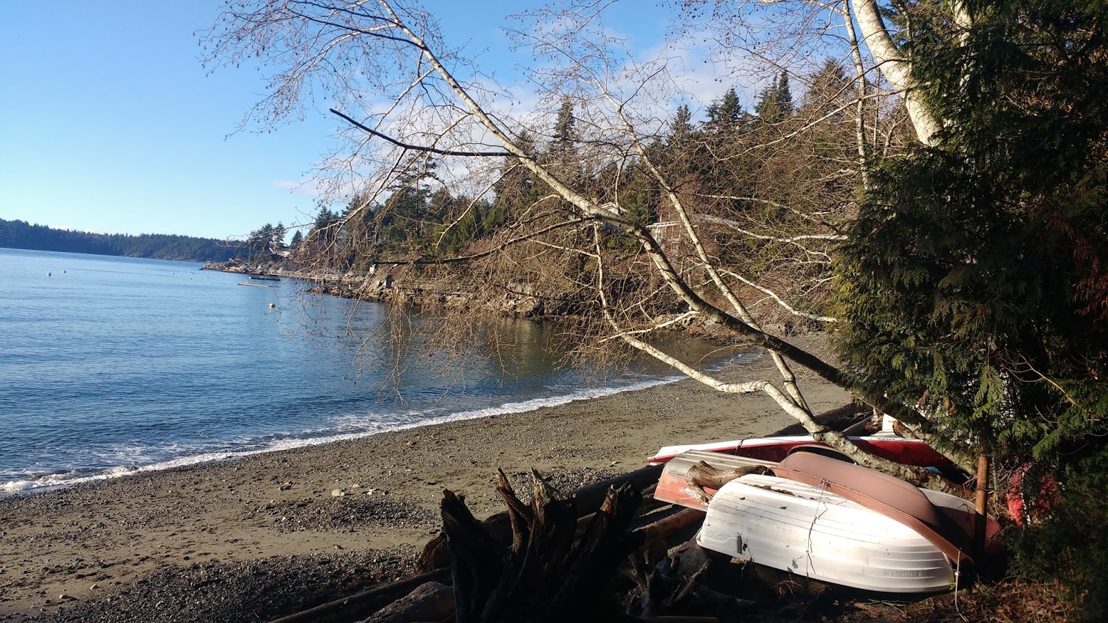

I had mentioned the history of Bowen Bay in my blog post about Cromie Trail. This beach had remained popular among the locals, especially youngsters, and even had a swimming float.

After a quick look around, we headed back up the hill towards Evergreen.

We turned right onto Malkin Creek Rd and soon enough were back up at the intersection with Amelia Lane.


Now, I say "intersection," but actually Malkin Creek Rd ends in a cul-de-sac to the left, and Amelia Lane continues on to the right. But street signage makes this area easy to naviagate.

Just then, a big raptor soared high over our heads. I thought it was an eagle or a turkey vulture, but my phone camera was unable to capture a clear shot. Both are common on Bowen Island. My guess was turkey vulture. If it were closer, I could have given you a definitive ID.


It wove through the young alder trees. We could hear, and sometimes see, the creek running parallel, on our right.

Almost 200m later, the trail opened again to the road, so we could have walked up the road to this point, if we had chosen to. However, the trail continued on to the right.

As we passed this junction, I snapped a photo of it. Recognize it? I didn't, for another few minutes... ;)

We continued onward, along the trail to the right, and crossed over the creek we had been following.


Suddenly, I recognized a power pole and a unique tree. Colin laughed at me, but the tree was hard to forget--I knew I had seen it before. How could this be?


Checking the GPS, I realized that we were indeed on a stretch of trail that we had walked the day before. The intersection that we had just passed was the trailhead with the chain that we had entered from from the road, walking in the opposite direction down Amelia Lane, the day before.
We then arrived at a very familiar intersection: the one where with the chain, where I stood for quite a while, not being able to figure out which direction the sign "lookout" was pointing. This time, we took that very same "mystery" trail to the right.


As we walked toward it, we realized that we were actually at a kind of T-intersection with the "road": to the right was the "yellow trail" from the trealhead map, and to the right was the "grey trail" from the trailhead map. Here's a reminder:

Finally, that intersection made sense! This section was indeed very "road"-like, besides from the fact that it was gravel and not pavement. It was obviously being used by vehicles, which is why the trail we had just exited needed to be chained off from vehicles.
Houses popped up left and right along this stretch, and there was even a giant red bin on the side of the road, from someone in the midst of construction.

We arrived at an intersection with some signage. There was a clear trail sign, pointing to "viewpoint." This must have been the HUGE viewpoint marked at the end of the "yellow trail" on the map. I tried to convince Colin to go check it out, but he wanted to head back. There was also a map of the subdivision, which turned out to be fairly valuable.


This was the *only* map that showed the trail cutting across the Y of the road in this area. (You remember me not being able to locate it on any of my four maps? Well, sadly, we were only maybe 50m or less away from this sign at the time.) Anyway, the photo below shows the end of that trail, as it passed Magggie's Pond. Suddenly, THAT part of the trail made sense too! Ok, so to walk this section we did today, you only need 5 maps... sigh.

Although we saw the trail running beside the road, we decided to walk on the road itself, just for a change from the day before. Rory suddenly perked up, and trotted down the road. He's such a city dog. Or maybe he remembered that we had some more beef jerky left in the truck...? ;)

About 300m later, we were back at the parking lot. (Sorry, Rory, no drinking fountains on this road, but at least you get to ride in the truck at the end of your journey. lol.)

After our walk, Ben came for another visit. With a small son at home, he was eager for some adult conversation... that is to say, conversations with adults, not... well, you know. ;) He brought us a housewarming gift of Lagavulin, and the most hilarious motion sensor light for our toilet. (um, now that I think of it, those gifts were unrelated, I hope.) After being activated, the light stayed on for 3 minutes, changing colors. I absolutely loved it!!!! Merry Christmas to me!!!


No comments:
Post a Comment