
Inspired by the day before's breakfast, tried a DIY version with stuff I found in my fridge.

The "rainbow" photos that had been popping up all day the day before were still arriving on the community's FB page. This was my favorite. :)

Checking out the Schedule E map whilst sipping my coffee, I noticed far more trails marked in the Cates Hill area than I knew about (see screenshot below). I decided to check them out and see what was there.

Basically, I walked up Village Dr to Berry Rd to Cates Hill Rd, turned right and walked to the first little road on the right (Cates Ln). From there, I took a trail down to Grafton Rd, then up through another trail to Cates Hill Rd, and down the Cates Hill Trail that I had walked many times before.
It was approximately a 4 km route, with about 100m of elevation.

(click map to enlarge)
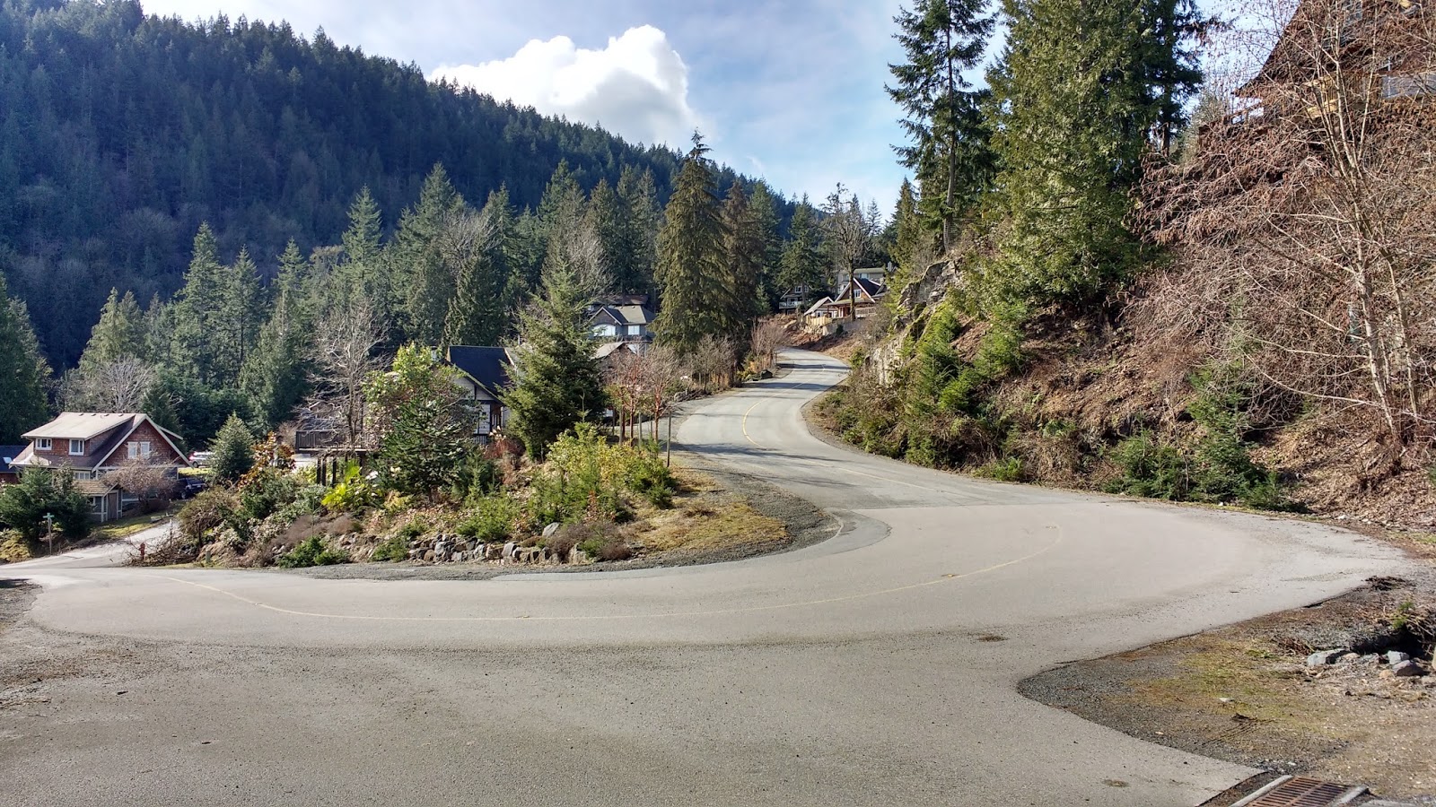
Starting at the trailhead with the yellow signpost at the first hairpin of Village Dr, I headed up the hill on the road.


When I walked around the tree to get a better angle, the Flicker took off, in a splash of flame-orange. The Pileated Woodpecker kept hammering away at the trunk, oblivious to me or my camera. I figured this was the same woodpecker I had seen on an earlier walk on this hill, since I was only one street over from where I had seen it before.

I continued upward on Village Dr, to its intersection with Berry Rd.

A backhoe was hard at work, leveling off the corner lot.

I turned left on Berry Rd, then right onto Cates Hill Rd.


About 170m down the hill, I turned right onto Cates Hill Lane. (I know, someone was really imaginative with these street names...)

The Lane was paved but REALLY "lane"-like: only one car-width wide. I had to wait for a truck to turn in ahead of me before I could walk in.

I saw a wide dirt road leading off to my right, with a yellow guy wire on its right, but my GPS told me that it wasn't quite far enough along the Lane to be the trail I was looking for. I wondered whether this was also a trail, or just a long driveway. There were no house number signs that I could see.

Where Cates Ln started to curl, I located the trail shown on the Schedule E map. It was right between a power pole and a yellow guy wire marker.


I headed in to the trail, which was a small footpath that meandered through the trees.

It went very slightly downhill until it met with what appeared to be a logging road. Well, THAT wasn't on the Schedule E map at all! The trail on the map looked like it went straight, but I couldn't locate any path on the other side of the logging road. Which way was I supposed to go??

First, I turned left. That quickly led to a house with a large green yard. I peered down across the grass, trying to see if any trail led through that way. I couldn't see anything, so I just turned around and went back to try the other direction.

In the other direction I quickly ended up at yet ANOTHER fork in the trail. None of this was on the map. One trail led up the hill to the right. Another, downhill to the left.

Standing in the intersection, I saw there was a tiny pink trail flag on the ground... at the foot of each trail. sigh. That didn't help!! I wondered whether the right hand trail led up to the entrance I had passed on Cates Hill Lane. It seemed about the right width and type. (Update: it WAS the other end of that trail! There were also other trails forking off from that one, heading through what looked like a new subdivision and joining Rivendell Dr at Tir-Na-NoG school. See the orange dotted route on the map above.)

But I knew that the trail I wanted went downhill, so I took the grassy left hand trail.

Maybe 50m down that path, I passed a big red storage/garbage in on the right side of the trail. Next to it, a dirt road led into the woods. Now THAT was surely a driveway of some kind, I mused.

On the opposite side of the trail, another much rougher logging-road style road led steeply downhill. It was quite overgrown, and seemed like it hadn't been used in a while.

So I just continued straight ahead on my grassy road.

That is, until I saw vehicles parked up ahead. Whaaa??? Why? It felt like I was in the middle of no-where. But as I got closer, I realized that the vehicles were parked on a cement road.

Extremely curious, I followed the pavement... down to... the intersection of Artisan Lane and Roocroft Lane!! I was maybe a couple hundred metres from Artisan Square!


Instead of heading back up to the red bin, I stayed right, and kept heading downhill. This part of the "road" was quite overgrown with brush. I picked my way through, praying there wouldn't be ticks. Unless someone came through here and mowed down these bushes, I would expect the road to be impassible in a couple of years.

When I got through the brush, the road was bisected by a small creek. To the left was the other end of the overgrown "logging road" that led up to the red bin. I guess it was just an old shortcut.


Then... a winding footpath led uphill to my left. I was confused. Was THAT the trail that showed on the Schedule E map?? The trail I was on seemed to continue a little farther, then turn left also.


Then I realized that the two trails heading left rejoined on the other side of this raised group of trees.

Just past the group of trees, the trail I was already on seemed to lead straight down to Grafton Rd. So ok, no mystery there!

But what was this trail, heading uphill to my left?? My GPS showed that I was directly below where the trail first left Cates Lane! I decided to go up the trail and see if it was indeed the trail I was supposed to be on this whole time.


Yep, that was the same house with the grassy field. I exited the trail into the same grassy clearing I had seen previously... Now I was on the opposite side of where I had been standing before. I guess I could have gone through the field and then straight down through here after all!

Satisfied at solving that mystery, I turned about and walked back down, past the group of trees, and out to the road.


There was only one hitch... The quite full ditch between me and the road. A pink flag marked that this was where I should exit, but I couldn't see a way down and over the ditch without falling in. Finally, I walked a few feet to my right, and found an easier way down, complete with a couple of large rocks serving as a makeshift "bridge" over the water, and a low-hanging branch to hang on to.

Finally on Grafton Rd, I turned left and walked along the shoulder.

I saw a much gentler exit onto the road a few metres later. Sigh. I didn't bother climbing back up to see whether it connected to the trail I had just been on.

A bit farther along, many big trees were cut down. It seemed like a lot was being cleared, in preparation for a new house. There were several little trail entrances along this stretch, some with wooden staircases! All of these had house addresses on them, so I assumed they were private pedestrian accesses to the homes higher on the hill.


Soon Grafton Rd's "shoulder" dwindled to nothing. Cars and huge trucks zoomed by, and I balanced precariously between the cement and the ditch.


Where Grafton Rd met Cates Hill Rd, I found the other trail that cut straight back up to Twiggleberries B&B. It was marked with a Twiggleberries sign and arrow.

The legend of Trwiggleberries is actually quite amusing: "Far away in a time long forgotten, there was a rocky island surrounded by a calm sea... This island was hospitable to neither man nor beast as very little could grow on its rocky outcroppings..." Sound familiar?? hahahaha. The only plant that could thrive there was the Twiggleberry bush, which only provided enough sustenance for a group of faeries. When humans started coming to the island, the faeries asked a sorcerer to cast a spell to "cause a mist to form around the island so that it could no longer be found by mortals."
TIL: so THAT's why Bowen Island is constantly inside a cloud! ;)
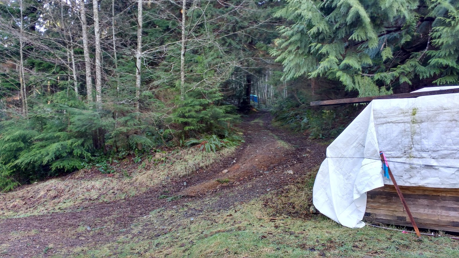
The path up to the B&B consisted of two tire tracks. It led rather steeply uphill. Just then, my phone died (I must have been using my GPS a little too much, trying to sort out the trail!), so I switched to my camera for photos. yes, I had carried my camera all the way to that point without using it.


Looking down it, I could see a little yurt tucked into the trees.

Up near the top of the hill, I passed a little shack and an open gate.


Here it is from the other side. The path comes out to the left of the big blue tarp, and that's Twiggleberries B&B up on the hill to the right.

I didn't go up to the B&B, but just continued heading towards Cates Hill Rd. I passed a lovely garden on the left. I couldn't capture it well on film, because of the fence in between us, but I could see that it was large and lovely, even in February! It had an unusual sculpture. That twigged my memory, and made me wonder whether this was the place I had recently read about online...


** UPDATE: **
It absolutely was that place! I got an opportunity to visit this garden in May, through the Bowen Island Garden Club. It was truly gorgeous and very inspiring.

There were grape vines, fruit trees, hops, berry bushes, several small ponds, and trails throughout, which led to several unique nooks with benches, and of course, many flowers.


As we walked through, I would point to various plants and comment: "We have that one!" And Colin would try to name it. Then we'd comment on how ours didn't look quite as good as theirs. XD


I was especially dazzled by their fragrant Paulownia tree. It was similar in scent to a heady rose. I wanted to stand under it all day.

After visiting the seedling shed, we expected this little building to be more of the same... NOPE!! Wow.

** END OF UPDATE **
Just before exiting onto the cul-de-sac of Cates Hill Rd, I saw this cute trail accented with colorful buoys. I assumed that was also a private path to a house.


Here's the view back towards where I exited onto the cul-de-sac, in case you want to follow my trail in the opposite direction.

On the cul-de-sac, this shy little house peeked out over a rocky walkway, to see what I was up to. ;)

I walked briefly along Cates Hill Rd. I could have gone down Minnows Ln to join the Cates Hill Trail, as Colin and I did one snowy day, but I instead decided to go down to the entrance shown on bowentrails.ca, across from 621 Cates Hill Rd.


Once on the trail, I turned left at the junction. My butt was getting me pretty far... ;) Note that the trail coming from the right was the one from Minnow Lane, marked in dots on my map above.


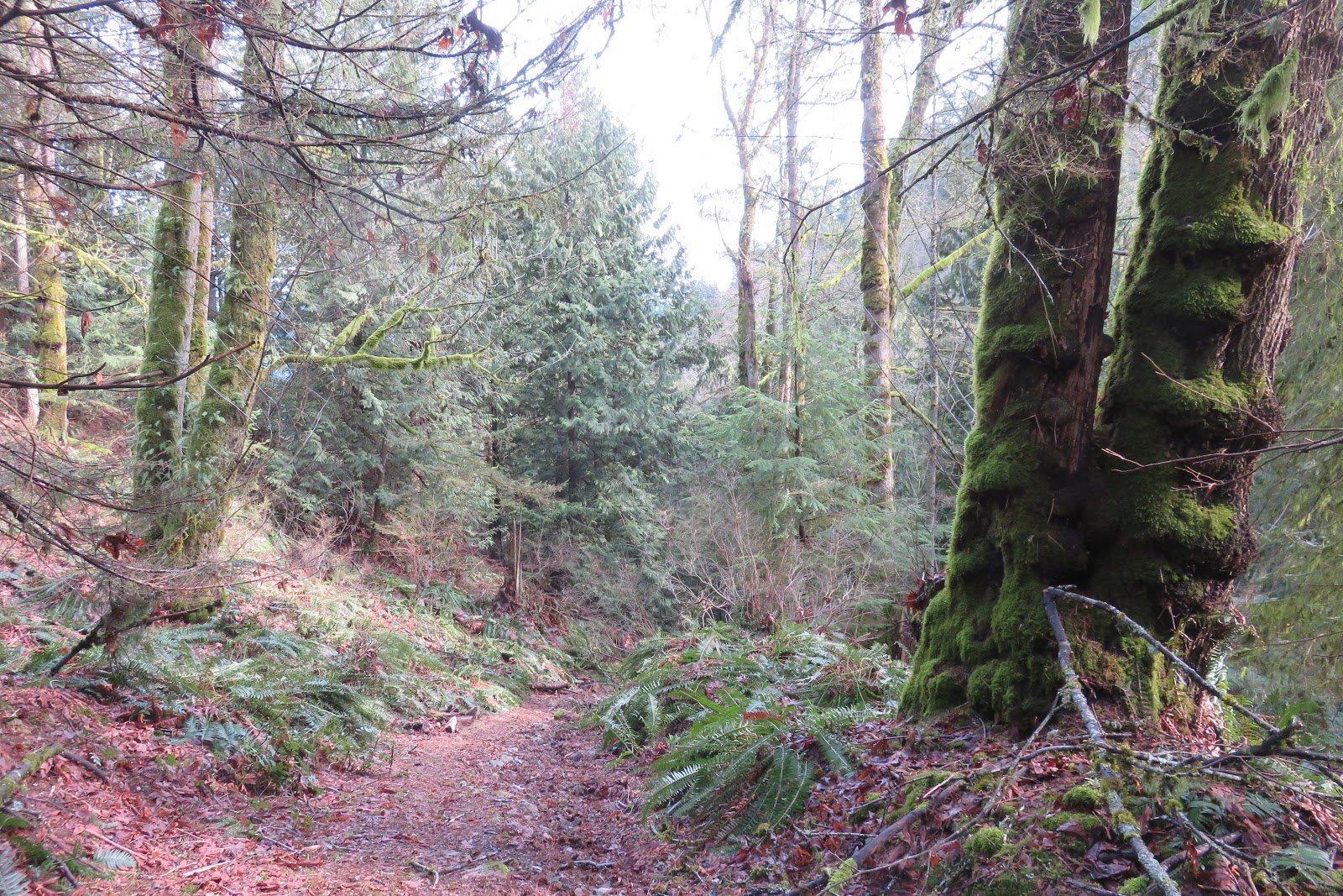
I continued onward along the well-marked path. What a contrast to walking here in the snow!!

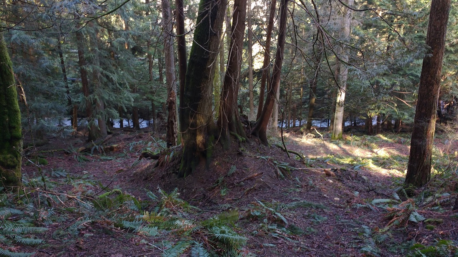
The little creek beside the trail was free of ice, and quiet.


Then the trail dropped down, and mingled with an offshoot of the creek, making for a wet and muddy trail to the pair of houses in the clearing. (ok, maybe not THAT wet and muddy...)


Two ravens cackled at me. Were the same birds following me?

I didn't mind, because the weather was fine and I was feeling good. I kept descending, down towards Davies Creek.


I didn't go all the way down to the Creek on this day, although I easily could have, by keeping right at the fork. Instead, I kept left, and skipped a steep downhill-then-uphill-again section. ;)

Joining the wider road-like trail, I kept right at what appeared to be a fork, but in fact was not. (The left hand path goes nowhere.)


Passing the BC Hydro boxes, I exited out past the yellow post back onto Village Dr.


As I walked onto the pavement, I got a beautiful view of the mountains! I used my camera to its advantage, and got a few great shots of the peaks in the snow and mist.


What a spectacular ending to the hike! :D
No comments:
Post a Comment