
The forecast had called for rain, but the sky was clear and blue. :D
My Schedule E map beckoned me over to Bluewater, where it appeared that a trail echoed Bowen Bay Rd and Windjammer Rd. I thought I'd try looking for it, and if I could find it, take it up to the little "lake" at the end of Mutiny Lane, and wander around there in search of the old mine shafts said to be in the area (see red dots on map below). On the way back, I'd try to find the trail along the coastline (see pink dots on map below).

Well, as you can see from my map below, I didn't end up finding any of the trails I was looking for! Although I did end up with a great hike!
I ended up on Bluewater Trail, and doing a loop via Handlogger's Trail. On the way back, I looked for the trail along the coastline, but couldn't find that either, so I visited Crayola Beach and King Edward Bay Beach via small trails from the road, then followed Windjammer Rd back to my car (at P).
The route was approximately 8.5km in total. Rising at least 315m, then dropping back down again.

Remembering my experiences at Fort Casey in the summer, I tossed a couple of high powered flashlights into my backpack, just in case I did find the mine shafts and had the nerve to go in.
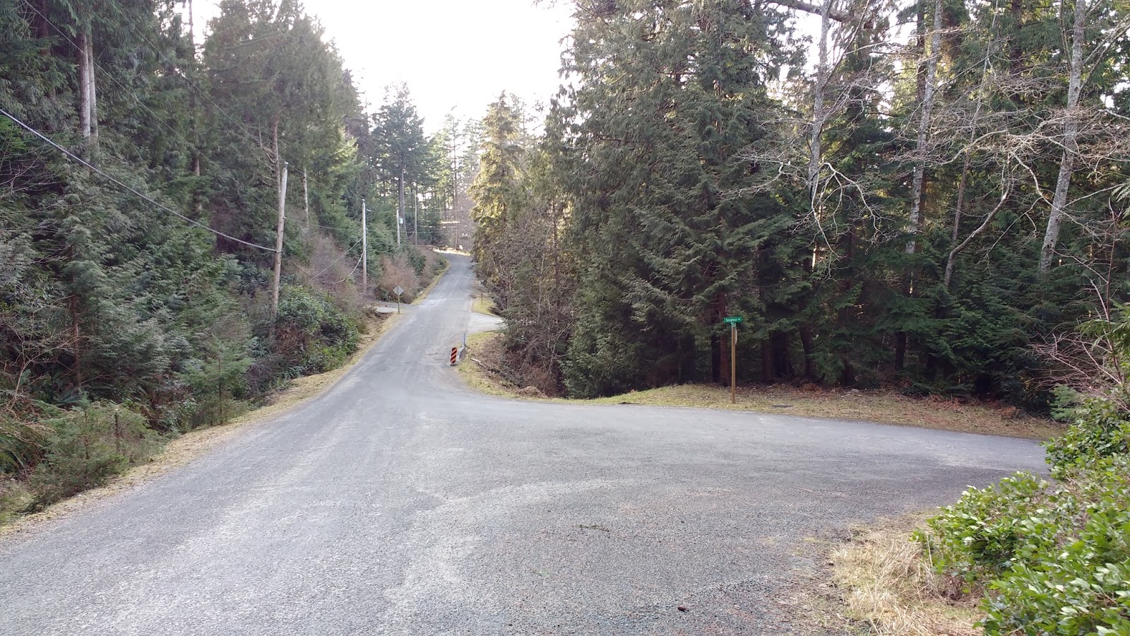
I drove to the Evergreen area, and parked in the cul-de-sac at the end of Malkin Creek Rd.

On this side of the island, the sky looked grey and foreboding. :( Shivering, I second-guessed my decision to leave the bright blue sky of the East side of the island.
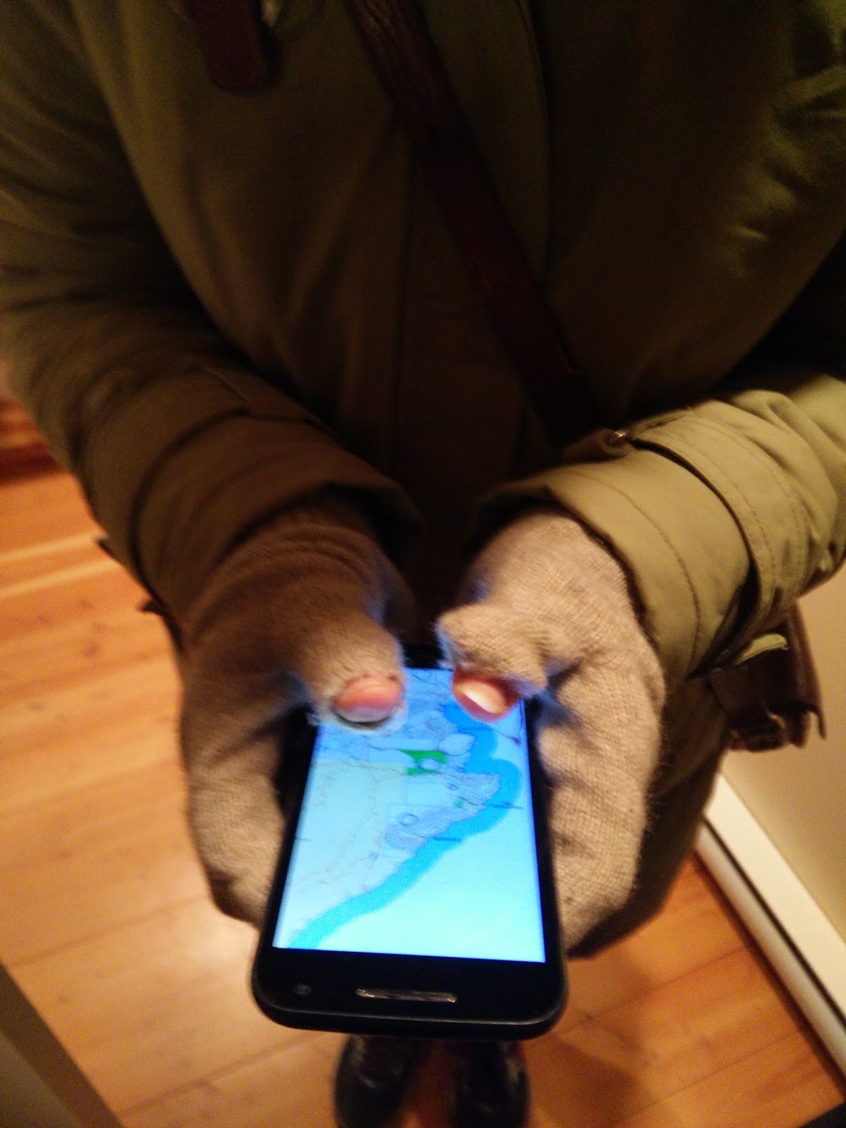
Putting on my gloves, I realized that both thumbs had holes. Then realized that it would actually work out pretty well to operate my phone that way. ;)
Wandering around in circles near the end of Malkin Dr, looking for the promised trail, I finally admitted to myself that I couldn't find it, and scoured the map for a plan B.
I wasn't totally disappointed at not finding the trail, because I knew that some of the trails on Schedule E were merely "proposed" trails. I'd look for it again from the other end, just to be sure.
I headed up Amelia Lane, and stayed on the road instead of the path, although I could have taken either one to the next junction.


A sign by the trail pointed to "Malkin Creek Trails" down the trail on the right and left to "Mt. Gardner."

Since I had already hiked Evergreen in the past, I knew that the right hand trail would take me away from my intended destination. I checked the middle trail, and it quickly led to a big non-ambiguous sign.

So I ended up heading up to the end of Amelia Lane, where I found the end of the Bowen Bay Trail.


A small sign there also pointed down the trail to "Mt Gardner."

The rough trail headed uphill, through salal, into the forest, and joined beside a creek.


I recognized the spot where Colin and I had leaped over the creek, heading in the other direction, and since that time, someone had cut a step into a fallen log, to make the crossing easier.

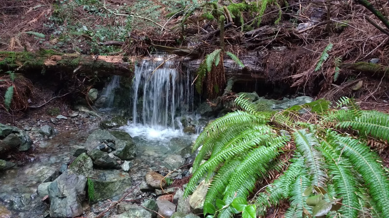
The trail then ran beside the creek where it cascaded down in a series of small waterfalls. It was really beautiful!


As the next junction, which didn't show on any of my maps, someone had blocked off the left-hand fork with some logs and branches, so I just continued on the right-hand fork. My GPS confirmed that this was correct.


I passed a pair of GIGANTIC shelf fungus. I took a photo of my compass card on them, for scale, but it turned out blurry. The top fungus was more than a foot across, and the bottom one even bigger! :o

The trail led through some light forest until it came to a junction.

At the junction I turned left onto what google maps called Bluewater Trail. This section of the trail is also known as the Handlogger's Trail, which is what is marked on the trail signage.


The trail got pretty wet in the next section, and I made my way around on the left side of the real trail. They coulda used some of that never-wet sand. (Not to be confused with never-nude...)

Next I forged through deep salal, following the little red diamonds on the trees, which mark many of the Mt Gardner trails.


Then the trail got really wet again. It was like I was walking in a creek bed.

Then the "creek bed" I was in crossed another very active creek, running perpendicular. I stopped to admire a tiny waterfall, before stepping over.


The trail was not terribly clear, except for the red diamond trail markers, which led me around, under, and over fallen trees.

Then I was back in another wet creek bed. I could see a theme forming for this hike... ;) I tried to look up all the creeks I had been passing on the bowentrails Waterways map (see below), but I got overwhelmed.


(click image to enlarge, or view original at
At one point the trail was so wet and muddy that I climbed up on the high ground to the right, and followed the edge of a large rock face.

After that, I was finally at another junction. I knew that Bluewater Trail and Handlogger's Trail split into separate trails about 750m after the last junction. A trail sign pointed "down" to yet another narrow creek bed on the left of the junction. That was the Bluewater Mines Trail, which would take me to the end of Mutiny Lane. It really did appear to head "down" ! I considered taking that route, but I was feeling good, and didn't want to cut my hike short.
The sign pointed "ahead" to Handlogger's Trail, which is the one I wanted to take, to loop around a more scenic route.

A few feet past the trail sign, along the same trail, a very rustic arrow pointed to "Mt Gardner" in faded yellow paint. it would be a roundabout route, but one could get to the summit this way. I, however, planned to turn left at the next junction, and head back down to Bluewater via the Bluewater Reservoir Trail.

This trail was rocky and steep, and... you guessed it... a creek bed.

Finally, the trail flattened out and dried out... briefly! >.<


Then it started heading uphill again. I imagined the marathoners running through these trails, for their training, or in the actual Handlogger's Half Marathon. It seemed hardcore, but pretty pleasant, if one was in good enough shape.

After a good long stretch of pretty steep uphill, I determined that I was not in good enough shape. ;)

The path transformed yet again into a creek bed, and I struggled with the constant uphill.

I reached a junction where the trail appeared to go up and over a small hill to the right of the trail. I paused, hoping that I wouldn't be going up there. Looking around, I saw a lot of large unidentifiable metal pieces, rusted beyond recognition.


Were they part of an old car? Or some kind of logging equipment? How did they get up here? Certainly there were no roads... I was just climbing up narrow pathways and small creek beds! It was a mystery to me.
I finally decided to traipse through the creek bed at the bottom, to see whether the trail on the right simply came back down the hill right after and rejoined the "creek" trail. It did. I praised my lucky stars that I could skip that little portion.
[EDIT: I finally found out that this little hill was the access to the upper Bonanza Mine! If I had taken the little hill detour that I was trying to avoid above, I would have seen the entrance. The debris was left over from the mining days. Read on for more info on this mine adit.]
However, the creek bed soon turned into a pond. I couldn't tell where the path led. It seemed like the pond WAS the path... Both sides of the "pond" had what appeared to be rough trails. I finally chose the right hand side of the pond, and made it past.

The trail continued on the other side of the water. In the end, I think I would have been fine going on either side of the "pond," but this side seemed a little easier and more clear.

Next came a bigger challenge: a large creek had wiped out the trail! I picked my way across the rushing water. Small waterfalls fell to my left and to my right. Actually, it was easier than it looked! But still a little precarious. Steady feet were needed.

The trail led upward, past this cool little bluff. I spent way too long trying to capture it on film, and this was the best I could get. It reminded me of the fern grottos in Kawa'i.

After a little more uphill, I reached an intersection. I assumed it was where Handlogger's Trail was junctioning with Bluewater Reservoir Trail. But there was no signage. I decided to keep to the left, because that was the direction I was supposed to take on that particular junction. A little later, I would realize that this was NOT the junction I thought it was, but still, I managed to take the correct fork.


I was watching for the next junction, and that's how the little trail to a surprise lookout caught my eye.


Arriving at the lookout, I was flabberghasted at the amazing view!

(click pano to enlarge)


I stood looking out at the Paisley Island group, and Keats Island in front of the Langdale ferry terminal at Gibson's of the Sunshine Coast.

Back on the main trail, I forged yet another creek bisecting the path.

Then arrived at the actual junction of Handlogger's Trail and Bluewater Reservoir Trail. This one had the official trail signage. Going right would take me around the North side of Mt Gardner, and give me a chance to go to the summit or descend the East side of the mountain to Killarney Lake. But that was not in the cards for the day. So I took the left fork, to descend the Bluewater Reservoir Trail to... the reservoir! ;)


This is where google maps crapped out on me. They don't show this section of the trail, so I just watched my GPS to make sure I was generally going in the right direction, and kept an eye on a copy of the Schedule E map.

Actually, the trail continued North-ish for a bit, through yet another wet creek bed, before making a sharp u-turn to the left.


I was watching for another fork at the turning point, as a waymarker, since the Schedule E map showed one. I wondered whether the gap in the trees at the turn was "the path." It was pretty grown over, and very unclear. I saw a tire tread of a motorbike coming out of the forest off that curve, but still couldn't tell whether that was the path showing on the Schedule E map. With no-where else to go, I simply followed the obvious curve of the trail around the hairpin turn.
It led to a gorgeous mossy area. Everything was so green. I got peekaboo views of the water through the trees on my right. I wondered whether I would see a wood nymph...


The trail continued to head downhill. Looking at my GPS, I noticed I was pretty close to something called the "Mossy Outcrop." It was given 5 stars. There was one review: "Mmmmm. Moss." Well, with praise like that, how could I miss out? ;) I kept an eye out for this "mossy outcrop."

Soon, I saw a trail leading off to my right. It sure looked like it might be leading towards a mossy area... I checked my GPS, yep, I should be right on top of it! So I headed up.

Mmmmm... mossy!

The outcrop was actually a lot larger than I expected: definitely a great picnic spot!


There were stones ready to be used for seats and side-tables, and a great view.


Someone had taken my picnic idea a step further and had at some point made a little campfire there.

Now, I am no moss enthusiast, but I was surprised and fascinated by the abundance and diversity of mosses and air plants growing on the clearing. Did I mention: mmmmmmm.... moss! ;) I need to get a moss identification book now...

(click on photos to enlarge)


Walking down hill after Mossy Outcrop, I was nearly crying... These recent days of mountain climbing had been taking their toll on my knees! :'(

I got a little distracted from my sore knees when having to navigate this creek that wandered over the path twice in a row. The first part, I had to pick my way through the water on rocks; the second part, I crossed the creek and found dry footing on the other side.


On the next downhill section, I noticed a trail down the hill to my right. Before long, I encountered a trail forking back on my right.


I thought I could see a stone circle not far along the path, so I ran down the short distance to see. It seemed like the path ended just at the circle.

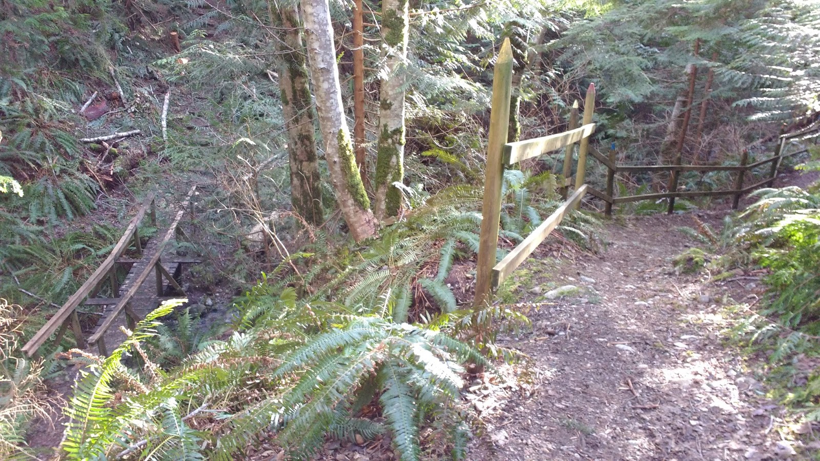
I retraced my steps back to the fork and continued onward. At the next creek, there was mercifully a cute little foot bridge.

During one last long downhill stretch, I reached the water tower. But just before the water tower was yet another fork, leading back to my right. Having the water tower in sight, I didn't head down that other fork. I was keeping my eyes peeled for the entrance(s) to the Bonanza Mines.


(click map to enlarge, or see original at
https://bcrockhounder.files.wordpress.com/2016/03/bcr-apr-2004.pdf )


According to the BC Rockhounder article, all the Bonanza shafts (well, actually, only vertical mining tunnels are technically "shafts"; horizontal tunnels are known as "adits") were drilled in 1905.
The two adits near Mutiny Lane (at about 150m in elevation) yielded mainly chalcopyrite and pyrrhotite, and barely any copper, gold, or silver. The lower of the two adits was about 50m deep, and spit into a Y, and that sounded interesting! The higher of the two was only 5m deep, but I liked the proximity: two for one!
Another tiny 5m long adit, marked as #4 in the map below, was higher up the mountain (at 260m in elevation), off the trail near a small stream. No-one seems to talk about this adit. I am guessing that it is hard to access and too small to be of note.
Another, much longer (90m) adit was even higher up the mountain (at 360m in elevation). This was the main Bonanza Mine, named #3. Van had also mentioned this adit on the forum, with directions and landmarks (although it would have been useful for him to actually mention the names of Bluewater Mines Trail and Handlogger's/Mt Gardner Trail-- matching the property map below to the bowentrails.ca PDF map below it, it was easy to see how to get there).

(click to enlarge, or go to aris.empr.gov.BC/ArisReports/27809.PDF)
(NOTE: There seems to be a problem with going directly to this link... try googling "bowen island bonanza mines" or using explorer rather than chrome).
(NOTE: There seems to be a problem with going directly to this link... try googling "bowen island bonanza mines" or using explorer rather than chrome).

(click to enlarge, or go to
According to BC Rockhounder, that higher-altitude adit contained quartz and gold, with smaller yields of pyrite, sphalerite, galena, arsenopyrite and chalcopyrite within the quartz vein. It sounded like an exciting adit to explore! But beware: both sources warned of a deep water-filled shaft near the entrance of the tunnel. That sounded a little nerve-wracking, and since it was a 35-45 min hike back up the mountain I had just descended (according to Van), I decided to leave that one for another day, and focus on the one nearby.
The overall problem with the Bonanza Mines was the arsenic and lead intermingled with the ores. For one thing, these elements naturally leached out of the rocks and risked poisoning the water in the Bluewater area. Adding an ore-processing plant would only add to that burden. For another, the process of extracting the gold from the arsenic would be "difficult and expensive." Therefore, they were not able to extract enough ore to make a single shipment.
According to the Summary Report on the Bonanza Mine, Prospector James Laird checked the mines again in 1988, and staked claims in 2004, "following the temporary lifting of a long-held staking
moratorium." After his examination of the mines, Laird concluded that "The mine area could
be used as a teaching site, to promote an understanding of historic mining
methods and the geology of Bowen Island, similar to the BC Museum of Miningat Britannia Beach." That would have been really cool; however, it seems that nothing has developed since that time.
Laird's Summary Report also includes photos of the entrances to all the adits, which also would have been very useful to have, before I set out looking for them! >.<
Approaching the end of Mutiny Lane, I was eager to visit the lower two Bonanza Mines, but pretty nervous to do it alone.
As if in answer to my prayers, I met Elliott and Hailey, a young couple who were visiting the island for a few days. We teamed up to find the lower mine adits, #1 and #2.

We wandered in circles around trying to find them, based on the description we found on the Bowen Island Forum (I unfortunately didn't have the above "property map" yet! It would have made things a LOT easier!!). Van's description on the Forum sounded simple enough "on paper," but trying to follow it, we realized that we couldn't.
Van had written: "The first one what i will call the lower mineshaft is in the Bluewater area with the entrance off of Mutiny Lane which runs off Upper Windjammer. Access is on the right side of Mutiny Lane about 100 feet or so further up from the pump house on your left. If you reach the gate at the end then you went to far. The mine shaft is about 100 yards up the trail."
First of all, when Mutiny Lane "ends" in two different forks, separated by 90 degrees, "Access is on the right side of Mutiny Lane" didn't mean a lot. We wandered up and down the ends of both roads, to no avail.
Next, we couldn't figure out what the "pump house" referred to. We investigated several different possibilities for "pump house." There was a small shack near the water tower.

By poking around there, within "about 100 feet," we managed to find the reservoir. Elsewhere on the forum, I read that "Blue Water Reservoir was once named the "Howard C. Hunter" Reservoir in honor of the man who engineered it under E. Naud's development project in the area during the 1960s." Apparently, there was a plaque to that effect, somewhere on the property. We didn't see one.

There was a kind of "gate" in the fence on the near end of the reservoir, but Van's instructions had said "if you reach the gate you've gone too far." Was THIS the gate he meant? It all didn't seem right...

We went back to the intersection of Mutiny Lane and Mutiny Lane.
Next, we thought we could use my GPS to estimate "100 yards up the trail"... but WHICH trail was Van speaking of? I was pretty sure it wasn't on the trail I had just descended a.k.a. Bluewater Reservoir Trail -- I was looking for the mines on my way down. Elliott and Haley had just taken the last left fork I had passed on my way down, which they said led to another stone circle, and a lookout over the ocean. no mines there. Then they mentioned that there was a third path, just past the fork entrance. So we tried that. It led no where.
Haley was keen on seeing the stone circle that I had passed at the previous fork, and since it was nearby and we were starting to give up hope of finding the mines, I walked her over to see it.
On our way back, we encountered a dirt-biker, making his descent. He knew the mine, gave us directions, and proceeded downhill. As we followed his tracks down, I commented that we should have asked him to make an arrow, like hikers do for each other on the Camino. As if he had heard me, suddenly he roared back uphill to us, and said he had left a skid mark in the gravel in front of the entrance to the trail to the mines, to show us the way!

We were happy to have solid directions, and continued down the hill until we reached his mark, right beside the trailhead kiosk. Elliott groaned, as he pointed to the right, "that's our car!" They had parked right beside the entrance, and not seen it. Apparently, THIS tiny side-trail is what Van meant by "The mine shaft is about 100 yards up the trail." THIS was the "Bluewater Mines Trail." Looking at the various maps later on, I realized that I must have walked right by the adit #3 and not recognized it. It made me wonder whether the rusted metal pieces I had found were part of the "slag heap" of adit #3...?? [EDIT: yep, they were.]

From the kiosk on Mutiny Lane, the trail zigzagged up the small incline, and soon we could see two holes heading into the rock, one above the other. Jackpot!! er, I mean "Bonanza!!" :D We had found adits #1 and #2!


It was quite dark inside, so we turned on all of my flashlights, and headed in. The ground was flooded with water, maybe up to 30cm (1 foot) in places. At the beginning, where the water was shallower, we carefully chose our footsteps on the bigger rocks and higher piles of gravel, but later, we had to resort to balancing on logs that someone had laid along the tunnel. The logs sank to the bottom as we stepped on them, which meant they didn't actually clear the surface of the water. Water seeped through the mesh of my running shoes. What a day to pick runners over my (waterproof) hiking boots!


Looking down by my feet, my eyes caught motion in the murky water. :o I flashed my light downwards: a Northern Salamander!


The right hand fork was not much longer. We saw that people had been in there and left some trash and melted wax from candles.

We turned around and headed out.

Buoyed by our experience in the lower adit, we headed up to the upper of the pair. I lost my footing in the same spot coming and going! "There must be bad karma there, from when Miner Bob stole Miner Joe's pocket watch," I joked. Then Elliott stumbled there too. Maybe there really WAS bad karma in that particular spot! :o
The upper adit was even more flooded than the lower one. The sunken logs in the floor of the tunnel were nowhere near the surface. From the entrance, I flashed my flashlight around inside. I could see the end of the tunnel, only a couple of metres in. There was no point in actually entering.


Feeling satisfied, we walked back down to the kiosk and their car. They were eager to drive around more and explore the island. They asked me about local pubs, and I directed them to Snug Cove. They offered me a ride, but I still wanted to try to find the shoreline trail through Bluewater.
After bidding Elliott and Hailey adieu, I headed down Mutiny Lane towards Bluewater. About 100m later, to the right of the road, I saw another tiny cabin. Was THIS the "pumphouse"? It would be "on the left" if you were coming up Mutiny Rd towards the trailhead (i.e. how I took the photo below)... sigh.


The Bluewater neighborhood owes its main infrastructure to Ernie Naud, although its history goes back to 1892, when a record shows a 160-acre pre-emption of land (Lot 1545). Unfortunately, the name of that person is lost to history, but 1910, logging was begun in the area by Samuel Byers, and mineral prospector John Thompson built a wharf at what would later become Byers Beach. Byers eventually sold his logging rights to GNR Timber, nearly a half-century later, and that is where Mr. Naud enters the narrative. He and two others owned GNR Timber, but he eventually bought out his partners and formed Eddy Holdings Ltd. All three partners remained living in Bluewater, but it was Naud that began subdividing the area. In 1958, 31 lots were opened up in King Edward Bay. Over the next few years, over 50 more lots were subdivided, and Windjammer Rd, Captain's Way, and Clipper Place were created. Naud's hope was to create a huge 50-unit resort with a marina and recreational amenities like swimming pools and tennis courts. This, obviously, never came to pass, but Bluewater subdivision had been created in the process.
Heading away from the reservoir, Mutiny Lane became Windjammer Rd and continued on straight ahead. I followed this to Spy Glass Rd. It seemed that I could have turned right earlier, and taken what google maps called "Bluewater Promenade" (note that the street signs IRL all say Windjammer Rd), but I thought "Spy Glass" sounded more dramatic.

At Spy Glass Rd I turned right to try to find the trail to Crayola Beach, which I thought would lead me to the shoreline trail. Before I turned, I scoured the left side of the road, to try to find the other end of the trail I was hoping to find earlier. Nothing.

It took me right back to "Bluewater Promenade" aka Windjammer Rd. ;p I turned left here, and passed another Lifepak defibrillator box, like the one I had seen on Melmore Rd. I supposed that certain communities had fundraised to receive these boxes, as I didn't see them in every neighborhood of the island.


Just around the corner, I saw a brown sign pointing to "Public Beach Access."


It was right across from a yard with a really neat climbing set-up. A giant stump was set up with toeholds and ropes. Nearby a jungle gym and trampoline awaited. I was actually so distracted by this set-up that I missed the trail sign, the first time I passed it.

Heading down the trail, I noticed a little creek ran parallel to it. At one point, the trail seemed to split, and a little bridge crossed the creek and took the path up the other side of the ravine on a set of stairs.

I wasn't sure where that led, but I knew I wanted to follow the Crayola Crayons to Crayola Beach!

The trail meandered down beside the creek, and I stopped to read a CAWES sign warning not to touch baby fawns or seals, because their mothers often left them to go forage for food, and would be back soon enough. Reminded of food, I pulled out a granola bar and munched my way down the trail.

After a set of stone stairs, I reached the very lovely Crayola Beach.


I peered around the shoreline to try to see a trail. I could not. I wondered whether the "trail" was simply along the water line. It seemed like one could scramble over the rocks and get around the point, but I had no idea what was on the other side of the point. After scrambling all that way, I could end up scrambling all the way back again... I wasn't sure I was up for that magnitude of exploring, after a long day on the mountain.

I retraced my steps along Spy Glass to back to Windjammer and continued along the road.


Along the way, I passed a poster for Screenagers, a documentary showing that evening at the Island Pacific School. That would be a fun way to end the day! I made a mental note to tell Colin that we should go.


I followed Windjammer down to Captain's Way, passing the quite dilapidated sign announcing "Blue Water Park Improvement District." I think the sign itself could have used some "improvement." ;) It was actually quite rare on Bowen to see a sign in such condition.


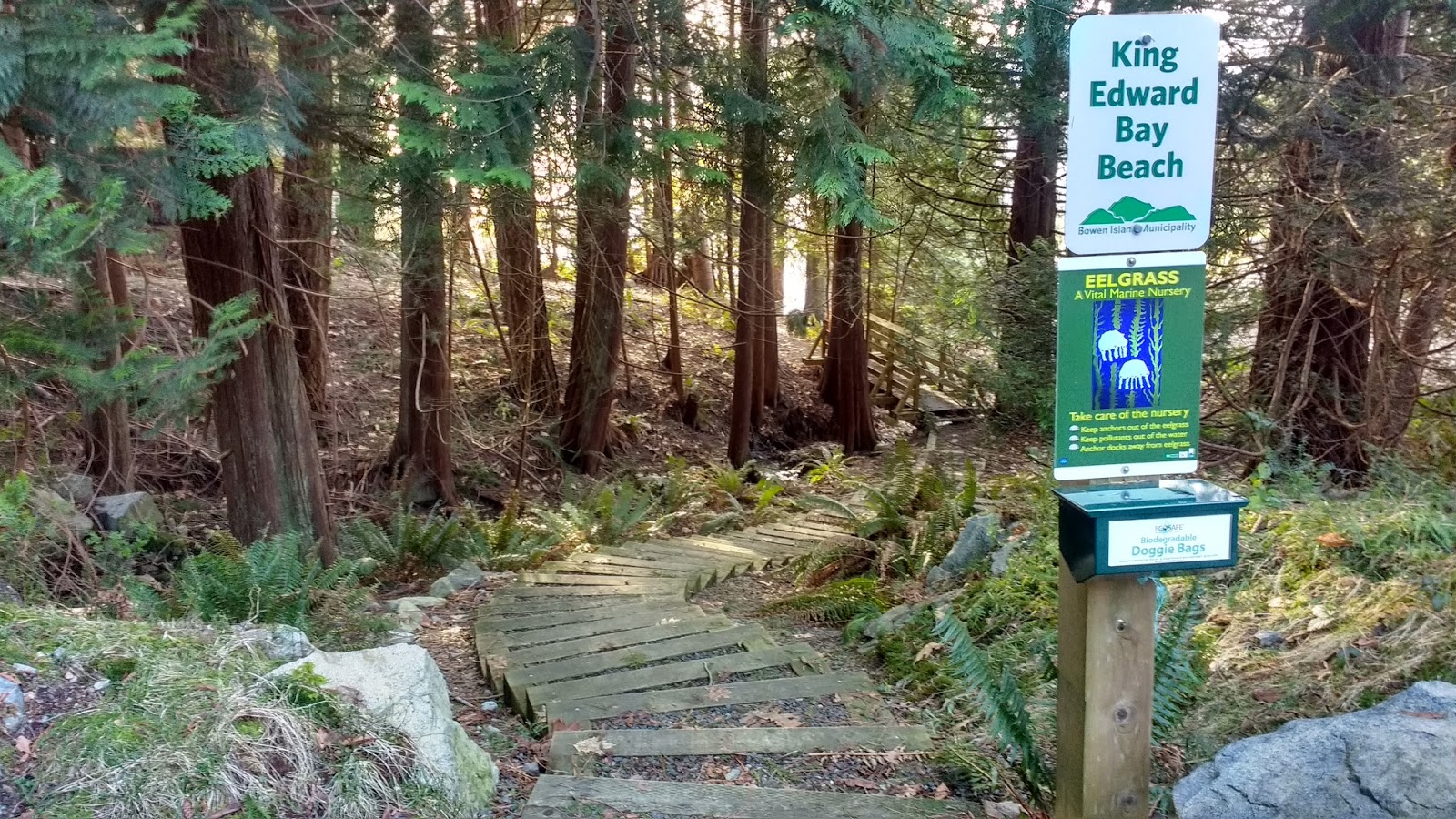
At Captain's Way, I turned right, and headed down to King Edward Bay Beach. Very soon after the intersection, I saw a white sign announcing "King Edward Bay Beach Public Beach Access."


Thus began a trail with a series of cute little wooden bridges, with several little side trails leading up to a paved road or lane on the left-- it didn't show on google maps. I stuck to the main trail through the forest, which meant taking the right-hand fork at every junction.


At one point I noticed the trail was following another paved road to the right. That was Frances Walk. A set of stairs led down the final descent to a small parking lot with a garbage can. A sign at the lot said, "guest parking for strata homes." So I supposed there was no public parking for the beach at that location.


I followed another sign on the other side of the parking lot. It led down another set of stairs.
Part way down, the trail paralleled a creek. I could see a cute little A-frame house, across the creek, and up on the hill to my right. I continued down the staircase to the beach.


The beach was quite lovely.


I headed back up the trail, but just to be different, took Frances Walk back from the parking lot.


I walked along Windjammer Rd, where most houses on the right side seemed to enjoy gorgeous ocean views.

I passed Emily Lane, where I had attended the inaugural BITS meeting. All these little side streets were not yet showing on google maps.

Arriving back at Malkin Rd, I hung a left and climbed the hill to the cul-de-sac where my car was waiting.


I got in my car and drive across island, to pick up something at the pharmacy on the way home. Guess who was in front of me in line? Lol. Elliott and Hailey! What were the chances?!?! Well, I supposed considering that Bowen only has one small "downtown," I guess they were pretty good...
I'm pretty sure that they were actually real people, and not figments of my imagination following me around... right, Elliot??
That evening, Colin and I did go to the film screening at Cates Hill Chapel, next to the school. It was about youth growing up in a digital age. Pretty interesting. The previews sure made the Island Pacific School look AWESOME!!! Then, after the screening, because another group didn't eat their catering, we were treated to an impromptu wine and cheese at the school. :D It was a wine and cheese bonanza!
Thanks for this great description of the trails to the Bluewater mines and along the shoreline. Lots here to explore!
ReplyDelete