*************************************
Today is our final hike in Beaujolais, France. There was only one real choice for what that would be: back to Saint-Cyr-le-Chatoux to check on Littlest Hobo. Walking with him in the Foret Cantinière has been a big highlight of my sojourn here, and the memory of him walking away from me in La Cantinère has haunted me... did he make it back home ok?
Plans made, we wake up to pouring rain. I can hardly believe it. I keep peering out the sky at the windows as I finish up the last of my packing.
Finally, the rain stops around 2pm. We will not have time for a huge randonnée today, but I would really like to give it a go.
I plot a route from Saint-Cyr to Chavanière and back, on a new route and in a different direction than our previous hikes in the area. Our hike will follow one section of the Sentier des Agneaux (Trail of the Lambs), but in a "backward" direction, against the arrows. It is a 5-6 km loop that goes through a 200m elevation change, first down, then up again. Although, as you will see in the map below, a mid-hike change of plans bumped that 200m to 260m, but maximized the new trails we were able to cover.


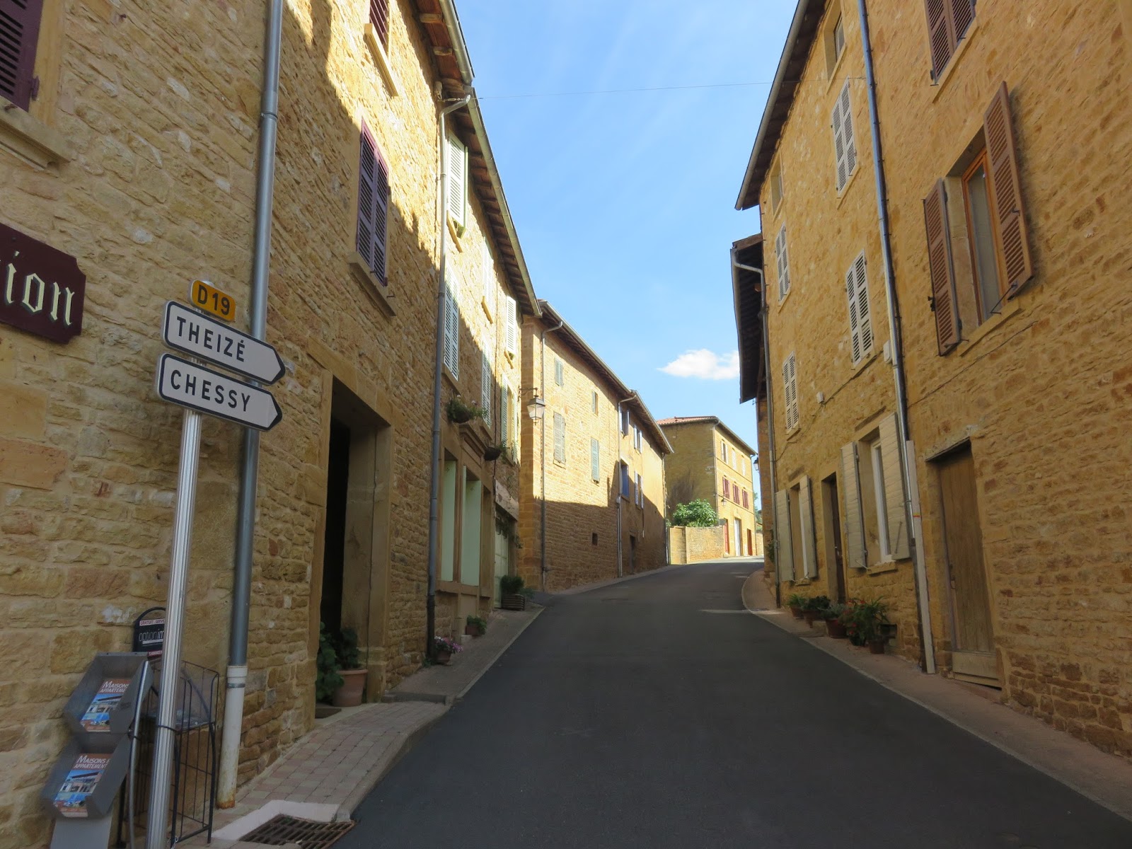
We get in the camionnette and drive to Saint-Cyr. The sun is trying to come out, but it is still mostly behind ominous-looking clouds. We park at Espace Monique Rivière by the trail map and head into town, looking for Littlest Hobo.
There are dozens of little songbirds flying around La Madrone. The sheep next to the path greet us. No wait, they are coming to eat the tasty lunch someone had put in their dishes. They could care less about us. lol. Despite not being able to keep the sheep's attention, I find it fitting that we see them just as we are about to walk the Lamb's Trail. Plus, now I can't get Victor Garbor's "Woooool!" out of my head.


Following the road into town and the "St-Cyr-le Chatoux Le Village" randonnée signpost, I am excited to see the Littlest Hobo laying under a car, on the same street where we first met him. I am thrilled he made it home ok!

I run down to meet him, and he struggles to his feet. He looks way too thin. His coat has lost its lustre. His once-sharp eyes are dull, and he doesn't seem to recognize us, although he weakly nuzzles my hand. I am shocked and confused. He seems to have aged 20 years! Was this the result of us leaving him to get home on his own from La Cantinière? Did he experience some horrible trauma while trying to get home? I feel a wave of guilt and sorrow.

Then I check his collar and it doesn't seem right... I am pretty sure this is not the collar he was wearing last time I saw him. Is it possible this is not Littlest Hobo after all? He looks so similar, and is in the right location, but is not acting at all right.
As if in answer to my question, I hear enthusiastic barking coming from the door next to us. I call out: "Is that you, Hobo? Are you in there, sweetie?" This prompts another round of happy barking. I want to knock on the door, to see if anyone is home, and to verify that Littlest Hobo is in there, alive and well. But I am shy, and convince myself that the multiple rounds of barking means that no-one is home.
Colin muses, "This guy must be Hobo's father or uncle or something." I nod nervously, unconvinced. Colin continues, "Many people have more than one of the same type of dog. We almost adopted our dog's brother as well." I nod again, still looking at the door. Colin tries again, "Listen to that healthy happy barking. Surely, it's Littlest Hobo inside--he is barking because he recognizes our voices and wants to say hi. See, he is ok. He sounds good."
Mollified, we head out on our hike. We see a Golden Lamb head arrow, but we are going "backward" on the trail, so instead we follow the yellow randonnée signpost towards Les Aigais.

As we select Le Bourg street at the intersection, we pass a couple with the biggest hiking backpacks ever. We joke that they must be doing the full 12km Lambs Trail loop. Now that we are old hats at travelling the Cantinière forest, Colin and I only carry one small backpack between us. Sadly, on this cold overcast day, neither of us thought to bring a coat.
At the entrance to Le Bourg, there is a very ornate white crucifix, which reads: Gratitude Protection 22 August 1944, marking the turning point in World War 2 and the liberation of several cities in France.

As we head down the hill of Le Bourg, the wind is bitingly cold. I half-jog, trying to warm up. Colin says, "Soon we'll be going uphill... That might warm us up." (Ever heard that phrase "Be careful what you wish for, you just might get it?")

The sheep grazing on the slopes seem oblivious to the weather. We pass a paved road branching off to the right, and soon we reach the path we want: a gravel road heading off to the left, marked with another crucifix. This crucifix has the initials BG on it.


The trail continues a downward pitch, then levels off. We pass through a variety of beautiful forests and fields before being deposited back on pavement at the Aigais randonnée signpost.


We turn left onto the road. The road turns at the end of the valley that cradles the Ruisseau des Aigais, and follows along the other side. At the corner, a gravel path branches off the pavement. According to the map, this path would take us close to the Bois Chapelin signpost. However, today we stick to the pavement and take "the scenic route" to the Bois de la Chavenière signpost.


The skies begin to clear, and we pass a tree with another cool mushroom growing on it.

We are watching for the next path branching off to the left. If we stay on the paved road too long, we will end up way off track, unable to easily get back. We easily recognize the next fork, but because the stakes are high that we get this turn right, Colin double-checks it with googlemaps.

This trail takes us back into the woods. We stay right at the next fork. Going left would take us directly to the Bois de la Chavenière signpost, but as I said, we are taking the scenic route. ;) Plus, the left fork looks steep. ;)


We want to keep left at the next fork, and it is easy, since someone has carefully blocked off the right-hand fork with a log placed about two feet off the ground.

The path starts to pitch upwards. "Here we go..." I pant. We will be doing about 180m of elevation in the next 2 km. The brown leaves cover the path and remind me that summer is ending and autumn is beginning. It's at once beautiful and sad.


We pass the Bois de la Chavenière signpost, the campsite we saw on our hike with Littlest Hobo, then arrive at the Bois Chapelin signpost. By now, Colin's plan of warmth-by-hill-climb has definitely come to pass.
My original plan was to turn left and follow the flat trail we had done before with the Littlest Hobo, just in the opposite direction. However, standing here, we decide we will take a path not taken, and head directly forward to Point 773. I glance at the map and notice the route is slightly shorter. I don't think to ask why.

The trail is very rough and rocky, and heads very steeply upward through thick brush. I think of the wide clear flat gravel road we could have taken, and have second thoughts about our last-minute choice.

While resting and trying to catch our breath part-way up, Colin notes, "I thought this probably was going to be a big hill, because the path we normally take goes so far around it on the map. Only an idiot would want to walk over this." Ummm... what you say now??? Something that could have been brought to my attention EARLIER!!!

By the time we reach the top, just short of the Point 773 randonnée signpost, I am coated in a nice glistening sweat, but enthusiastically raise my arms in triumph: "I'm a star! I'm on top!"

We follow the signpost arrow left and head down towards the nearby Bois Chai signpost. At Bois Chai, we head left towards Le Crèt Pilon signpost.


Since last time we took the right-hand fork up to the viewpoint, this time we take the left-hand fork, just for fun. It leads along a grassy track back to Espace Monique Rivière.


At the Espace Monique Rivière, we take a moment to honor the gravity of this moment: the end of our last randonnée in France. (I think Colin captured it better than me... I look more like grumpy cat.) The fencepost facing us shows two randonnée Xs... end of the road.


On the drive back, I call out to all the landmarks as we pass them: "Bye Allières... Bye Chez Chris... Bye good bakery that's always closed... Bye think of the children..."
We see the grapes along Le Cocon are bigger, although not yet purple like the grapes near Ternand. We decide to give one a try anyway: we feel an affection towards these vines, as we have passed them nearly every day of our sojourn here. I jump out of the camionnette and grab two. It feels like closure to try one of the grapes before we leave. The taste is disturbingly sour.


Back at the gite, I check the Littlest Hobo blog photos against the photos I took today. It's definitely not Littlest Hobo we saw: the markings on their noses do not match. I breathe a sigh of relief. Littlest Hobo was most certainly the dog inside the house.
My shoes, which were brand new when we arrived in May, are worn through. I calculate that I've walked about 850 km this summer.

We go online and pick our seats for the plane tomorrow. Then I write a poem in the Livre d'Or (guest book):
Chamelet? / On est Pret!
Belle journée: / randonnée.
Sac-à-dos / comme il faut
Crème solaire / pieds à terre.
'Tout à l'heure / Chat Voleur!
Le Cocon: / papillons.
Grand Bola / vers Létra:
Vaches et veaux, / bon caveau.
Prées d'avoine, / Croix des Moines,
Vieux lavoirs, / champs de foire,
Beaux villages / sans nuages...
Il nous faut / plus de l'eau!
Bar tabac, / pizza snack:
Tous fermé / chaque journée.
Pierres dorées / vin rosé...
Beaujolais? / Tout à fait!
We grab a bottle of sparkling rosé made by the Stéphane in Oingt, plus a large bottle of microbrew beer, and head over to Alban's side of the gite. He welcomes us in, and his coworker Guillaume is there. They frown and laugh as we present our booze: apparently, Alban's ex-wife's family brews the beer we brought... oops! Sore topic. He pops it into a cupboard and opens the rosé. Then another bottle of sparkling wine.
We ask Alban and Guillaume about their most memorable jobs with Acrobart. The Eiffel Tower is a strong contender. Then they start talking about local birds and I want to participate, but I don't know any of the names in French... Alban brings up "two little eagles" he said he saw near the gite yesterday. Cool! I thought I saw an eagle one time, but didn't know if they had eagles here. After a few more drinks, Alban offers us a $5 bill that he brought home from his trip to Montreal a few years ago.

The next morning, Alban drops us at the train station in Chamelet, and I shed a tear to leave this wonderful place that has stolen my heart and shown me a lifestyle of unprecedented inner peace and joy.

What comes next? I truly don't know, but living here has given me a glimpse of what my life could be like, and I hope this insight will guide me towards a glorious future. Perhaps foottoearth 2: electric boogaloo??
If you liked this blog, drop me a line in the comments and let me know! I'd love to hear from you. :D I'd be thrilled if this blog has been helpful to any hikers out there, navigating the randonnée trails in Beaujolais.