
I had a real adventure today! I was trying to use the Schedule E map to make a loop around Conical Hill (a.k.a. Duncan's Hat), but I ended up getting a little turned around and summiting the hill by accident! (The hill is about 300m in elevation.) I eventually did find the trail around the hill as well, so in the end, it was a win, and an interesting hike of approximately 8 km. (Note that I marked the Mid-Island Trail in dotted lines in the map below, for reference.)

(click map to enlarge)
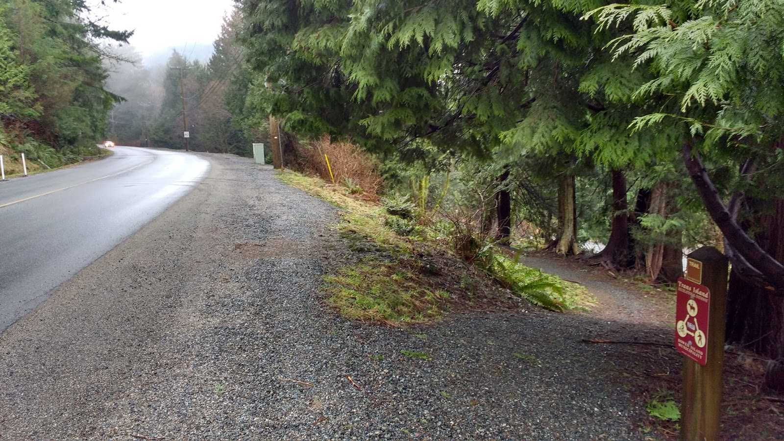
I started off with an enjoyable Sushi lunch at Bowen Sushi To Go in Village Square. From the Village, I went up the Trans-Island Trail (TIT) along Grafton Rd. It was marked with a small "trail" sign. At this point in the trail, it's not much more than a gravel sidewalk.


Reaching the Bowen Island Community School, which is the island's only elementary school, there was an opportunity to walk inside the protection of the fence. I often went that way, to avoid the traffic on Grafton Rd; however, on this day, I walked on the road-side, as it was 5% more efficient for the direction I wanted to head on this particular day.


At the intersection, Mt Gardner Rd branched off to the right. I crossed it to stay on Grafton Rd. The Trans-Island Trail began just on the the other side of the intersection. It was marked with another "trail" sign, as well as a larger illustrated sign noting "Trans-Island Trail."
The trail went downhill slightly, to drop below road level. For a little while, it ran between Grafton Rd and Mt Gardner Rd, before Mt Gardner Rd pulled away.

After that, it really felt more like a "trail," as there were bushes and light forest on both sides of the trail. Being below road level also muffled much of the car noise coming from the busy Grafton Rd, the only road that crossed the island East-West.

The trail then rose back up to level with Grafton Rd, above. This is the section where I had had a lot of trouble staying on my feet, in last winter's snow. Without snow, it was easy to navigate. You can compare this section with its snowy counterpart here, in Blog 16.

Back up at road level, an unnamed gravel lane bisected the path. The TIT continued directly on the other side, marked with another small "trail sign."


The trail narrowed, and ran along the edge of a parking area usually occupied with Bowen Fuels tankers. Geographically (as the crow flies), we were not very far from the island's only gas station. However, the tanker would have to go back onto Grafton Rd and then Mt Gardner Rd to deliver its goods.

Shortly after passing the tanker, the path split. I headed back up towards Grafton Rd, along the left hand path.

Up on Grafton Rd, I had to cross Carter Rd to continue on the TIT. The trail entrance was just past the intersection again. The trail sign was not as obvious as the blue municipal signage for Artisan Square, Bowen's other main shopping area, after the Village.


The trail wove in and out of the trees alongside the road. Across from the entrance to Artisan Square, I could see the signage advertising the various shops. I kept left and stayed in the trees, past the rock walled back side of the bus stop, and continuing straight on through the trail junction.


I really loved this tree growing out of an old stump which still sported its springboard marks from logging in days gone by. Most of Bowen Island was logged between c. 1890s and 1950s.

Over a small bridge, and the landscape opened up to my right. I had to go take a peek and see whether I could actually see Terminal Creek flowing by, down below. I could!


A fork in the trail offered a little variety for the hiker, as both forks rejoined a little later, before the trail headed back up to Grafton Rd yet again.

Just before the trail rejoined the road, the trail split, and I stayed right, to remain in the forest. Walking on Grafton Rd is not so fun. It's busy and there is barely a shoulder.

I found the next section quite beautiful. It felt very removed from the road above, and secluded in the forest.
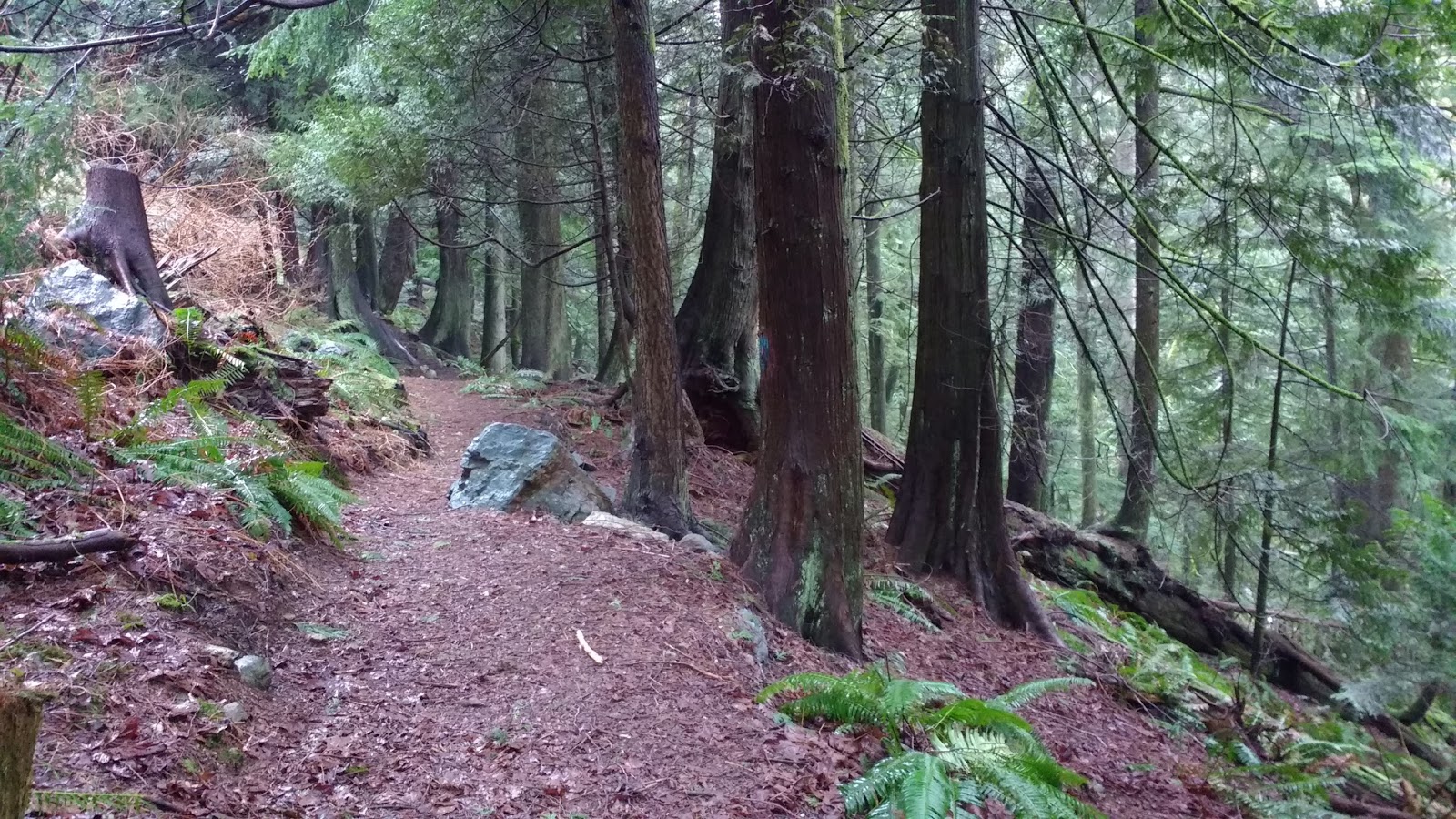
Sadly, couple of trees had come down, and fallen across the path, but someone had already chainsawed through them in such a way that hikers could continue through on the path unimpeded.

All good things eventually end, and a staircase put me back up on Grafton Rd.


For those of you headed in the opposite direction, I took this photo of the trail entrance. There were not signs or landmarks on this end, to mark the trail. From this angle, it barely looked like anything at all!

On Grafton Rd, I continued onward, by merging right with the road. A nerve-wracking moment occurred as I was walking past this guardrail, with traffic passing me. But then I was finally at the corner of Charlie's Lane, where the Schedule E map said a trail led between Conical Hill and the next hill, straight to Grafton Lake.


There appeared to be a wide path heading in the right direction, just to the left of the street sign. This really seemed like the correct location, according to the Schedule E map. However, there was a lot of debris from fallen trees, and I couldn't see the path after a short while. If this was the path, it no longer seemed passable.

I went back to the intersection, and started walking along Charlie's Lane. At the first bend, there appeared to be a path heading off to the left. This again seemed to be heading in the correct direction, but again, it disintegrated into what appeared to be a deer trail soon afterwards. Gun-shy after my last experience with a deer trail, I went back to Charlie's Lane.


When I was in sight of a small bridge over Terminal Creek, I spied what appeared to be a logging road, heading off to the right. Maybe 50 feet into that trail was a "No Hunting or Tresspassing" sign. That trail did not seem to head in the right direction anyway.


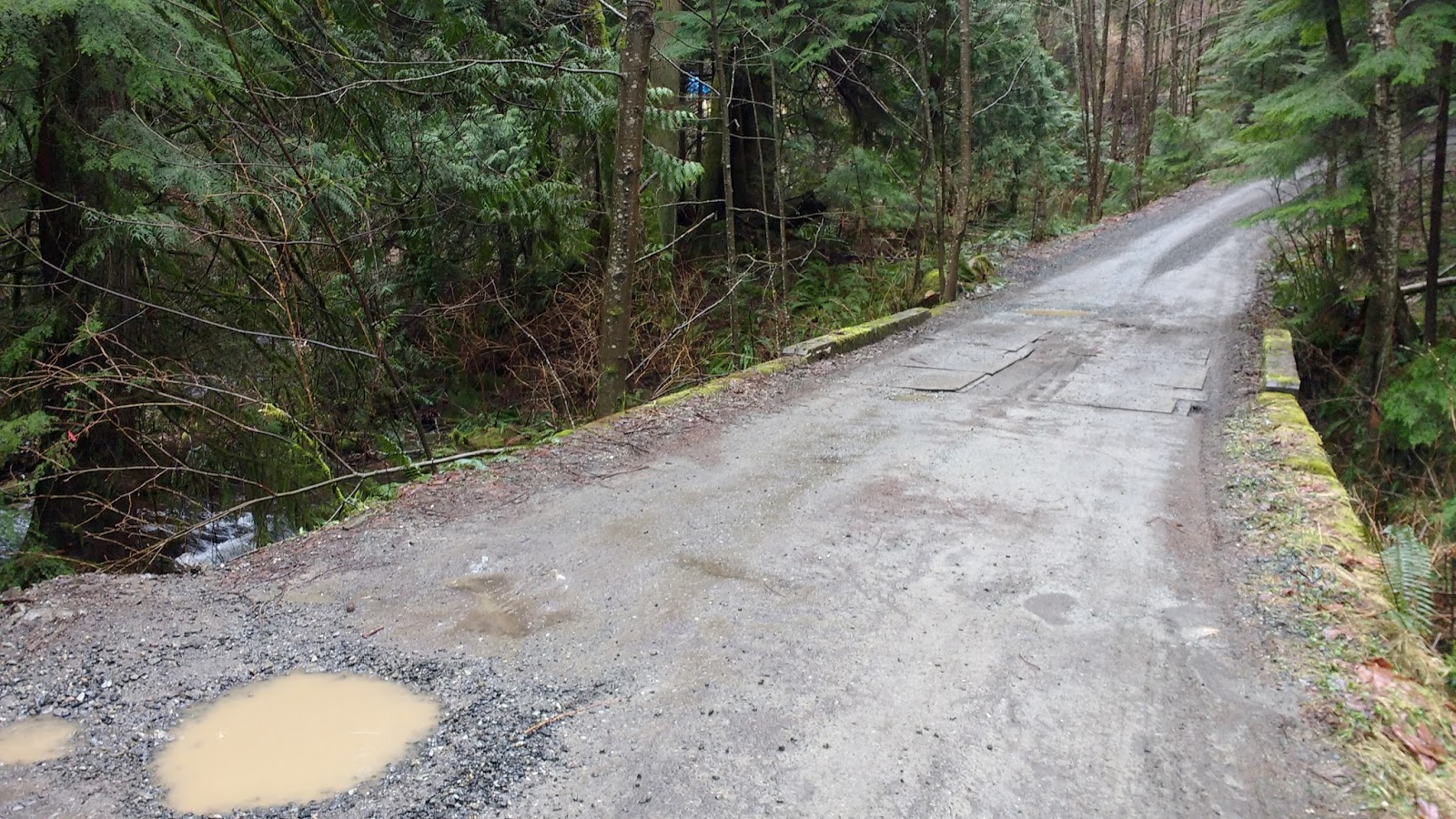
I crossed the bridge and enjoyed the view of the creek.

I also spied a rough trail through the brush, just after the bridge. It seemed like it might head up to a house, so I just made a mental note of it, and continued on Charlie's Lane.

I was quite surprised to first be passed by several cars (where were they headed?!?! I didn't think there was much up this way), then to see another road that was not on google maps. A street sign pointed right, to Dempsey Rd. It seemed like the wrong direction, so I continued on Charlie's Lane, to the left.


It started to rain lightly, and I managed to avoid being sucked into a giant puddle. I waved "hi" to Julian as I passed.
The road seemed to end at someone's house. They had a "beware of dog" sign. I slowly approached their driveway.

To my left, he ground dropped away, and I could see what looked like a trail cutting through the woods in the correct direction. Maybe THAT's where I was supposed to be? I wondered whether I could access it nearby, or whether I had to go back to the bridge and try that last trail I saw.

In the house's driveway, I could see a field off to the left. Maybe I could connect to the trail through there? I scanned the edges of the clearing, trying to tell. I could not, and didn't feel right tromping around through their yard, especially if they had a guard dog. (Did I mention my confidence had been shaken on my last walk?) I imagined something like this...


It seemed like MAYBE there was a way to cut through to the trail I had seen, near a barn-like structure on the far end of the field, but I chickened out and went back to the road.
To boost my confidence (nothing beats a nice clear level path to feel like you know where you're going), I walked up Dempsey Lane, just to see whether it turned back and perhaps passed by the house I had just seen. It did not. Up the hill around the bend was a single house, and that's all.


I headed back down to Charlie's Lane, and turned left to go back to the bridge and more closely check out the trail I had seen before.


I spotted an entrance off the side of the road. I headed in. A moderately established trail led to a tree with a ribbon, just before a very makeshift "foot bridge" over a side tributary of the creek.


Despite its appearances, the "bridge" was secure enough. On the other side of the "bridge," the trail I had seen before led uphill towards the house on the left, but from this proximity I could see that another trail headed out to the right, and seemed to follow Terminal Creek towards Grafton Lake. It was about the width of a logging road.


Although many trees appeared to have fallen over the trail, some had been chainsawed through, and more orange markers urged me onward.

I picked my way carefully, over and under fallen logs, pretty pleased that this seemed like the right trail at last. Every few metres, orange flag tape hung on branches. The property markers were off to the left of the trail. My GPS seemed to show that I was heading along the line shown on the Schedule E map. Everything seemed just about as it should be! It even stopped raining!

At one point, I saw an interesting cement tube... but it was empty. I supposed it was left over from some kind of construction long ago.


The ground got very very wet and muddy, but I was pleased to see footprints in the mud. Surely, I was on the correct path! I picked my way through the sopping ground, wishing I had worn my boots instead of my running shoes.


At one point, I tried to balance on the side of the trail, and step on crumbled cedar pieces that had fallen onto the trail, in an attempt to stay above the water level, but the wood simply turned to mush under my feet. I was just going to have to accept wet feet on this trip.

Up ahead I could see some kind of small building, and yellow flags beckoned me down a clear path to the building.

To my right, at that moment, I could see the clearing with the barn-like structure that I had visited earlier. It sure looked like there was a rough roadway or path that went through there at some point, but fallen logs, brush, and the creek tributaries made it look fairly impassable now.

I approached the small building. It was about the size of a shed. Walking around to the other side of the building, I read "Cove Bay Improvement District Chlorination Station" on the door.

And saw that a clear gravel road led off in a parallel route to the way I had come. D'OH!!! Was THAT the "path" I was supposed to be on the whole time?!?!?!


You might be surprised to learn that "Currently, though, there is no filtration for the Cove Bay System. [...] Municipal Councillor Cro Lucas, the liaison to the Bowen Island Infrastructure Committee, says that this system meets current standards, just. 'The system has been grandfathered, in terms of acceptability,' says Lucas." Without filtration, there are still suspended organics in the water, such as algae or decomposing plant matter (which is why many people's tap water looks more like urine in the summer months!), and furthermore, certain parasites are known to be chlorine-resistant. Plus, the use of chlorine creates some of its own problems, such as harmful cancer-causing chemical by-products like Trihalomethanes (THMs) and haloacetic acids (HAAs). You can read a detailed study of the water quality and standards here.
BIM identified the need for a new water treatment plant way back in 1997. However, it was just days ago (Mar 11, 2017) that their nearly $4 million grant application had been approved. According to Councillor Lucas, the new system "would cost each user $130 per year," and that is actually much cheaper than the bill most residents currently rack up in having their own private filtration system in their homes. My last UV-light and particle filter change, for example, cost $400, and is expected to last 6-12 months before it is replaced. Ouch.
Leaving the chlorine shack behind me, I continued onward on the gravel road in the direction I was already heading. Yes, on the clear gravel road. Sigh. I would definitely also stick to the gravel road on my way back through here, after I successfully circled Duncan's Hat.

Now, even though the road was clear, it was pretty potholed, and each of those giant potholes were filled with water. I stepped around them, happy to at least feel like I was at LAST on the correct trail...

But then: TWIST!!! The road split into three! I was totally confused. None of these were on the Schedule E map or google maps. I didn't know which way to go. The left-most fork hairpinned back and paralleled the road I was already on. The right-most fork appeared to go in the direction I wanted, towards Grafton Lake. The centre fork was more of a grassy footpath. It was also a potential contender to lead to Grafton Lake. I decided to check the grassy middle path out first, since it was the least established. I figured it might peter out quickly, and I was right: it led to what I can only say was a "dump" of old household stuff, including a claw-foot tub(!) and shower curtain, along with some oil barrels, an old trailer, and some garbage bags and random refuse. Some of it was not even recognizable.


I went back to the intersection. Deciding not to deal with the fork that led backwards in the direction I had come, I forged onward along the right-most path. However, it very soon split again!!


I walked a few feet up the right-hand fork, to see if a small tag on a tree had anything written on it. Whatever was once there was long worn off. Only a pink ribbon marker marked the trail.

Consulting my GPS multiple times, I decided not to follow this path, and kept going on the left-hand fork, where I was walking before.
It was still quite wet, and one section had flooded out. Someone had constructed a makeshift "bridge" out of logs on the right side of the trail. It didn't help that much.

Then the trail forked again!! But I could see the lake up ahead, and figured that the trail to my left was the one on the Schedule E map that led back to Grafton Rd. At this point, I was situated pretty much in the centre of the 158 hectare (390 acre) Grafton Lake (Rennison) Lands.

According to the report prepared by the Bowen Island Conservancy, the Rennison property includes "part of the major central valley of the island, with the lake and associated valley bottom, and slopes to the north and east to Crown land and Conical Hill (Duncan’s Hat), respectively. The topography also includes slopes of Mt Apodaca on the south side of the study area, connecting the development lands with the Bowen Island Ecological Reserve." Here's a map from that report.

To give some more context and perspective, here is a photo of the area taken from the Grafton Lake Project's Project Description. The lands are currently in the process of being rezoned and redeveloped, to include residential housing and commercial office space (36% of the land), as well as a large nature preserve (57% of the land), public orchards, and a connective public trail network. I was standing at the eastern "viewpoint" on the map below.


(click image to enlarge or visit www.graftonlake.ca/portfolio-items/grafton-rezoning-map/?portfolioID=1155)
I wanted to circle Conical Hill (the conical-shaped hill in the centre of far side of the lake), and the Schedule E map said there was a trail that went to the right here, along the shore of the lake (see screenshots below). I started looking around for a candidate.

(click image to enlarge or visit www.graftonlake.ca/portfolio-items/the-lands/?portfolioID=1155#prettyPhoto[galleryrelated]/0/)
I found a really rough trail heading off to the right, which quickly started to head uphill, over some fallen logs. At that point I was not so sure I was on the actual trail, but soon after, the trail became much more clear... and glorious!!

Suddenly I was skimming the edge of mossy cliffs, running high above the east end of the lake! The views were great-- I couldn't do them justice with my phone camera. I was pretty pleased. :)


According to the Conservancy report, "The lake is bordered by extensive wetlands, riparian zones surrounding small streams, and large tracts of young and mature conifer forest [eg. western hemlock, western redcedar and red alder, with the occasional Sitka spruce]. [...] There are few, if any, small lakes in Metro Vancouver that have an equal range and quality of wetlands: marsh, fen, and swamp are common." I could see a big swath of cattails and bull rushes on the eastern end of the lake. I kept my eye out for velvet-leaf blueberry, which is a plant so rare in this area that Grafton Lake is the only location it grows among all the Island Trusts Area.
My excitement over the lovely trail and beautiful views turned to anxiety, however, as the trail got rougher and rougher. I picked my way carefully up steep rocky inclines, holding on to the rock face, roots, and nearby trees. This was no simple stroll in the park!!

The path continued like this for most of the length of the East side of the lake. Then it started dropping down, and actually went all the way to water-level. At that point, I saw that someone had made a rope swing, and there was a single lonely sock, a spool of fishing line, and a nickel. I supposed that someone had used this as a swimming hole (the Conservancy report had mentioned a popular swimming hole on the South-east side of the lake. I wondered whether this was it). It seemed a long way to walk for a swim!


A little past the "swimming hole," the path was flat and easy. I passed another pile of refuse... this time, seemingly piled in a firepit and partially burned. What a strange place for a fire! There was no "clearing" to speak of, and not much of a view there either.

My GPS showed me that I had finally cleared Conical Hill on my right, and I started looking for the fork that would take me to the Mid-Island Trail.

I arrived at a familiar-looking junction. I recognized it from my hike along the Mid-Island Trail! On that trip, I had come down the fork on the right, and headed out on the fork on my left. I was pleased to have now walked all three forks. I turned right, and noted a little hand-made sign reading "Cross-Island Trail."


Feeling confident now, totally recognizing the path, I headed up the rough hill. This was a fairly steep section, but at least it was easy to stay on my feet.

I checked off familiar spots on my mental list of landmarks. The fork in the path, which rejoined again shortly after; the flooded section of trail, with the detour path around the left side; the flat easy section, leading to the rocky downhill that doubled as a creek bed. Check check check.


I remembered where the trail diverged from the creekbed, off to the left, and looked for the handmade sign on the tree, which was still there. I also remembered that I could have stayed in the creekbed if I wanted, because the trail would rejoin it again later anyway.


I remembered the huge mossy maple, and looked for the creek crossing. I had gotten confused at that crossing on my first time through here, while walking in the opposite direction, because there was actually a fork in the trail at the creek; but in this direction, it was easy to step over the creek and continue straight onward.


The downed hemlocks and alders were still there, blocking the path. It is impossible to see where the trail continues through these trees, but I learned from experience: go lengthwise (parallel to the trunks) through the hemlocks, then crosswise (perpendicular to the trunks) through the alders. The trail will reappear.


I was feeling pretty confident, and thought I knew where I needed to turn, to complete my planned loop. I remembered that there was a sign for "Duncan's Hat," which was another name for Conical Hill. I figured that would take me around back to the gravel road near the Chlorination shack. (Spoiler: turn out, that is NOT the way to get back there!!)
As the trail curved, I could see a little cabin off to my left. I knew the "Duncan's Hat" sign would be on my right. (Sorry for the potato quality of the below pano.) Behind the sign, pink and blue ribbons marked the "trail," such as it was. I double checked my GPS, and it seemed like the right place.


I thought it would soon angle left and run through that dark ridge on the map above, taking me to the valley on the opposite side of the hill. (SPOILER: I was wrong.)
The trail was really rough and fairly hard to see. Thank goodness for the ribbons! Several times I stopped in my tracks, scanning and praying for another ribbon, because I could not have found the trail without them.


Then the trail headed uphill. Steeply uphill. In the photo below, I am crawling on my hands and knees up the incline. Again, I was hanging on to rocks and roots and whatever I could find, hailing myself up with my handholds. I started to worry: what if this trail DIDN'T connect to the other side? I was nervous about crawling back DOWN this incline.

Things didn't get any better, as I climbed higher and higher. Soon, I was scrambling over wet mossy crags. (I didn't find out until later that I had missed the real trail in this section, because of a hidden flag. I moved the flag on the way down to make it more visible.)

I was following the flags, but I kept going up and up and up. I started to get scared. Shouldn't I be going AROUND the hill? It really seemed like I was going OVER. It was a much less fun version of my Camino game "over or around?"

Just when I thought my anxiety couldn't get any higher, I arrived at a field of salal, about 50m across and about chest-high. I could see a blue flag on the far side of the salal, posted to a tree. This was the path... although I couldn't actually SEE any path... I forged in, worried about ticks, about my nearly-invisible footing, and about losing sight of that blue marker. Even writing about it now, I feel the anxiety again.

About half way through the field, I looked back: there was no marker on that side!! If I DID have to come back through here (heaven forbid!), how would I know where the path was?!?! I spent a moment trying to memorize the trees where I had entered the salal, just in case. (spoiler: it was a smart move, as I did end up coming back through there, and I attached a tiny piece of pink flag onto a tree there on my way out. I wished I had more ribbon, but I had to make do with a piece that I had found on the ground.)
After the salal, the ribbons led me uphill yet again... At this point, I started to worry that the path WOULDN'T go over, and that I wouldn't have time before dusk to go all the way back and THEN around...

Then I arrived at a wall of cliff. A blue ribbon told me to go up and over. I stood there, paralyzed. I worried about slipping on the wet mossy barely-there footholds. But I was scared to go back as well. Finally, I worked up my nerve, grabbed some hand holds and pulled myself up, praying that I wouldn't have to come back this way.

After a couple more switchbacks, I arrived at a clearing. It was actually pretty nice, and it crossed my mind that it would make a nice camp spot. But more importantly: I was at the summit!! I checked my GPS... Yep. Summit. Very tippy top!


Looking around, I recognized Mt Gardner by the antenna towers at its summit. I tried to appreciate the views, but I was already ready to cry... even before it started to pour.... >.<


After texting Colin my victory, I then texted him my worry... I couldn't find the continuation of the trail over the top of the hill, meaning I would have to go back the steep slippery way I had come, only now in the pouring rain... and mounting dusk...
Just when I thought all hope was lost, and the tears were mixing with the rain on my cheeks, I saw some blue ribbon flags at the far end of the clearing. I followed them to a beautiful view of Grafton Lake. However, they ended in a mess of ribbons piled under a rock.


I wandered around the summit aimlessly, hoping for a trail down, but seeing only sheer drops on all sides. Having made a full circle back to where I started, I sighed and started down the way I had come up.

I didn't take many photos on the way back, partly because of the tears, and partly because I was mostly crawling down on all fours like a crab. I slipped and fell four times. (totally didn't pull of the graceful parkour)


I messaged Colin about how wet and dirty I was by the time I hit the bottom, and of course he joked about the double entendre. It lightened the mood.
At least I felt safe back on the Mid-Island Trail. Due to its width and even grade, I am fairly certain that most of it (and certainly this portion) was the remains of an old logging road. It was easy to walk on and I knew exactly where it went, meaning that if necessary, I could get through all the way to Carter Rd, even in the dark. I considered forgetting about "circling" Duncan's Hat, and just walking back along the MIT.
However, by the time I got to the junction with the "No Motorized Vehicles" sign, I was feeling better. The dusk was not growing as quickly as I had expected, and I was really curious as to where that right fork led. It seemed like it might lead back around to the other side of the hill. Although I had chickened out exploring it the last time I did the Mid-Island Trail, this time, I decided to go for it.


Yes! That's the one! It was fast and flat, and led directly back to the trail junction with the worn-off tag and the pink ribbon. A couple metres farther, to the left, was the major trail junction near the chlorine shack. I took the left-hand fork back past the chlorine shack.


This time I stayed on the gravel road. I noticed a couple of shacks up on the hill above the road, but they did not look inhabited. Maybe they were part of the chlorination works yard?

A little farther I passed a green house, then an open gate. I kept following the gravel road past the gate, and walked through a surprisingly densely populated area that I didn't even know existed. This road was not on google maps.


After the grouping of houses, the gravel road wound through the forest, then dumped out onto Grafton Rd! It turns out that this was Connolly Rd!! Obviously, the road continued beyond what was on google maps.


My cell phone battery was almost dead by that time, but I knew where I was, and could take Grafton Rd back to the Cove. Having finally located several trails I had been looking for (and a bonus trail, to the summit of Duncan's Hat), I felt accomplished while heading home from my walk, but I would definitely need another cry and a big nap once I got home.

