
This morning, our host Alban delivers the bad news: he will not be able to drop us at the train station in Lyon tomorrow morning on his way to work. His schedule has been changed, so that he will no longer be driving in that direction.
Alban has a very interesting job for a company named Acrobart, based in Lyon, which specializes in "works in hard-to-reach-places." This means on any given day, Alban could be dangling from a highrise or bridge, scaling a church steeple, or crawling in a subterranean tunnel anywhere in the region. Unfortunately for us, this means that he doesn't often know which job he will be called to do--and therefore which city he will be working in--until the last minute.
Since the Chamelet train station is not much more than a sign beside the tracks, we will now have to spend this morning driving to Villefranche-sur-Saone to buy train tickets for tomorrow morning. This puts a serious cramp in our hiking plans for the day. We wrack our brains, trying to figure out a way to get out of driving to Villefranche.
We know that the train through Chamelet passes through Les Ponts Tarrets in Légny, a town with a population of 650, about 14km to the south of our gite along Highway D385. We had hiked through there recently, and saw they have more amenities there than in many other towns of the region. Colin wants to buy a few souvenirs for his family and workmates before we leave, and I mention that Alban said Les Ponts Tarrets has a store with a good selection of "Produits du Terroir." I reason that we could hit the Oedoria in Létra on the way, and perhaps between the two stores, he could find enough souvenirs to suit his needs. Then, we could also feel like the trip served more than one purpose.
Our stop at the Oedoria provides some success, as we pick up a few jars of regional specialties. Feeling optimistic, we park in downtown Pont Tarrets and walk over to the Info Centre next to the train station. It is closed. We try the Produits du Terroir store: it is closed. We see a hotel in a mini-mall on the other side of the tracks, and we reason that hotel guests would often need train tickets... surely, the hotel would at worst know how we could buy tickets, and at best, actually do it for us! The desk clerk is very helpful in telling us we will have to drive to Villefranche to buy train tickets there. The irony is not lost on us.

Twenty-five minutes later along Highway D338, we arrive in Villefranche, and park next to the train station. Even though it's only a few dozen metres between the train station and the yellow randonnée signpost titled Le Bourg, I snap a photo to feel like I did some hiking.

After we use the self-serve machines at the train station to buy our tickets, I suggest stopping at the grocery store across the street for croissants. While we stand in line waiting to pay, a woman chases her three shoplifting children around the store, screaming at them while they laugh uproariously. After leaving the store, we can still hear her yelling about a block away. This day is certainly not turning out the way we had hoped.
After all these shenanigans, Colin estimates we have about 45 minutes to hike, before he needs to be back at work for his skype "meeting time." I notice we are near an area of the map I had always wanted to hike. It would be more or less on the way home, and the landscape is dotted with castles, churches, and other points of interest. I suggest a loop between Jarnioux Le Bourg and Pouilly Le Monial: just under 4km. Colin thinks it will take too long.
I try again: what about Ville-sur-Jarnioux to La Pénière? It would be just under 3km, and still pass a Lavoir (pilgrim bath), a church, a few pilgrim crosses, a Madonna, and whatever a "chirat" is... as it winds its way through Collognes and Saint-Roch. One bonus of this route is that it can be shortened or lengthened as time permits.

The name Ville-sur-Jarnioux is not, as you might think, indicating a "town" (ville) but rather a Roman "estate" (villa) that pre-dates the existing town. The town has existed here from at least 889 CE. Today, it hosts an impressive population of 800 people.
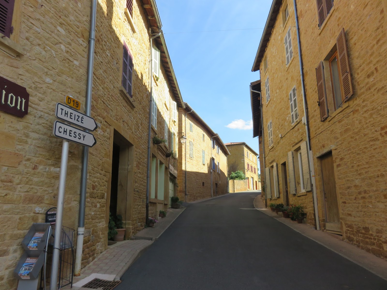
We park the camionnette in the parking lot, indicated by a big blue "P" on the randonnée map, and walk over to the yellow randonnée signpost bearing the same name. Beside it, there is a copy of the randonnée map of the area. The signpost arrows point to Oingt (4.8km) and Theizé (4.6km), where we have had really enjoyable hikes in the past, but today our first stop is Le Croix Chervet, just past the Southern end of town.

We walk South along Highway D19. Soon we see a city sign with the name Jarnioux crossed off, indicating the town limits. Red and yellow randonnée flags adorn the lamp poles. We pass a stone cross on the right side of the road just before Chemin Laval, and assume it is Le Croix Chervet, but then we notice that the painted randonnée flag on the back of the street sign indicates this is the "wrong way."


We turn around and backtrack one block to Montée Chez Les Bois, where we spy the yellow randonnée signpost for Croix Chevret. Here, the arrows for Oingt and Theizé are broken off... I take it as foreshadowing that these wonderful hikes will no longer be available to us after tomorrow.

Our next stop is Collognes, and the randonnée map shows we can take either Montée Chez Les Bois or Chemin du Tacot to arc around the town. I prefer Chemin du Tacot, partly because we already walked a different section of it previously, and partly because it's the route highlighted on the randonnée map. As I mentioned in a previous post, the Voie du Tacot is a 24km trail that runs along the old Beaujolais railway line from Liergues to Sarcey. In Jarnioux, the Tacot trail is well marked with signs either showing its name, or arrows painted with cute little green trains.


We cross Highway D19 again, as it swings around the perimeter of the town. Already, we see another crossed out "Jarnioux" city sign, indicating we've already reached the Western limits of the town. We follow the Chemin du Tacot signs and arrive at what appears to be a little train station.


The building is all boarded up, and the only signage we can find is a plaque reading "H. Cornaz & C -- 1900," which is apparently the name of the company that was contracted to construct the "innovative" concrete train stations along this line. Thanks to The Google on The internets, I learn that the Beaujolais Railway was built in 1898 between Villefranche and Tarare. The trains stopped running through this area in 1934, but the tracks are still visible running along the top edge of the orchards and vineyards.

Much of this area is covered in vineyards. As I mentioned in my post about Oingt, the vines in this region are primarily the Gamay grape, which produce the famous Beaujolais style of wine. However, the Chardonnay grape is also grown here, to produce the popular white wine of the same name. As the road curves, we get a nice view of the town behind us. We do not find the Lavoir, and assume it must be on the D19 Highway that runs parallel to the Chemin du Tacot.

Chemin du Tacot completes its half-circle around the town and intersects with Montée de la Madone, which runs North-South. At the corner is the Collognes randonnée signpost. Looking up the hill to our left, we see Saint-Roch.

The 16th Century Chapel of Saint-Roch faces a cross mounted on a cairn. Directly in front of the chapel stands a pure white crowned Madonna.


On the ridge behind the chapel, I can see another stone cross. Concerned about time, we turn back towards Jarnioux and follow Montée de la Madone pass the Collognes randonnée signpost once again.


We pass more orchards. The apples are beginning to ripen, and I see the same type of mystery fruit tree growing here that I discovered on Le Cocon. I still don't know what type of tree it is.


We cross Highway D116 and the road changes its name to Rue de la Mairie. We follow it through the town to the Church of Saint-Martin. The golden stones of the houses glint in the sunlight, and well-tended flowers spill out over low walls and into the roadway.


Church of Saint-Martin is surprisingly large, for the size of the town. A little girl stands in the street, blowing bubbles. We circle the church completely, noting its fountain and lovely stained glass windows. Construction of the church as we see it today began in the 12th Century, on the site of an earlier Roman Benedictine Oratory.


We take the Rue de la Mairie to the Highway D19. At the corner, I spot a store called Caverne des Merveilles. I love the name! We don't have time to investigate the contents of the store, which I am sure can only be something exciting from Through the Looking Glass or perhaps The Emerald City... or Omaha Nebraska...? (Later discovering it is actually a shop of semi-precious stones and jewellery, Colin is happy to have dodged a bullet: if I had known, I would have dragged him in, spending many minutes and dollars filling my pockets with rocks.)

One small stretch of golden houses separate us from the parking lot where we began. The buildings here are an exceptional example of the Pierre Dorée style. While every village in this region used to quarry its own golden stones, today only Ville-sur-Jarnioux, Jarnioux, and Marcy still have active quarries.

Between the railroad trail, the vineyards, the pilgrim crosses, and the houses' perfectly golden stones, this village hike could not be more representative of the Pierres Dorées region. In combination with our frustrating pre-hike experiences -- with the many unexplained closures and ridiculous procedures -- today was really quite representative of our entire séjourn in this region. ;)
Back at the gite, I whip up some pasta using up the last of the green peppers and mushrooms. Colin starts his meetings and I decide on the perfect last hike: I have it... but you'll have to wait to find out which one I picked! ;) Stay tuned...
No comments:
Post a Comment