
As I mentioned in my last post, I had hurt my foot falling down Duncan's Hat a couple of weeks prior.
Well, my foot was still hurting, but the sun was finally out and I was desperate to walk in non-rainy weather. There had been only 17 hours of direct sunlight in Vancouver in March 2017.
I decided to explore the trails forming a cross within the Cape Rd "circle" (I call it a circle... is it more of a square? a wavy trapezoid?) Parking on Roger Curtis Rd, I planned out a figure-8 loop through Whitesails Trail and Roger Curtis Trail, with side trips down Waterfall Trail and Ocean Rocks Trail.
Well, my surprise discovery of the Bluff Trail made me elongate my figure 8 a little, but in the end it was a great hike of about 7.5 km, with minimal elevation change through the centre, and about 100m drops to the coast on each of Waterfall Trail and Ocean Rocks Trail -- which is still significant, considering that elevation change is over maybe 500m of distance. The best map on this area is at bowentrails.ca, so below I used a screenshot of their map to show my route.

(click map to enlarge)
I parked on Roger Curtis Lane. As I mentioned on my previous visit to the area, when I walked along the shoreline on Cape Roger Curtis Trail, there was a well-appointed porta-potty and a garbage can conveniently located at the end of the parking lot.

Someone had added googly eyes to the garbage can, which gave me a giggle. There were lots of song birds tweeting, as I set out. It was all very idyllic.

I walked up the slight incline of Roger Curtis Lane. The road was really only one car-width wide, but paved and even. The gullies on both sides of the road were filled with run-off water, making its way down to the sea.

Upon reaching the intersection with Cape Dr, I took a right, and could see the stairs of the trail at a close distance. Even though the Rotary's bowentrails.ca map said that I should be at Roger Curtis Trail, the posted sign read Whilesails Trail.


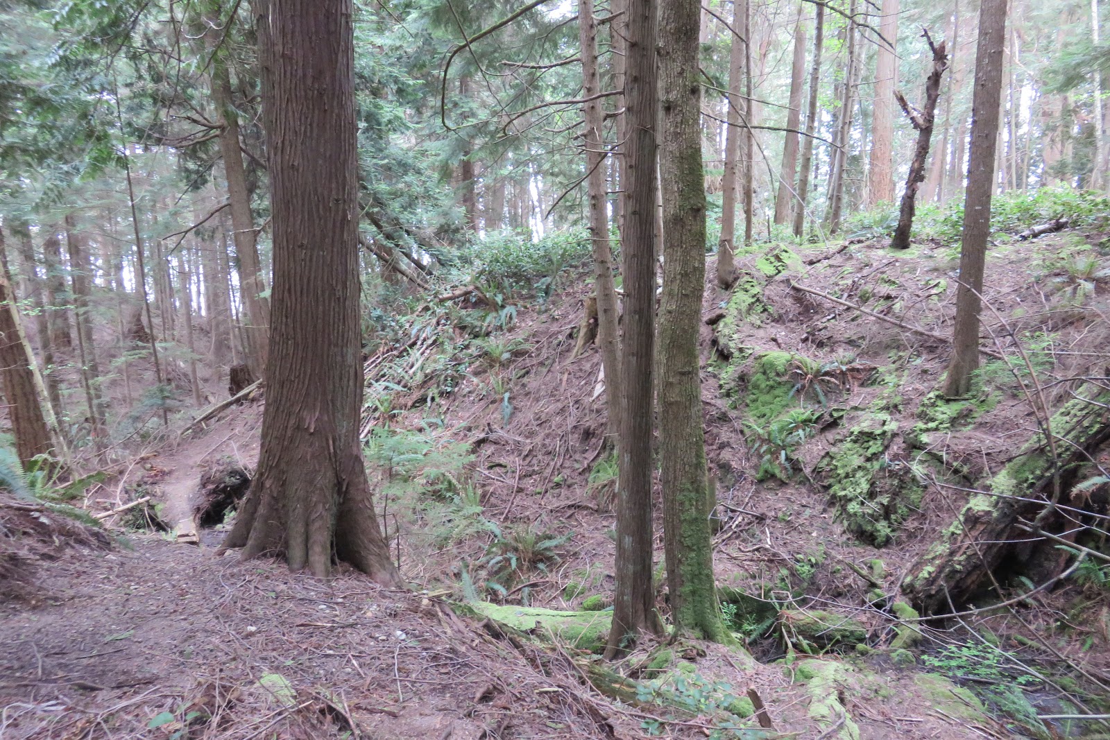
I hopped over a ditch filled with water, and started up the grassy incline towards the stairs. Just past the top of the stairs, the trail continued up and over mossy rock face. With all the rock and moss, I imagined that this trail could be very slippery and treacherous when wet. My memory wandered to my trip up (and--more importantly--down!) Duncan's Hat, but of course this was nowhere as steep as that.


Standing on the second set of stairs, looking ahead, I wasn't sure where the trail led next. I could see a sign in a clearing nearby, so I went over to check it out. It was an ad for The Cape on Bowen, a real estate development. According to the map on the sign, I was standing on Lot 47 (see light blue property, below).


Many of the properties in Phase 1 (dark green) had been sold already, although only a handful of houses had been built [UPDATE: at the time of publication, there were only two Phase 1 Lots remaining unsold]. At millions a pop, these 10-acre lots were subject to a lot of controversy over the last few years. I had recently heard that the developer was having trouble selling the lots in Phase 2 (blue and maroon), and there were rumours that he would try to sell these off as a package to another developer. However, I was intrigued to see the light green roads marked out on the map, and even more so, the trail I was following (running beside Lot 47) appeared to be left as a public thorough-fare, instead of an "easement" over one of the (privately-owned) lots.
I located the trail at the top of the second set of stairs, and continued onward. What was really weird was: the trail was only apparent when I was standing on it-- even then, only up close. I could only see about 20 ft of trail in front of me or behind me. Past that in either direction, it was as if it simply disappeared. Some kind of magic seemed at work here!

Next, the trail went into the trees, and rolled gently up and down through the landscape. In a couple spots, the trail had flooded into a large puddle. They were easy enough to get around.


In this section there were quite a few slugs. Most were Ariolimax columbianus, more commonly known as the Pacific Banana Slug: the second-largest slug in the world. (I know you're curious: the biggest is Limus Maximus -- ARE YOU NOT ENTERTAINED?!?!?!)
The banana slug is a native species, whose markings can resemble a ripening banana. I was surprised at the number of different patterns I saw on the different slugs. I wished I had taken more photos. There were also a couple Arion Ater or Black Slugs. These slugs have been introduced from Europe, and often out-compete the Banana Slug on Bowen Island.


The trail was pretty easy to follow through the woods, as there were bright pink ribbon flags at regular intervals. I passed this ancient tree stump, whose springboard slots peered at me like eyes of a suspicious elephant. In BC, some of our old-growth forests included Douglas Firs and Cedars up to 1000 years old. Today, due to widespread logging over the past century, only one or two of these giants remain intact on Bowen Island.

I used my GPS to check: the trail to the right went south. That's definitely not what I wanted.

The trail to the left seemed to actually go vaguely east... but a few steps down it, the trail seemed to split into three (see photo below): the trail on the right of the tree below definitely headed east! Yes! The trail to the left appeared to be headed north. And there was a third trail, behind the tree, also heading north.

The two left two trails had pink flags, but the far left trail was the most "official" looking -- it was wide and flat -- but it didn't appear to have any flags... until I walked down it a few metres... then I saw a pink flag, hidden behind a tree on the left side of the trail. Great placement. :p
Back at the intersection, I walked down the middle fork. It was narrow and rough, and rejoined the left-most trail soon after. Why someone would want to take a rough steep trail instead of the short easy flat one, I don't know. Anyway, back again at the same intersection, I finally chose the right hand fork to continue "straight through" the Cape Dr circle. It rose quickly up the hill, to a clearing.

The trail was narrow, steep, and rough, with loose earth and small rocks, plus thin layer of dirt and moss on boulders. I was not sure my foot was going to like this. :P A raven cackled from somewhere in the trees..
Just before the clearing, a tree was down. It looked like someone had come and cleared the two trees who became uprooted, then the other tree cracked right off and fell on top. Fortunately, it was easy enough to step over it.


Unfortunately, my camera chose that moment to die. I had thought it was fully charged, but I guess that it wasn't. I switched to my phone for photos.

Once in the clearing, I could tell that the path cut straight across, and re-entered the woods on the other side. But I was really curious about what was up the ridge to my left. It seemed like an even bigger clearing, and there was a flat gravel area. I assumed this is the Lot's proposed housing site.

Looking down the other side of the hill from where I'd come, I could see a road! That was really confusing, because I was pretty sure that I was in the middle of the Cape Rd Circle... There should not be any paved roads there, right?? I got on google maps and realized that there was an unnamed road that led into the middle of the "circle" after all! That must be what I was seeing.

I made my way back to the trail I had originally been on, to continue onward through the clearing. And re-injured my foot on the downhill back to trail! >.<
As I entered into the woods, I realized that the trail practically joined up with the site's "driveway" a little later. Omg, I could have just walked on the flat gravel to/from the house site. Instead, I re-injured my foot, scrambling up and down the rough slope. Raven cackled some more.


I exited the trail onto Cape Rd. Here's photo looking back at the trail entrance from the road, in case you want to go in that direction. The sign says Roger Curtis Trail, which matched the bowentrails.ca map. I'm guessing that the first sign I encountered, reading Whitesails Trail, was in error. According to the map, Whitesails Trail should run perpendicular to this one. I guess I would find out soon enough, as I planned to walk a stretch on the road, and cross the same area on that other trail.

According to the Schedule E map, if I simply crossed Cape Rd and continued straight, the trail would take me right in to Fairy Fen and Crownlandia. The bowentrails.ca showed that trail joining Cape Dr a little farther south. Sounded like it would need further investigation. ;) I definitely saw the other end of that trail on my previous hikes through Crownlandia. I'd have to save that trip for another day.
So instead, I turned left (north) onto Cape Rd with the plan to walk on the road around the "corner" then get back on the trail. On the right side of the road was another flat area: perhaps it too would become a house in the future. On the left side of the road was a big flat open area. I wondered what this area would look like, once it was all developed. It seemed like a shame to lose this big chunk of "wilderness."

Turning the "corner," ravens flew overhead and cackled. Then a mature bald eagle. I swung my camera upward, but didn't manage to get a clear shot.

Once I turned the corner, the road started heading downhill. I saw what looked like a trail or logging road running parallel to road. I wondered whether it ran the length of this side of the road, in other words: could I have been walking on THAT instead of the road?? But I hadn't noticed an entrance to it, as I first rounded the bend. I tried to trace it with my eyes, watching for where it might exit onto the road on the other end.

At one point, it seemed like the trail went past a couple of small shacks. I couldn't tell what they were from the road side. I thought maybe water stations or power stations. I could see a sign facing the other direction, away from the road, but didn't trust my sore foot on the steep incline to get down there and look. So I stayed on the road.

Just before DeeCee Rd, a sign announced the entrance to Whitesails Trail.


To my surprise and delight, just past a pair of ribboned trees lay the trail I had been following with my eyes as I walked on the road! I decided my foot could handle exploring this trail, just to see what those shacks were. I turned left and headed up to the shacks. The path continued past the small clearing where the shacks were located.


Boy was I in for a surprise. Once I got close to the shacks, I could finally read the sign I had seen from the back. "No trespassing: Explosives!" Oh my goodness!! Good thing I didn't trespass from the road to read the sign!! It was unclear whether the sign referred to just the clearing where the shacks were located or the whole trail I was on. I guessed just the shacks, but just to be safe, turned around and retraced my steps back the way I had come.

Back at the junction with Whitesails Trail, I decided to follow this mystery trail all the way back to the road, just to see how far it went. It turns out, not very far! The other end exited to Cape Rd basically at DeeCee Rd. Once again, I retraced my steps back to the junction with Whitesails Trail.


The intersection was marked with another pair of pink-ribboned trees. I headed in to the forest, musing how the shacks with the explosives were probably a result of the development in the area. They would have to blast some of the rock in order to make those perfectly flat housing sites, not to mention some of the access roads to said sites.

Ducking under a fallen tree, I arrived at a set of wooden stairs. At the bottom of the stairs, a little bridge led over a small creek. At the top of the stairs, I stumbled upon this interesting looking bone. I assume it is from a deer. I had encountered a couple of deer carcasses on the island already.


Farther up on the trail was another pair of staircases, leading up and over a small hill.

I paused for a rest next to a fallen tree's giant rootball. I couldn't help but remember a story from The Golden Spruce, a book I had managed to read one year on the BC Ferries, one chapter per trip, as I travelled to Vancouver Island and back. The tale in question was about some loggers who had felled a huge old-growth tree, then rested against its rootball to eat their lunches. The tree spontaneously righted itself and crushed the loggers to death. That story haunts me every time I see a huge rootball on a fallen tree. Which, on Bowen, is fairly often. >.<

Anther, much smaller tree had fallen on the last section of trail before the road. With some effort, I navitgated around it. The driveway to my right led up to a house under construction. There were plastic pipes strewn about on it. Up ahead, two more driveways branched off. One read "Lot 44."


The trail continued through a small gap in the trees, between the two next driveways. You can see the gap in the photo below, up ahead and just to the left of the pavement I was standing on.


Walking through the gap, I was quite surprised to recognize the clearing ahead of me: it was the house site I had climbed up to earlier, from the other trail! In this direction, the house site was up to my left, and the trail circled around to the right, past a stump and into the trees.

At the treeline, it seemed like the trail forked, with the left fork heading up towards the housing sige, but a blue flag marked the right way into the woods, and the trail curved right. That was also little confusing, because the trail seemed to lead back towards the road. But it turned out to be correct.


I recognized the little section where the rough steep trail and the big smooth unmarked trail split then rejoined shortly after. Soon I was back at the centre junction of the "Cape Rd Circle."


Staying on the correct trail to just head "straight through" was much less complicated, heading in this direction. The trail simply led straight onward.


I crossed the road and stopped to take a selfie with another giant rootball and decide what to do, when a woman and her dog came walking down the cement towards me. I noticed her just as I was pressing the "capture" on my camera for my selfie.

The lady was kind enough to point out the continuation of the trail. It was directly across the cement "driveway" from where I came out, past the big rootball where I was standing, and up the grassy hill to the right of another, grassy driveway. Here's a shot from the exit of the trail and the view across to the grassy/mossy hill. The trail actually is fairly straight through, it's just hard to see.

How prophetic her warning would come to be!! I came back through that part of the trail with Kitty and Gary maybe 6 weeks later, and was shocked to see that the big tree stump had righted itself!! Shades of the Golden Spruce!!!!! :O

So I followed the trail past the rootball and went up and over the mossy hill. I could imagine how slippery this would be in wet weather. In the dry sunshine, it was ok.


After a steep downhill on rocky soil, and a short wooden staircase, I exited onto Cape Rd at the intersection with Huszar Creek Rd. If that name rings a bell, it should: it's the same name as the creek near Fairy Fen. It is, in fact, the same creek, now emptying into the sea.

The entrance to the Waterfall Trail was just to the left of the intersection (about 100m away), but it was practically unmarked at this juncture. There was a 4x4 post at the trailhead, and no signage. However, my GPS told me I was indeed at the right spot, according to the PDF map at bowentrails.ca.

The trail went in along what seemed like a logging road, but was probably a driveway access. A stream of water shone an unnatural orange. Most likely, this was the result of the presence of some iron-oxidating bacteria, and nothing toxic.

The salal were in bloom. These were the first salal blossoms I had seen that year. Bowen Island is absolutely covered in salal brush. Its leaves and berries have been traditionally used by the Coast Salish First Nations peoples for thousands of years. The berries were used fresh, or dried into cakes for the winter, when they were added to soups and stews. The leaves were dried and used in astringent and immune-boosting medicinal teas, or mashed into a poultice to treat insect bites. In modern times, most people are likely to recognize salal leaves as a "filler" in their floral arrangement, although some still do make jams from the berries, or, like me, eat the berries straight off the bush. ;)

The trail was well-marked with ribbons. There was a surprising variety of terrain in this stretch. It led through to a paved road, which again surprised me, because it was not on the map. Some of the roads in this area were just too new for google to keep up. I guessed it might have been more of Huszar Rd, extended to service the new development's lots.


Perhaps the strangest sight was the Waterfall Trail sign, placed off to the side of the road, beside a guardrail. Who would think to start their hike HERE? (Where-ever "here" was!) I crossed the road and continued on the trail.


The trail was rough and steep, and meandered through a lot of fallen trees, but was fairly well-marked with ribbons. It seemed to me that whoever cleared the trees for this trail just felled them and then pushed them to the side. Many were criss-crossed over the creek itself. I felt like it could have been done with a little more care... but perhaps this was just the first stage of the trail, and the developers were planning on returning to clean the area up and polish the trail's appearance.


At one point we got a nice view of the "waterfall." The creek basically ran beside the trail, but for the most part we could not get an unobstructed view of it.

As the trail approached the ocean's shore, a guard rail kept me from sliding off the trail into the adjacent creek.

At the shore, the trail was pretty precarious. I chose my steps slowly and carefully. But once on the rock bluffs, my feet were steadier and the views were definitely worth it!


I spied Vancouver peeking out around one corner, and the University of British Columbia was more or less straight ahead. Tankers floated in English Bay.


I could hear Huszar Creek splashing its way down the cliffs to my left, but didn't want to scramble over the bluffs to see if I could see it. Instead, I headed back along the trail, and made my way over through a small clearing to the top of the waterfall. To my surprise, there was a small beach tucked away into the cliffs, at the base of the waterfall. Alas, even from the top of the falls, I could not get a clear view of them. I retraced my steps back to Cape Dr.

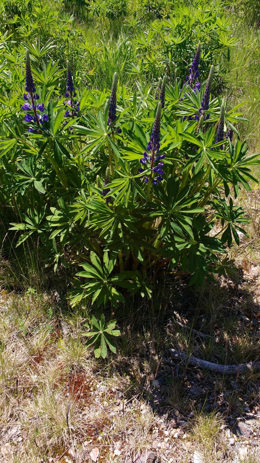
Walking along Cape Dr, I passed the intersection with Huszar Rd, and went another 200m or so until I saw the sign for Ocean Rocks Trail. On this first day I passed this field, it was bare, but the second time, when I went back with my friends Kitty and Gary about 6 weeks later, it was filled wall-to-wall with gorgeous indigo lupins in full bloom.


Unfortunately, a tree had fallen over the start of the trail, and I had to do some fancy bushwacking. It was at this point that I realized that my cell phone was almost out of battery. My power bank was not working, for some reason. I was annoyed, and started conserving lasers. (BTW, when I went back 6 weeks later, that tree was still blocking the path.)

The trail went uphill to the top of the ridge that I could initially see from the road. From there, I realized that I probably could have walked through the meadow and up the little bluff instead of bushwacking through the fallen tree on the official trail.

Then the trail plunged downhill. It was VERY steep with lots to switchbacks. I started to think that this wasn't so smart, with my sore foot, but I kept on going, trying to keep every footstep moving precisely up and down like pressing on a gas pedal, and trying to avoid any possible side-to side or rolling action.

The trail came out at another cleared housing site. On the ocean side of it were some rock bluffs and some more great views! Actually, I found the views of the rock bluffs even more spectacular here than the views over the ocean. I wondered whether this trail would still exist, once the house was placed on this lot.


Looking back towards where the trail met the flat housing site, I noticed that there were a few more ribbons off to the left. It seemed like the trail continued along the coast.
I didn't fancy going back up that steep trail, nor more bushwhacking back at the trailhead, so I decided to try the trail along the coast.

It was a pretty rough trail, but wow it had amazing views. I was so annoyed that both my camera and my cell phone had died. I try to coax my cell phone camera into "just one more photo..." and managed to capture this one. Oh yeah, that's the trail, running along the top of the cliff. It was nerve-wracking.


(click screenshot to enlarge, or visit the most up-to-date version at www.thecapeonbowen.ca)
I was excited, thinking that if I made it through, I would have completed the entire bluff trail along the coast of the Cape. However, it was not to be. A HUGE tree had fallen over the path, and it dangled precariously over the edge of the cliff and the rocky shore far below. I considered trying to scramble over it, but it seemed ready to slip and plunge into the crags, taking me with it! So instead I bushwacked up to Lot 18, next to the White House.
As I walked up the driveway of Lot 18, a contractor working on the white house glanced at me in surprise, and kindly directed me to the road. I came out at Prospect Lane and Lighthouse Dr, and turned left onto Cape Dr.
About 1km later, I made the turn onto Cape Roger Curtis Rd. Just before the turn I saw a single work glove in the middle of the road. Then maybe 25m later, its mate. One of the contractors must have left them on the roof of their truck.
Walking down Cape Roger Curtis Rd, a Police truck passed me. I stepped off the road so he could get by on the slim paved lane. He waved cheerily. Just as I was getting close to the parking lot, he passed me again, while heading in the opposite direction. I waved at him again and we both laughed. He was just checking on the parking lot, I guessed.
On the way home, I tried to stop at the Irly, but it had JUST closed. Then I tried to stop at the Ruddy. Since salal had been on my mind, I would have liked to pick up some BC-made salal-soap, but a car stole the last parking spot, right in front of me, so I took it as a sign and went home.
Just as I was walking up my walkway, something hit the back of my neck: it had started to rain. I smiled and tucked myself inside.
No comments:
Post a Comment