
Today we map out a walk back in the region of Sainte Paule (see top left area of map below). We decide to park in Oingt (go ahead… make
your best guess on how to say Oingt, then check here). After walking through
Oingt, we will walk down to Saint-Laurent d’Oingt to the church I saw perched
on the hillside yesterday.
Then we’ll walk back on a trail parallel to Le Ruisseau Vervuis for a while, then cut over back to Oingt. It’s
an 8km hike with an elevation change (both down and up) of 275m.

We park the camionnette at the Stade Joannes Minot, and are quickly rewarded with a
randonnée signpost that very helpfully indicates “All Directions” with an
arrow. I guess we can’t go wrong by following it. ;)


We walk down Rue Chemin du Stade and within 0.1km we find the La Guillardière
signpost, again pointing us in “All Directions,” but also fortunately to Place de
Presberg, our next destination. We turn
right onto Montée de la Guillardière. The
road is filled with lovely flowers, and we can soon see the town of Oingt ahead
of us, with its iconic 18m tower. The signpost at Place Presberg points us towards Prony and Saint-Laurent d’Oingt.


We walk down Route du Bois d’Oingt past La Porte du Nizy, a 13th
century gate was at one time a drawbridge entrance to the battlements. Now it is the only part of the old ramparts
still standing.

A randonnée sign painted on a tree tells us to turn left off the road…
past some very golden stones and onto a grassy path. (Yes, look closely, that's the grassy path on the right of the photo.) This is apparently Chemin des Peupliers. The
purpose of this path is to avoid walking all the way to the corner and making a
sharp right onto Route de Saint-Laurent d’Oingt.

We are soon at the Prony signpost, in front of the Tuilerie de Prony, a
tile factory. The sign tells us to
continue straight on the same road, past the factory, towards Dalbepierre and St Laurent d’Oingt. We somehow miss the Dalbepierre signpost, but
googlemaps gets us onto Rue Dalbepierre (left fork). We hang a left, and as we walk, we can see Saint-Laurent d’Oingt in the distance, and beyond
that, our destination church on the hill.


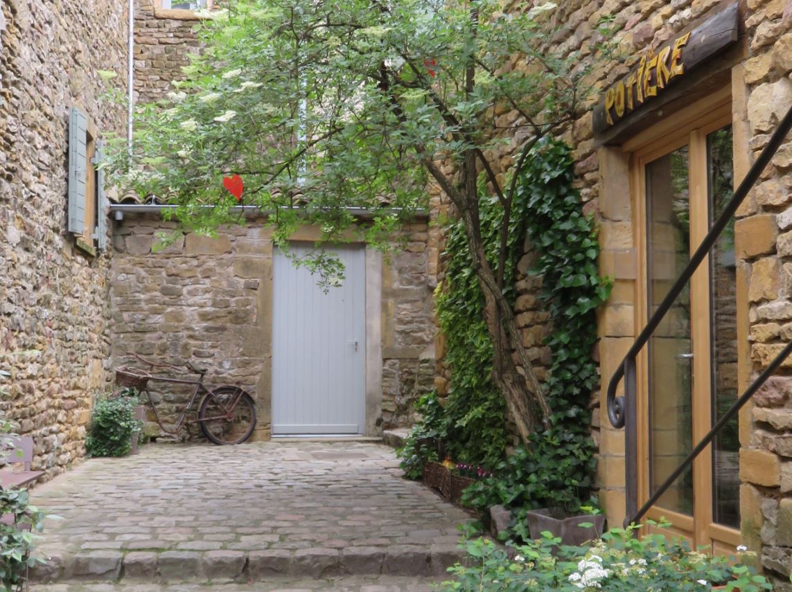
As we walk, Rue Dalbepierre changes its name to Le Gonet. As we pass through the countryside, we walk
among vineyards and grassy fields, speckled with the occasional house. This gorgeous one, pictured below, is actually a gite called L'Orée du Paradis. It looks amazing!!

A little farther, we find ourselves at the Le
Bussy signpost. Here we turn right and
head towards “Le Bourg” of Saint-Laurent d’Oingt.
The grassy path drops down so abruptly, it seems to simply drop off a
cliff. However, it is just an optical
illusion: once we get closer to the crest, we can see it is actually a gentle
downward slope. The grassy path exits
onto the paved Chemin du Lavoir, which heads directly up to the school (visible in background at right in the "optical illusion photo"). I enjoy
the little songbirds darting in and out of the orchard to our left, including
one bright yellow bird that I never manage to capture on film. Instead, you can
enjoy this bird that I did manage to capture on film. ;)


We arrive into the Bourg of Saint-Laurent d’Oingt in front of a very
impressive building on Rue du 14
Juillet. To the right, we see some
public toilets, set into the stone wall.
It appears we can go left or right to get around the building and head
up to the church. We go right, up Montée
de Priuré. We soon see some signage pointing us up Rue Nicholas Chervin. There
is a restaurant on our right, named... what else?... Le Saint-Laurent Restaurant Bar.
We consider buying an ice cream from its
storefront, but then decide against it.


On Rue Nicholas Chervin, Les Escaliers de la Chapelle come up quickly, and we head up a long staircase
that opens unceremoniously into a grassy field.
There, ahead of us, is the church!


After climbing up to the church, we look back at Oingt (on the far ridge), which looks impressively far away. Did we really just come from there? A sign offers us much information about the
different kinds of grape vines in the Beaujolais region, including the ways they are pruned. We had been wondering why some vines were lower
to the ground and spread out horizontally, while others were trimmed more like trees, with tall trunks rising
a couple of feet before branching out. Apparently, the two styles used in the Beaujolais region are called “Gobelet”
and “Guyot.”

You might be surprised to learn that Oingt is not traditionally a wine-making region. In fact, centuries ago, when Oingt was at its height, only
about 10% of the land held vineyards. Most
of the vineyards that now blanket the countryside date from the 20th
century.
The wine that we non-specialists call “Beaujolais” is not a type of
grape, but refers to the location where the wine is made. In fact, “Beaujolais wine” can be further divided into 12 different appellations (specific
sub-areas that are legally allowed to label their wine by their location). The Beaujolais grape varietal is called Gamay. Beaujolais is sometimes not given as much respect as some
of the other types of wine in France, because Gamay grapes produce a light easy-drinking wine. I admit, I used to always forgo Gamay for the heavier or “full-bodied” wines like Cabernet
Sauvignon, Zinfandel, and Syrah, but as my palate is growing, I am starting to
give more credit to the often-neglected wines like the Gamay. Sometimes it’s nice to have an easy-drinking “food
wine” that doesn’t knock you out after a glass or two. Plus, I’ve noticed that not all Beaujolais wines
are created equal, and some can definitely hold their own as a sipping wine.
I digress. The church is closed (natch), but I manage to take a neat
photo of the interior through the keyhole.
This is a strange skill I have been gaining while in France. Inside, I can see a lovely statue in front of
a stained glass window.


Beside the church is a well-kept cemetery. We walk down the paved road between the church and the cemetery, and
into some of the surrounding vineyards. The map indicates
there should be a second church around here somewhere. We circle around the vineyards, including one that
appears to be a graveyard for grapevines, and watch a hawk hunt in the adjacent field. We never find a second church. We
return to the road, and head towards the Mont Joli signpost.


As we stand at the Mont Joli signpost, pondering which path to choose to return to Oingt, a kindly young
fellow stops his bike and asks us if we need directions. We decide to head to the Ruisseau Vervuis, to
see if we can actually see the creek itself (as opposed to yesterday,
where we got close but didn’t get to see the creek). As we head down the rocky path towards the
creek, we can see the steep rocky path we took yesterday, running down from Sainte Paule to the creek on the hill ahead to the far left. Its golden stones stand out in stark relief
against the green of the vineyards.

We pass through a tiny forest, then along the bottom of a vineyard. It's very picturesque. We
can see some kind of stone bluffs ahead of us, and wonder if it’s a man-made wall
or a quarry. I hope the trail gets close to the bluffs... it would be neat to walk along there.


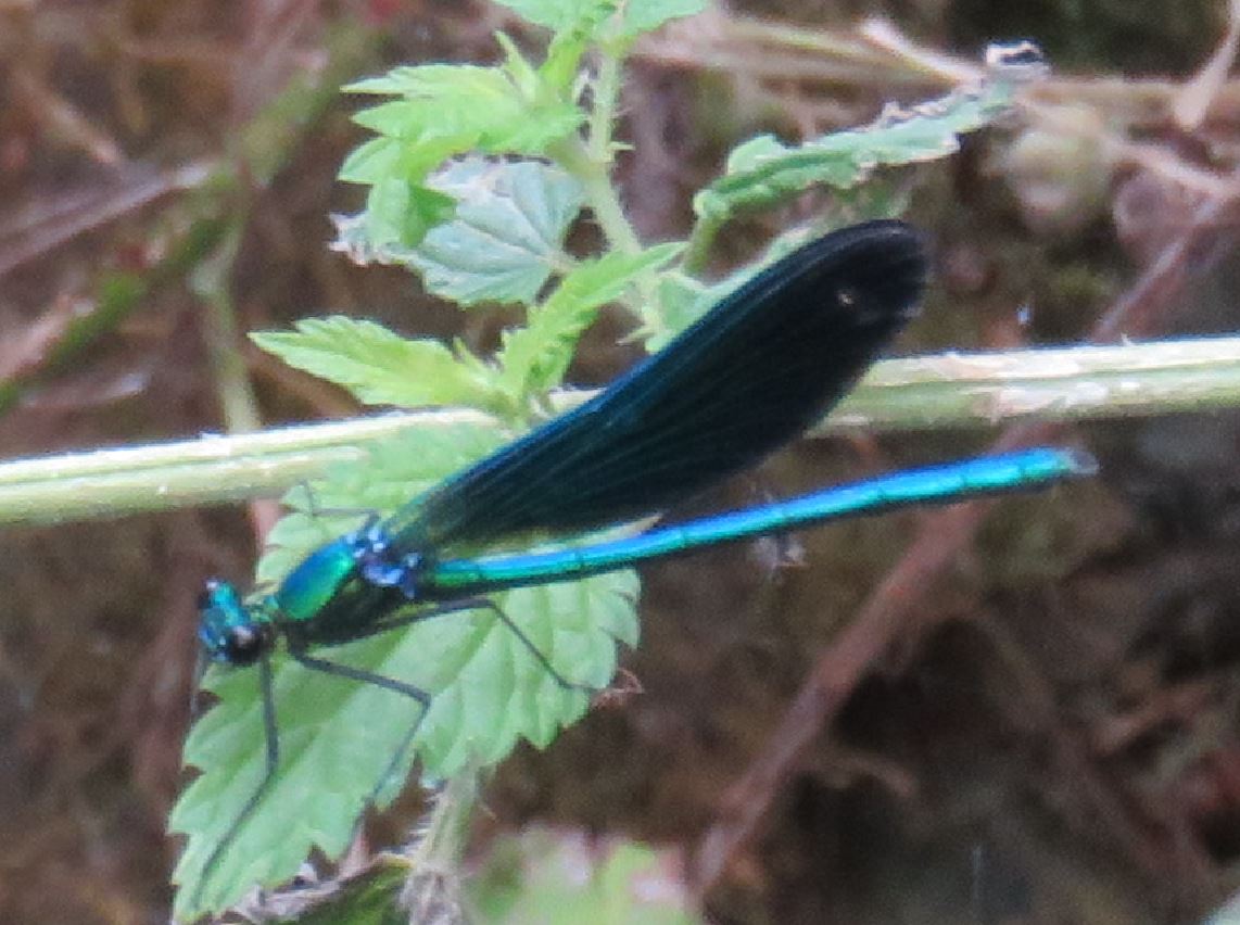
Reaching the Ruisseau de Vervius signpost, we can hear -- but not see --
the creek. We decide to follow the
sound, turn left, and quickly stumble upon a very tiny creek teeming with very large blue
dragonflies. The dragonflies are much
more impressive than the creek itself.


Then we turn around 180 degrees and return to the signpost, and take the path uphill towards Polluis. It’s a quick 40m rise in elevation within 200m of distance. :p For the first time today, we are hot and
sweaty. We pass two horses, standing
head to rump, very cooperatively fanning each other’s faces with their tails. Then I spy a cute little lizard shading
himself in the rock wall. It seems we are not the only ones around here who are affected by the heat.


Between Polluis and La Garenne, we hit our only stumbling block. The road appears to go straight on, but the real
path turns to the left. We
actually head down Dalbepierre road a while before Colin says: “This doesn’t
feel right,” and checks the GPS. We
backtrack and notice that there is actually a randonnée “X” on the road,
indicating “wrong way.” The correct
walking path is a narrow unlabeled cement road that quickly disintegrates into
gravel, with a sign that indicates “no entry except firefighters.” It turns out, that is the Chemin de
Prony. We head into the trees, and the shade is a nice relief after our steep ascent from the creek. Along this path, we pass the rock bluffs we
had seen in the distance earlier, and realize it is a quarry. We also pass a really neat looking “castle”
that I am pretty sure is just somebody’s home. Because in France, it seems people often live in castles. Soon we find ourselves back by the Prony tile factory and signpost,
having come up the path perpendicular to the road we had walked earlier on our way to Saint-Laurent d’Oingt.


We turn left back onto Route de Saint-Laurent d’Oingt. Then, instead of returning exactly the way we
had come, we skip Chemin des Peupliers and follow Route de Saint-Laurent d’Oingt
all the way to the corner where it meets Route du Bois d’Oingt. Right after our left turn onto Route du Bois
d’Oingt, Colin suggests a nameless grassy path that heads more directly up into
Oingt. We head up the path, which
reminds me of the trails in Brittany: it’s barely more than a walkway behind
people’s back yards. We think of our recent
hike in Les Bois Pouissons near Le Maroc, where we ended up
walking into a garden party. Fortunately,
this time, we soon encounter a set of stairs that drop us at the Restaurant
Creperie Les Pierres Dorees and Le Table du Donjon.


Next to the restaurants is the cave au vins Duperray (Domaine d'Iconium) belonging to “the
other Stephane,” but of course, today it is closed. A stop at the wine cave is probably not
a good idea right now anyway, since Colin has to soon work his evening shift.

Turning left onto Rue Paul Causeret, Oingt’s iconic tower, “Le Donjon,”
looms ahead of us. It is the only part
of the old castle of Oingt that is still standing. We go over to see it, and find out it is only
open on Sunday afternoons. So while we
don’t get to see the inside of the tower, we do have fun watching some cats and
birds by the tower.


Undiscouraged, we walk on and visit the church Saint Mathieu, the oldest building
in Oingt, dating to the 10th century, when Oingt was called “Iconium.”
The doors are (surprisingly) open! Inside there is a statue of Saint Mathieu
that looks uncannily like Mr.
Burns.


As we stroll down Rue Paul Causeret, there is signage to tell us about
parts of the castle and ramparts that are no longer in existence. What are in existence today are many little
artisanal shops and cafés, but of course… you guessed it… none are open. We wander through some of the smaller streets
of the town. It really is quite
picturesque, and earns well its place as the only town in Rhone to be among “France’s
most beautiful villages.”


We finally exit to Rue Presberg through La Porte Nizy. Since the town really seems deserted, we are
quite shocked to find a couple having a coffee and croissant outside of Chez
Marguerite. On the corner is the
amusing two-cart
“market” I encountered with Matt and Mel. I turn to Colin: “Do you want any fish or cheese?” Then I feel badly when I notice the cheese
monger perk up as she spies us from across the street. They could probably really use some
customers.


We return to the camionette via Montée de la Guillardière. At the corner of Chemin du Stade, I am
greatly amused by one young cow repeatedly headbutting another cow’s behind,
and by the sweetest little white cow who seems to be eyeing me hopefully. I seem to be a sucker for a cute white cow. Who knew? Lol. I take one last look at the stunning scenery,
and turn toward the car to complete today’s excellent randonnée.


Try this again!
ReplyDeleteThat cat looks like Grey, my familiar, lol
Totally!!!!!!!! I knew that cat looked familiar. :D
Delete