
I digress. For today's randonnée, we plan to explore a forested mountain area we have not yet visited. First, we will travel North to "Les Voûtes" (the Vault), then wind our way slowly downhill through the forest, and hopefully see a mountain spring (we are guessing that is what the star marked "Source" refers to on the map, because it is placed at the beginning of Ruisseau du Pully). The end of our hike will drop us through La Chapelle, Chamelet, and back to the gite, the same as our last hike (see "Just another day").

We head North up Rue Le Cocon, to the "other" Rue Le Cocon (pictured far right) which takes us West to the Le Cocon signpost, and then Northward again to Places Cocon (remember this headache from "Off the map!"? lol.) With the exception of the confusing intersection of Le Cocon and Le Cocon, it's all actually very well-marked.


The road is clear and open, and to our surprise, the grassy shoulder of the road has been recently mowed. The view at this altitude seems like it should be impressive, but really, all we see is forest.


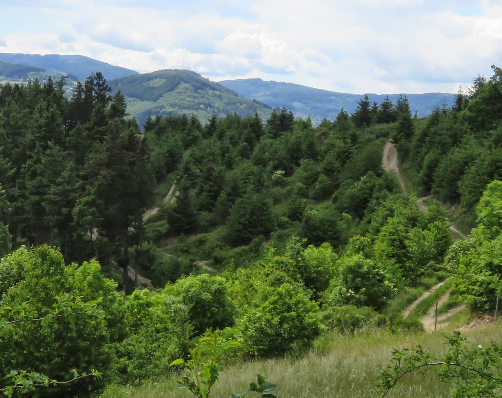
Travelling straight onward from Les Voûtes (i.e. the path I am standing on in the photo) would keep us out of the forest, so we follow the arrow for "La Chapelle" (the other path, leading off to the left in the photo). As the path curves to the left, I take in the strange view to the right: it seems like all the trees have been planted in straight lines down the hill. My mind flashes back to my grandpa's spruce tree farm, and I conclude this must be a man-made forest. (I google it and find out that this area had been almost completely deforested at one point, and a major reforestation project was undertaken in the 1970s to replace the lost native trees with coniferous trees. I now cannot seem to locate the source of that info. I will keep trying to find the link, and will post it when I find it).
*** UPDATE: I found the source of my info! It wasn't google after all. It was a book left in our gite called "les couleurs du Beaujolais: le Rhone." Plus, I was 100 years off in my timing. Oops. So now I can correct myself: "Up until the Middle Ages, the hills of the Beaujolais region were covered with beech and chestnut forests. Thereafter, however, much of the land was rapidly deforested and replanted with vines. In 1860 a reforestation program was launched and resinous trees were gradually planted on the higher hills. Scots pines, fir trees, and especially Douglas pines from California... were planted along with the indigenous spruce and larch trees" (p 113).
Unfortunately, while I am snapping a photo of the trees on the right, Colin calls: "Did you see that?! Amazing!!!" Apparently, a huge raptor, very likely a Common Buzzard, was sitting on the path ahead of us (i.e. on the left), munching on a little snack. I had missed it.


I enjoy the scent of fir on the air as we follow the path downward into a little valley, where it drops us into an intersection with three obvious paths, and two additional paths shown on googlemaps that take us a while to identify (the fourth is the grass path to the far right of the photo, the fifth is not shown in the photo, but runs into the bush on the near left corner). We determine that we are at the 5-point intersection due east from Places Cocon. The map hints at a direct walking route from the signpost at Places Cocon, but googlemaps shows that "path" to be Ruisseau de Muzy (a creek).


Taking the rightmost grassy path would take up back up towards Les Voûtes, the rightmost gravel path would take us along the Ruisseau Muzy due West, skirting the forest on the North side. We take the other gravel path, heading uphill towards "La Source."

We keep expecting to find La Source, but with all the switchbacks, we are getting confused as to where on the trail we actually are. We finally get to the junction where we think La Source SHOULD be, but we don't see anything. The yellow signpost is no help, simply indicating "Les Voûtes" behind us and "La Chapelle" ahead of us (both trails of the fork shown below will eventually lead to La Chapelle). We decide that this is probably not La Source's junction. We try to guess which road will give us the best chance at finding La Source. I seem to remember that the map showed a viewpoint at La Source (which I find out later is incorrect), so I suggest the upper trail.

We reach the apex of the trail, there is a half-hearted view and a strange bridge over nothing. I decide to take a photo, in case this turns out to be La Source. It's not, by the way. It turns out La Source was somewhere near the last junction (pictured above).

As little farther on, we reach an unexpected fence marked "Rhone Sapeurs-Pompiers: Ecole Départmentale, Terrain de Formation a la Conduite Opérationelle," which I think translates to something like "Rhone Firemen-training School." If La Source is beyond the gate, we have no hope of finding it.

We take the only other path out from the gate, which leads along a grassy field overlooking the "firemen training grounds." We can see a mess of criss-crossing trails that we assume they use to practice maneuvers.


The path runs lush and green before it suddenly turns to pavement and we reach "civilization," which is unquestionably announced by a fighter jet overhead, and a text message from my friend Nihan in Vancouver. I send her a "good morning" selfie (4pm here is 7am in Vancouver).


The rest of the route through La Chapelle and Chamelet is uneventful today, and much less exciting than last time, so if you missed this leg of the journey before, you can see my previous post: "Just another day in Chamelet."

Looks like you made it back for 'cheese time' once again. Do you ever meet other hikers on these trails? I wondered if your blog is read by people living nearby who have never walked the area that you are capturing in pictures and are inspired to get out and experience it. Or would they just think you are crazy Canadians?
ReplyDeleteI am REALLY curious about who is reading my blog in France. The hits from France far exceed what I am doing by myself, so I know other people here are looking at it.
DeleteActually, I am really thrilled at the overall hits I am getting on this site. Thank you Canada, France, USA, Ireland, UK, Ukraine, Italy, and Belarus!! :D I'd love to hear from you, and see which parts of the blog are capturing your interest.
To answer your question: most days we don't encounter anyone else on our hikes, but we have been here on two long weekends already, and on both of those we encountered many other hikers. Some are certainly locals, since they are walking without any special gear, close to the small towns, and often are with the whole family, including young kids. Others are decked out in runners and hiking poles, carrying water bottles and peering at maps, so they are certainly from elsewhere, and here to do some more serious hiking. Yesterday at Le Grand Bola, we met a man from Lyon who was out here specifically to randonnée.
Most people we meet here think we are Brits. It makes sense that UK tourists are more common here than Canadians. Or maybe it's Colin's pasty complexion. ;) One woman immediately started telling me all about "the new little princess." It took me a while to realize that Kate and William probably had a second baby. lol.
When they learn we are Canadian, all of them are really positive about Canada, and usually pepper us with more specific questions about Canada, and/or tell us about the time they visited Québec. lol. Perhaps unsurprisingly, Montréal is a big hit with the French.